Area Overview for RH10 3ER
Photos of RH10 3ER

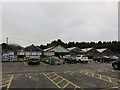
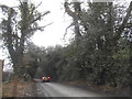
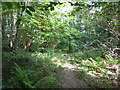
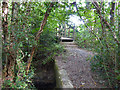
61 photos from this area
Area Information
Key information about the RH10 3ER including its size, population, and administrative classification.
- Area Type
- Postcode
- Area Size
- 1.2 hectares
- Population
- 1749
- Population Density
- 7041 people/km²
House Prices in RH10 3ER
21
Properties
£233,269
Average Sold Price
£105,000
Lowest Price
£356,000
Highest Price
Showing 21 properties
| Address | Type | Beds | Baths | Last Sale Price | Last Sale Date | |
|---|---|---|---|---|---|---|
| 23 Hampden Close, Pound Hill, Crawley, RH10 3ER | Terraced | 3 | 1 | £340,000 | Jul 2022 | |
| 9 Hampden Close, Pound Hill, Crawley, RH10 3ER | Bungalow | - | - | £356,000 | Jun 2021 | |
| 21 Hampden Close, Pound Hill, Crawley, RH10 3ER | house | - | - | £325,000 | May 2021 | |
| 17 Hampden Close, Pound Hill, Crawley, RH10 3ER | Terraced | 3 | 1 | £325,000 | Jun 2020 | |
| 14 Hampden Close, Pound Hill, Crawley, RH10 3ER | house | - | - | £340,000 | May 2018 | |
| 3 Hampden Close, Pound Hill, Crawley, RH10 3ER | Terraced | 3 | 2 | £190,000 | Nov 2014 | |
| 12 Hampden Close, Pound Hill, Crawley, RH10 3ER | Terraced | - | - | £214,500 | Jul 2007 | |
| 5 Hampden Close, Pound Hill, Crawley, RH10 3ER | house | - | - | £200,000 | May 2006 | |
| 11 Hampden Close, Pound Hill, Crawley, RH10 3ER | house | - | - | £170,000 | May 2005 | |
| 19 Hampden Close, Pound Hill, Crawley, RH10 3ER | Terraced | 4 | 3 | £192,000 | Jun 2004 |
Page 1 of 3
Energy Efficiency in RH10 3ER
Amenities
Schools
| Rank | School | Type | Entry gender | Ages |
|---|
Explore more schools in this area
Go to Schools tabDemographics
Household Size
Family (3-5 people)
most common
Accommodation Type
Houses
most common
Tenure
60
majority
Ethnic Group
White
most common
Religion
N/A
most common
Household Composition
N/A
most common
Age
47
median
Adults (30-64 years)
most common
Household Deprivation
N/A
with no deprivation
NS-SEC
30
in Lower managerial occupations
Explore more demographic insights in this area
Go to Demographics tabPlanning
Planning Constraints
- Flood RiskPremium
- Ramsar Wetland SitesPremium
- Area of Outstanding Natural BeautyPremium
- Protected Nature ReservePremium
- Protected WoodlandPremium