Area Overview for RH10 3EP
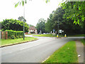
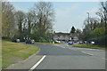
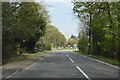
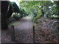
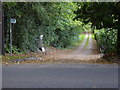
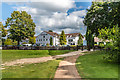
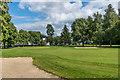
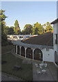
Photos of RH10 3EP


Area Information
Living in RH10 3EP means residing in a compact residential cluster defined by a precise postcode boundary. This specific area covers just 1.5 hectares, creating a tightly knit environment where the 1,623 residents form a close-knit community. The location sits within the RH10 postcode district, offering residents immediate proximity to major transport links while maintaining a distinct residential character. You will find that daily life here is shaped by a high density of population compared to the wider countryside, with 370 people living per square kilometre. The area functions as a practical base for those who value proximity to Gatwick Airport and surrounding commercial hubs. Your daily routine likely involves navigating between home and transport nodes like Kingscote or the various Gatwick shuttle stations. Because the area is so small, amenities are accessible within a very short walk or cycle. You do not need to travel far for essential services, as major retailers and transport interchange points surround this postcode. This concentration of services makes RH10 3EP a logical choice for commuters who require efficiency alongside a quiet, residential setting. The postcode acts as a gateway to wider opportunities while providing a contained neighbourhood feel.
- Area Type
- Postcode
- Area Size
- 1.5 hectares
- Population
- 1623
- Population Density
- 370 people/km²
The property market in RH10 3EP is characterised by a robust owner-occupied sector rather than a rental-heavy environment. With 83% of residents owning their homes, the area functions as an established neighbourhood where people buy rather than rent. The predominant accommodation type is houses, indicating that the stock caters to families or buyers seeking larger living spaces over shared buildings. This high ownership rate means that when properties come up for sale, they often address buyers looking for long-term stability in a residential cluster. Prospective buyers viewing homes in RH10 3EP should expect to find a market driven by those who have built equity or inherited property. The small area size of 1.5 hectares limits the volume of available stock, meaning supply will be low and competition may be specific to the available listings. Localised demand comes from the need for proximity to transport nodes like Gatwick South Terminal Shuttle Station without the urban noise of the airport terminals themselves. You will find that the 83% ownership figure reflects a market where residents plan to stay, passing value down through successive generations. This dynamic creates a buyer's market environment where careful negotiation is possible for those willing to act quickly on limited stock. The primary housing type remains traditional houses, appealing to those avoiding the constraints of flats or new-build developments.
House Prices in RH10 3EP
Showing 2 properties
| Address | Type | Beds | Baths | Last Sale Price | Last Sale Date | |
|---|---|---|---|---|---|---|
| Rowan, Turners Hill Road, Crawley Down, RH10 3EP | Detached | 8 | 7 | £1,775,000 | Jul 2021 | |
| The Mill House, Turners Hill Road, Crawley Down, RH10 3EP | Detached | - | - | - | - |
Energy Efficiency in RH10 3EP
Daily life in RH10 3EP benefits from immediate access to a wide range of amenities without requiring significant travel. Residents are surrounded by five retail locations, including Asda Copthorne, Morrisons Daily, and Co-op Crawley, ensuring you have full access to groceries and essentials within a few minutes' drive or public transport ride. You do not need to travel into Crawley town centre to find your weekly shop. Dining options and general shops are clustered near these supermarkets, allowing for quick errands and easy meal preparation. Transport links further enhance your lifestyle by placing three metro stations, five railway stations, and two airport facilities within practical reach. The South Terminal Coach Station provides additional bus connectivity, offering flexibility for those without private vehicles. Living in RH10 3EP means you can combine a quiet residential life with instant access to London Gatwick Airport and major rail hubs like Three Bridges and East Grinstead. This connectivity supports both leisure travel and work commutes, making the area a practical base for professionals and frequent flyers alike. The concentration of services means you can run errands, grab lunch, or travel further afield without leaving the immediate vicinity of your home.
Amenities
Schools
| Rank | School | Type | Entry gender | Ages |
|---|
Explore more schools in this area
Go to Schools tabDemographics
The community in RH10 3EP is defined by stability and a mature age profile. The median age for residents is 47 years, reflecting a population dominated by adults between 30 and 64 years old. This age distribution suggests a neighbourhood where families and professionals have settled for the long term rather than transient populations seeking temporary accommodation. With 83% of homes occupied by owners, the area exhibits strong community bonds and lower resident turnover rates. This high level of home ownership typically correlates with stable local institutions and established social networks. Housing stock consists predominantly of houses, catering to families or individuals seeking standalone or semi-detached properties rather than shared flats. The predominant ethnic group is White, which contributes to the area's established cultural character. You will find that the demographic makeup supports a relatively quiet atmosphere, as the older age profile often aligns with lower noise levels and reduced late-night activity. Homeowners are more likely to invest in property maintenance, preserving the visual appeal of the street. The combination of elderly and middle-aged residents creates a demographic profile that prioritises stability over rapid development or high-energy commercial transformation. This consistency offers a predictable environment for anyone considering a move to RH10 3EP.
Household Size
Accommodation Type
Tenure
Ethnic Group
Religion
Household Composition
Age
Household Deprivation
NS-SEC
Explore more demographic insights in this area
Go to Demographics tabPlanning
Planning Constraints
- Flood RiskPremium
- Ramsar Wetland SitesPremium
- Area of Outstanding Natural BeautyPremium
- Protected Nature ReservePremium
- Protected WoodlandPremium