Area Overview for RH10 1XQ
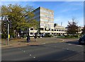
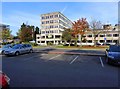
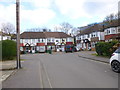
Photos of RH10 1XQ

Area Information
Living in RH10 1XQ offers a residential experience defined by its specific postcode cluster within the broader Crawley district. This small residential area accommodates a population of 2,615 people, creating a tight-knit neighbourhood environment rather than a sprawling urban sprawl. The setting is distinct because it sits in close proximity to major transport hubs, specifically London Gatwick Airport and key railway stations. You will find yourself surrounded by essential retail outlets such as Tesco Martletts and Iceland Crawley, which form the backbone of daily shopping errands. The area is particularly notable for its accessibility, located just moments from the South Terminal Coach Station and multiple Gatwick shuttle services. Daily life here revolves around the convenience of being near major infrastructure while maintaining a residential focus. The routine for a resident involves a short commute to Crawley Railway Station or a direct link to the airport terminals via the shuttle network. Schools like Northgate Primary and Manor Green College are within practical reach, though the character of the street depends on proximity to these facilities. The demographic profile suggests a mature community where many residents work in the local business parks or maintain remote roles supported by superior digital infrastructure. You do not need to travel far for supermarkets, bus stops, or rail connections, making this postcode a practical choice for those prioritising logistical efficiency. The area functions as a self-sufficient hub where the majority of essential needs are located within walking distance or a very short drive.
- Area Type
- Postcode
- Area Size
- Not available
- Population
- 2615
- Population Density
- 4034 people/km²
The property market in RH10 1XQ differs significantly from suburban housing locations due to its dominant rental nature. With home ownership sitting at just 29%, this area functions primarily as a letting zone for professionals, particularly those working near Gatwick Airport or in the wider Crawley commercial district. The prevailing accommodation type is flats, meaning buyers are unlikely to find traditional houses, bungalows, or semi-detached dwellings here. Instead, the housing stock consists of multi-unit buildings designed for density and efficient use of space. This market segment appeals to young professionals, expatriates, and corporate relocators who require flexibility and proximity to transport links rather than long-term investment in freehold properties. For a buyer specifically targeting this postcode, the focus must be on leasehold flats rather than freehold homes. The high percentage of rental dwellings indicates that demand here is driven by transient employment sectors such as aviation, logistics, and business services. You should expect to see a steady turnover of occupants as staff move in and out based on project duration or corporate contracts. The limited range of property types means competition will centre on location within the building, floor level, and proximity to the station or airport rather than garden size or driveway parking. This is a market defined by utility and convenience rather than architectural variety or traditional family housing.
House Prices in RH10 1XQ
No properties found in this postcode.
Energy Efficiency in RH10 1XQ
The lifestyle in RH10 1XQ centres on convenience, with a wide array of amenities located within practical walking or cycling distance. Retail options are well represented by five key supermarkets, including Tesco Martletts, Iceland Crawley, and Tesco Crawley. These outlets satisfy all grocery and household needs without requiring a trip into the city centre. For transport enthusiasts, the area is dominated by seven railway stations and two airport terminals nearby, making travel seamless. You can catch a train to London or drive to the airport without significant delay, a feature that shapes the daily rhythm of life here. Leisure and transport infrastructure are closely intertwined, with the Gatwick South and North Terminal Shuttle Stations serving as key hubs. The Kingscote metro station is also accessible, extending your reach across Greater London. Although parks and large leisure facilities are not detailed in the immediate data, the presence of major transport nodes creates a unique social environment where millions of people pass through daily. Dining and shopping are conveniently located at the supermarkets and stations, allowing for a spontaneous social life around food and transit. Living here means your weekly errands are short, your commutes are predictable, and your options for getting anywhere in the country or abroad are finite yet fast.
Amenities
Schools
Families residing in RH10 1XQ have access to two specific educational institutions within their vicinity. The local primary education option is Northgate Primary, which serves younger children in the neighbourhood. For special educational needs, Manor Green College is available nearby, providing a critical resource for students requiring tailored learning environments. The school landscape reflects the demographic reality that adult families are present, though the lower youth population suggests these schools may draw from a wider catchment area rather than solely from immediate local streets. The availability of a primary school and a specialist college offers a complete local education framework for families with children of various ages. While RH10 1XQ itself contains flats rather than school grounds, the proximity allows residents to participate in local community activities and events organised by these institutions. Northgate Primary provides a standard state education for elementary years, while Manor Green College addresses specialized learning requirements. This mix ensures that residents have immediate access to both general and specialist educational services without needing to travel into Crawley town centre for elementary schooling. The presence of these schools is a key factor for parents considering this locality for rental accommodation.
| Rank | School | Type | Entry gender | Ages |
|---|
Explore more schools in this area
Go to Schools tabDemographics
The community in RH10 1XQ is characterised by a mature population structure with a significant concentration of adults between the ages of 30 and 64 years. This age profile places the local median age at 47 years, indicating a household composition that likely prioritises stability and established living arrangements over the high mobility often seen in younger neighbourhoods. You will find that the area is not heavily populated with children, reflecting the dominance of middle-aged residents. The predominant ethnic group is White, and the social fabric reflects this statistical majority without significant minority subgroups mentioned in available records. Housing tenure presents a clear split in the community dynamic. Only 29% of households in this postcode area own their homes outright or via mortgage, which implies that rental properties make up the vast majority of the residential stock. This high proportion of private renters suggests a labour-market driven area where professionals and families waitpost to rent rather than buy. The accommodation type is almost exclusively flats, removing the option of detached houses or semi-detached properties from the local landscape. This architectural uniformity supports a high-density living environment where residents share communal corridors and external land rather than private gardens. You are looking at an urban-style residential block where neighbours interact through shared common spaces rather than private driveways.
Household Size
Accommodation Type
Tenure
Ethnic Group
Religion
Household Composition
Age
Household Deprivation
NS-SEC
Explore more demographic insights in this area
Go to Demographics tabPlanning
Planning Constraints
- Flood RiskPremium
- Ramsar Wetland SitesPremium
- Area of Outstanding Natural BeautyPremium
- Protected Nature ReservePremium
- Protected WoodlandPremium