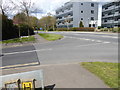
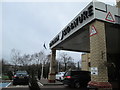
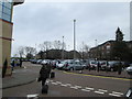
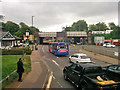
Area Overview for RH10 1LP
Photos of RH10 1LP
Area Information
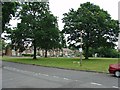
Living in RH10 1LP means residing within a defined residential cluster covering an area of 7724 square metres in England. This specific postcode serves 1583 people, creating a relatively small community with a population density of 204939 people per square kilometre. The character of daily life here is shaped by this concentrated population within a limited footprint. You will find a neighbourhood where residents are part of a distinct, small-scale living environment. While the total space is modest, the number of inhabitants suggests a close-knit setting where community interactions are likely frequent. The specific nature of this postcode indicates it is a focused residential spot rather than a broad rural village or sprawling urban district. Prospective buyers considering RH10 1LP are looking at a precise location where the physical boundaries are tight. This concentration of housing on just under eight thousand square metres defines the immediate experience for everyone on the list. It is an area where the sense of locality is strong due to the high density of residents in such a compact zone. Understanding this scale helps you visualise what living here entails, moving away from generic property descriptions to the reality of space and settlement.
- Area Type
- Postcode
- Area Size
- 7724 m²
- Population
- 1583
- Population Density
- 4622 people/km²
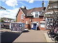
The property market in RH10 1LP is characterised by a mix of home ownership and rental living. With 53 per cent of homes owned, this is a locality where owner-occupiers hold a slight lead over tenants, though rental options remain significant. Houses dominate the stock, so you will not find many apartments or converted flats within this specific cluster. This focus on houses suggests families and individuals seeking semi-detached or detached living rather than urban flats. The small area size of 7724 square metres limits the sheer volume of available inventory compared to larger postcodes. Buyers looking at properties in RH10 1LP must navigate a market where supply is naturally constrained by the physical size of the zone. The predominance of houses typically implies larger gardens or more private outdoor space than found in high-density urban areas. Understanding that 53 per cent of residents own their homes helps you gauge price competition; buying directly from owners may differ from negotiating with landlords. The housing stock is clearly oriented towards traditional house designs rather than multi-unit developments. This factual layout means every available home represents a significant piece of the small total residential asset in this postcode.
House Prices in RH10 1LP
Showing 33 properties
| Address | Type | Beds | Baths | Last Sale Price | Last Sale Date | |
|---|---|---|---|---|---|---|
| 45 New Street, Three Bridges, Crawley, RH10 1LP | Terraced | 3 | 1 | £310,000 | Mar 2025 | |
| 47 New Street, Three Bridges, Crawley, RH10 1LP | Terraced | 3 | 1 | £377,000 | Feb 2023 | |
| 25 New Street, Three Bridges, Crawley, RH10 1LP | Terraced | 2 | - | £274,000 | Mar 2021 | |
| 55 New Street, Three Bridges, Crawley, RH10 1LP | house | - | - | £220,000 | Mar 2014 | |
| 51 New Street, Three Bridges, Crawley, RH10 1LP | Semi-detached | - | - | £125,000 | Dec 2011 | |
| 27 New Street, Three Bridges, Crawley, RH10 1LP | house | 2 | - | £193,000 | Feb 2008 | |
| 63 New Street, Three Bridges, Crawley, RH10 1LP | house | - | - | £237,000 | Jun 2007 | |
| 41 New Street, Three Bridges, Crawley, RH10 1LP | house | 3 | - | £219,000 | Jun 2007 | |
| 59 New Street, Three Bridges, Crawley, RH10 1LP | Detached | - | - | £435,900 | Oct 2006 | |
| 15 New Street, Three Bridges, Crawley, RH10 1LP | Semi-detached | 2 | - | £214,950 | Sep 2004 |
Energy Efficiency in RH10 1LP
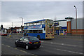
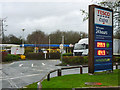
Your lifestyle in RH10 1LP revolves around the practical convenience of nearby amenities and transport links. Retail options within easy reach include Iceland Crawley, Lidl Central, and Tesco Crawley, giving you straightforward access to groceries and essentials. Five retail venues operate in this immediate sphere, ensuring you do not need to travel far for daily shopping. For rail travel, Three Bridges Railway Station, Crawley Railway Station, and Ifield Railway Station provide connections to wider travel networks. You also have access to two airports, with London Gatwick Airport being the primary aviation hub nearby. Public bus services are represented by the South Terminal Coach Station, offering regional bus connections. Additionally, three metro stations serve the area, including the Gatwick South Terminal Shuttle Station, Gatwick North Terminal Shuttle Station, and Kingscote. This range of facilities means you can manage your daily routine with minimal car dependency. The presence of both a shopping centre and major transport hubs integrates RH10 1LP into the broader commuter economy effectively.
Amenities
Schools
There are educational facilities immediately accessible to families living in RH10 1LP, though the choice is specific due to the small footprint of the area. Serenity School Crawley stands as the primary nearby institution listed for this location. This is a special school type, which includes children who require additional support to learn alongside their peers. The school holds a good Ofsted rating, indicating that it meets the required standards for quality and care. Because this is your only listed local option, your choices may involve looking to adjoining zones or travelling further afield depending on catchment boundaries. Special schools serve a vital role in the community by providing tailored educational environments for children with specific needs. When considering schools near RH10 1LP, you must acknowledge that this single institution defines the immediate educational landscape. The good rating offers reassurance regarding the quality of teaching and environment provided by Serenity School Crawley. Families with special educational requirements will find this facility directly relevant to their requirements. The lack of other listed options near this postcode means careful planning regarding travel times to the city or wider Crawley schools.
| Rank | School | Type | Entry gender | Ages |
|---|
Explore more schools in this area
Go to Schools tabDemographics
The community in RH10 1LP reflects a mature demographic profile with a median age of 47 years. Most residents fall into the adults age range of 30 to 64 years, indicating a population settled into mid-life stages. Home ownership stands at 53 per cent, meaning roughly half of the households own their property outright or with a mortgage while the other half likely rents. Houses form the predominant accommodation type, so you will encounter detached or semi-detached properties rather than flats or high-rise blocks. The ethnic group is predominantly White, reflecting the broader demographic trends of the surrounding region. This data paints a picture of a family-oriented street with established residents who have put down roots for a significant period. The high concentration of adults over thirty suggests the area is less drawn to students or young professionals seeking their first home. Safety considerations are relevant here; crime risk assessment places safety at a critical level with a score of 23 out of 100, meaning crime rates are above average. This fact requires you to weigh the stability of the long-term residents against the need for robust security measures. The demographic mix supports a quiet, residential atmosphere but demands awareness of the current crime statistics.
Household Size
Accommodation Type
Tenure
Ethnic Group
Religion
Household Composition
Age
Household Deprivation
NS-SEC
Explore more demographic insights in this area
Go to Demographics tabPlanning
Planning Constraints
- Flood RiskPremium
- Ramsar Wetland SitesPremium
- Area of Outstanding Natural BeautyPremium
- Protected Nature ReservePremium
- Protected WoodlandPremium