Area Overview for RH10 0ZZ
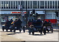
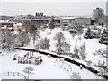
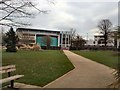
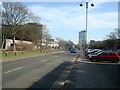
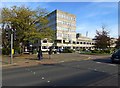
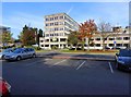
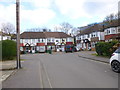
Photos of RH10 0ZZ

Area Information
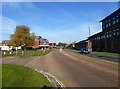
Living in RH10 0ZZ defines an experience centred on a compact residential cluster spanning just 1.3 hectares. The population stands at 2615 individuals, creating a densely populated environment with over 200,000 people per square kilometre. This high density shapes daily life, where you navigate a concentrated neighbourhood rather than sprawling suburbs. The smallest administrative unit within this postcode area still hosts a significant community, meaning local facilities are in high demand. Life here is dynamic, driven by the sheer number of residents packed into a limited space. This cluster operates as a distinct residential hub where proximity dictates convenience. You find yourself surrounded by neighbours, which fosters a tight-knit environment but also limits the feeling of open space. The area functions primarily as a sleeping quarter for those working in nearby hubs, given its location relative to major transport links. Daily routines involve short commensurability to larger town centres or the coast, depending on your destination. The physical boundaries of this postcode ensure that most of your immediate environment consists of housing stock rather than industrial or commercial land use. Understanding the scale of this settlement helps you anticipate the pace of life, which moves quickly due to the pressure of the high population density on a small footprint.
- Area Type
- Postcode
- Area Size
- 1.3 hectares
- Population
- 2615
- Population Density
- 4034 people/km²
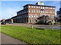
The housing market in RH10 0ZZ is characterised by a reliance on rental stock rather than ownership. With a home ownership rate of just 29%, the local property landscape skews heavily towards private and social rentals. This statistic indicates that most residents achieve tenure through monthly payments rather than mortgages or outright purchase. The predominant accommodation type consists of flats, which reinforces the nature of the housing stock as smaller, vertically oriented units designed for high-density living. If you are considering buying a home in RH10 0ZZ, you are entering a competitive rental market. The scarcity of owned properties contrasts sharply with the volume of available rental units. Flats remain the standard offering, meaning buyers looking for detached houses or bungalows would need to search beyond the immediate postcode boundaries. This concentration of flats supports a lifestyle suitable for singles and small families but may not appeal to those seeking indoor space or gardens. The market dynamics here differ from standard suburban areas where owner-occupiers dominate the sales figures. Understanding this balance is essential for anyone evaluating homes in RH10 0ZZ or surrounding clusters.
House Prices in RH10 0ZZ
No properties found in this postcode.
Energy Efficiency in RH10 0ZZ
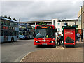
Daily life for residents of RH10 0ZZ balances convenience with the constraints of a small residential area. You have direct access to a range of retail options, including Tesco Martletts, Iceland Crawley, and Asda Crawley. These three major supermarkets are within practical reach, allowing you to complete all grocery shopping needs within a short trip. Five retail outlets serve the area, meaning you do not need to travel far for essentials or weekly shopping. For commuting, rail connectivity is strong with five railway stations nearby. Crawley Railway Station, Three Bridges Railway Station, and Ifield Railway Station offer direct links to wider transport networks. You can also access London Gatwick Airport via two nearby facilities, facilitating frequent travel. Public transport options include coaches at South Terminal Coach Station and metro services linking to Gatwick South Terminal Shuttle Station, Gatwick North Terminal Shuttle Station, and Kingscote. This density of transport hubs ensures you reach major destinations quickly. The combination of retail giants and transit stations creates a lifestyle where you do not need a car for daily tasks. Living in RH10 0ZZ provides a self-contained environment where work, shopping, and travel intersect efficiently.
Amenities
Schools
Families living in RH10 0ZZ have access to two specific educational institutions within the immediate vicinity. Northgate Primary serves as the local primary school for younger children attending the area. For special educational needs, residents have proximity to Manor Green College, which operates as a specialist institution. This mix of general and special school types provides an option for families with varying educational requirements. The presence of a specialist college indicates that the area caters to specific learning needs alongside standard primary education. The school types listed suggest a practical approach to local education provision. Northgate Primary handles standard curriculum delivery for the younger demographic, while Manor Green College addresses special educational needs. You do not find secondary schools explicitly named in the data for this specific postcode, meaning older children may commute further for secondary education. This arrangement is common in high-density postcode areas where land is dedicated to housing rather than large school grounds. Families choosing homes in RH10 0ZZ must verify catchment areas for Northgate Primary, as proximity often dictates admission eligibility in such tight-knit residential clusters.
| Rank | School | Type | Entry gender | Ages |
|---|
Explore more schools in this area
Go to Schools tabDemographics
The community profile in RH10 0ZZ reflects a mature household structure. The median age stands at 47, indicating that the population ages far older than the national average. Most residents fall into the adult bracket between 30 and 64 years of age, suggesting a lifestyle focused on career stability and mid-life planning rather than young family expansion. This age demographic influences local spending and community engagement patterns. You are likely to encounter neighbours who have established careers are settled in their current locations for significant periods. Housing tenure shows that only 29% of residents own their homes outright. Consequently, the majority of households are likely renting, either through private landlords or social housing agencies. This high rental proportion suggests a transient population compared to traditional owner-occupied estates. The predominant form of accommodation is flats, which aligns with the high population density and the need for space-efficient living solutions. While the area is predominantly White, the mix of tenancy types creates a diverse social fabric. You will find a community where shared living arrangements are common, fostering frequent interaction between strangers and existing residents in communal areas of these flats.
Household Size
Accommodation Type
Tenure
Ethnic Group
Religion
Household Composition
Age
Household Deprivation
NS-SEC
Explore more demographic insights in this area
Go to Demographics tabPlanning
Planning Constraints
- Flood RiskPremium
- Ramsar Wetland SitesPremium
- Area of Outstanding Natural BeautyPremium
- Protected Nature ReservePremium
- Protected WoodlandPremium