Area Overview for RH1 5NT
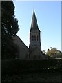
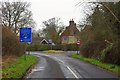
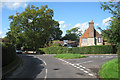
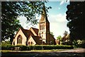
Photos of RH1 5NT
Area Information
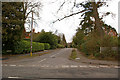
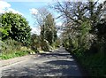
Living in RH1 5NT offers a quiet residential experience within a tightly defined cluster covering just 3,529 square metres. This specific postcode area serves 1,320 residents, creating a compact neighbourhood where proximity is key to daily life. The small footprint means you are surrounded by community members rather than spread out across a large estate. Most homes here are private dwellings rather than apartment blocks, fostering a distinct neighbourhood character different from high-density urban centres. You will find that life in RH1 5NT centres on convenience and stability. The low population density of 166 people per kilometre ensures a peaceful environment while remaining close to larger transport hubs. This area functions as a self-contained pocket of the wider Crawley and Gatwick region. Residents benefit from immediate access to rail lines and the Gatwick Airport without the noise pollution found in terminal zones. The sheer size of the area dictates a slower pace of life where local interactions are frequent and familiar faces are common. When searching for homes in RH1 5NT, you prioritise property over pilgrimage, seeking practical living spaces in a settled community rather than a developing district.
- Area Type
- Postcode
- Area Size
- 3529 m²
- Population
- 1320
- Population Density
- 166 people/km²
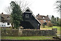
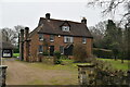
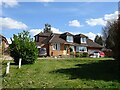
The property market in RH1 5NT is characterised by deep-rooted home ownership. With 76% of residents owning their homes, the housing stock is anchored by individuals who have chosen to stay rather than move. This statistic reveals a market where turnover is likely driven by life events such as inheritance or retirement rather than speculative flipping or short-term renting. When viewing homes in RH1 5NT, you will primarily see detached or semi-detached houses suited to families or couples who value space and permanence. The absence of apartments or flats aligns with the area's 1320 occupants spread across 3,529 square metres. This low density limits the supply of urban-style living, meaning buyers looking for flats must cast their nets further afield. The high ownership rate indicates strong local attachment to the neighbourhood. Prospective buyers here are part of a specific economic demographic capable of securing mortgages and building equity over decades. This contrasts sharply with areas where rental demand drives the market and landlords turn properties over rapidly. In RH1 5NT, the property landscape is static and reliable, offering security to those who can afford entry prices. The market reflects a desire for stability rather than investment speculation.
House Prices in RH1 5NT
Showing 3 properties
| Address | Type | Beds | Baths | Last Sale Price | Last Sale Date | |
|---|---|---|---|---|---|---|
| Hemingford, Kings Cross Lane, South Nutfield, RH1 5NT | Bungalow | 3 | 2 | £730,000 | Apr 2025 | |
| Ridge Green Cottage, Kings Cross Lane, South Nutfield, RH1 5NT | Retail | 3 | 2 | £770,000 | Apr 2022 | |
| Ruscombe Cottage, Kings Cross Lane, South Nutfield, RH1 5NT | Detached | - | - | - | - |
Energy Efficiency in RH1 5NT
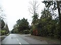
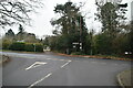
Daily life for residents of RH1 5NT revolves around immediate convenience and access to key transport nodes. Within practical reach, you will find five retail outlets, including a Spar convenience store and M&S East, alongside another Spar branch. These facilities handle most daily grocery and household needs without requiring a journey to the town centre. Transport infrastructure is a defining feature of your lifestyle, with five rail options nearby facilitating commutes to Crawley, Dorking, and other surrounding hubs. Two Gatwick Airport shuttle stations are also accessible, providing direct links to the airport terminals. Leisure and major shopping are supported by the nearby Metro stations, including Gatwick North Terminal Shuttle Station and Gatwick South Terminal Shuttle Station. A fifteen-minute walk or short drive can take you to the South Terminal Coach Station for further travel possibilities. This concentration of amenities around the airport and rail corridors suggests a lifestyle defined by mobility and transit rather than local leisure parks or museums within the immediate 3,529 square metre cluster. You rely on the wider RG7 and RH1 areas for extensive dining, cinema, and heritage sites, but your daily essentials are met locally. The area functions as a transit-focused residential zone where convenience is measured in travel time to major hubs.
Amenities
Schools
Families residing in RH1 5NT have access to specific educational institutions listed for the postcode. The nearest provision is Nutfield Church CofE Primary School. This school operates at a primary level and holds an Ofsted rating of good. The presence of a Church of England community primary school indicates a faith-based educational option available to local children. Currently, there are no secondary schools listed in the immediate vicinity of RH1 5NT in the provided data. This means that children attending the primary school will likely travel to another settlement for their secondary education. Homes near RH1 5NT are therefore often purchased with the intention of accessing the primary education provided at Nutfield Church CofE Primary School before transitioning later. The current school mix is singular rather than a diverse range of options ranging from infant to secondary provision. Parents must verify secondary route catchment areas separately. For those prioritising early education, having a primary school rated good ensures a solid start to a child's academic journey within the designated catchment for this small residential cluster.
| Rank | School | Type | Entry gender | Ages |
|---|
Explore more schools in this area
Go to Schools tabDemographics
The community in RH1 5NT is defined by maturity and stability. The median age of residents is 47 years, reflecting a population dominated by adults aged between 30 and 64. This demographic profile suggests a neighbourhood where professionals, families, and retirees coexist rather than a zone filled with young students or transient workforce. Unlike many satellite towns flooded with university students, RH1 5NT maintains a consistent age structure indicative of long-term settlement. Home ownership stands at an impressive 76% within this cluster. This high figure confirms that most households own their residences outright or have a significant portion of their mortgage cleared. You will encounter very few renters on the streets. The accommodation type is exclusively houses, which aligns with the ownership statistics and the quiet residential nature of the postcode. There is a notable absence of high-rise flats or purpose-built rental blocks, reinforcing the family-focused character of the area. The predominant ethnic group is White, mirroring the broader demographic trends of the surrounding Surrey and West Sussex regions. This settled demographic, coupled with high ownership rates, creates an environment where property values remain stable and the community ethos relies on established neighbours rather than a temporary rental population.
Household Size
Accommodation Type
Tenure
Ethnic Group
Religion
Household Composition
Age
Household Deprivation
NS-SEC
Explore more demographic insights in this area
Go to Demographics tabPlanning
Planning Constraints
- Flood RiskPremium
- Ramsar Wetland SitesPremium
- Area of Outstanding Natural BeautyPremium
- Protected Nature ReservePremium
- Protected WoodlandPremium