Area Overview for RH1 4QH
Photos of RH1 4QH


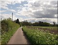
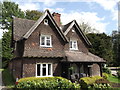
30 photos from this area
Area Information
Key information about the RH1 4QH including its size, population, and administrative classification.
- Area Type
- Postcode
- Area Size
- 1.1 km²
- Population
- 1574
- Population Density
- 178 people/km²
House Prices in RH1 4QH
36
Properties
£849,375
Average Sold Price
£365,000
Lowest Price
£1,630,000
Highest Price
Showing 36 properties
| Address | Type | Beds | Baths | Last Sale Price | Last Sale Date | |
|---|---|---|---|---|---|---|
| Little Pendell, Pendell Road, Bletchingley, RH1 4QH | house | 4 | 3 | £1,310,000 | Jun 2024 | |
| West Lodge, Pendell Road, Bletchingley, RH1 4QH | Detached | - | - | £450,000 | Mar 2023 | |
| Lake Farm Equestrian, Pendell Road, Bletchingley, RH1 4QH | Detached | 5 | 4 | £1,455,000 | Mar 2022 | |
| Lake Farm House, Pendell Road, Bletchingley, RH1 4QH | Semi-detached | 4 | 2 | £685,000 | Sep 2021 | |
| 3, Lake Farm Cottages, Pendell Road, Bletchingley, RH1 4QH | Semi-detached | 3 | 2 | £470,000 | Nov 2020 | |
| Pendell House, Pendell Road, Bletchingley, RH1 4QH | Detached | 8 | 5 | £1,630,000 | Aug 2014 | |
| 4, Lake Farm Cottages, Pendell Road, Bletchingley, RH1 4QH | house | 4 | 2 | £430,000 | Aug 2010 | |
| Maldons, Pendell Road, Bletchingley, RH1 4QH | Detached | 3 | 2 | £365,000 | Oct 1998 | |
| Pendell Court Farmhouse, Pendell Road, Bletchingley, RH1 4QH | Detached | 3 | 2 | - | - | |
| 2, Lake Farm Cottages, Pendell Road, Bletchingley, RH1 4QH | Semi-detached | 4 | 2 | - | - |
Page 1 of 4
Energy Efficiency in RH1 4QH
Amenities
Schools
| Rank | School | Type | Entry gender | Ages |
|---|
Explore more schools in this area
Go to Schools tabDemographics
Household Size
Family (3-5 people)
most common
Accommodation Type
Houses
most common
Tenure
73
majority
Ethnic Group
White
most common
Religion
N/A
most common
Household Composition
N/A
most common
Age
47
median
Adults (30-64 years)
most common
Household Deprivation
N/A
with no deprivation
NS-SEC
44
in Lower managerial occupations
Explore more demographic insights in this area
Go to Demographics tabPlanning
Planning Constraints
- Flood RiskPremium
- Ramsar Wetland SitesPremium
- Area of Outstanding Natural BeautyPremium
- Protected Nature ReservePremium
- Protected WoodlandPremium