Area Overview for RH1 4AP
Photos of RH1 4AP
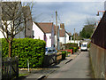
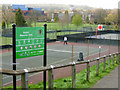
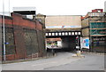
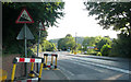
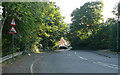
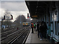
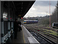
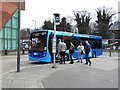
100 photos from this area
Area Information
Key information about the RH1 4AP including its size, population, and administrative classification.
- Area Type
- Postcode
- Area Size
- 1.3 hectares
- Population
- 1730
- Population Density
- 3259 people/km²
House Prices in RH1 4AP
17
Properties
£719,652
Average Sold Price
£285,000
Lowest Price
£1,441,250
Highest Price
Showing 17 properties
| Address | Type | Beds | Baths | Last Sale Price | Last Sale Date | |
|---|---|---|---|---|---|---|
| 20 Hillfield Road, Redhill, RH1 4AP | Semi-detached | 4 | 2 | £652,500 | Oct 2024 | |
| 2 Hillfield Road, Redhill, RH1 4AP | house | - | - | £1,441,250 | Nov 2021 | |
| 1A Hillfield Road, Redhill, RH1 4AP | house | - | - | £812,111 | Oct 2021 | |
| 2A Hillfield Road, Redhill, RH1 4AP | Detached | 5 | 2 | £850,000 | Jan 2020 | |
| 10 Hillfield Road, Redhill, RH1 4AP | Detached | 6 | 3 | £985,000 | Jan 2015 | |
| 5 Hillfield Road, Redhill, RH1 4AP | house | 3 | - | £315,000 | Aug 2012 | |
| 1B Hillfield Road, Redhill, RH1 4AP | house | 4 | - | £570,000 | Apr 2012 | |
| Oakwood, 8 Hillfield Road, Redhill, RH1 4AP | Detached | 6 | 3 | £566,005 | Sep 2003 | |
| 12 Hillfield Road, Redhill, RH1 4AP | Semi-detached | - | - | £285,000 | Sep 2002 | |
| 10B Hillfield Road, Redhill, RH1 4AP | Detached | 3 | - | - | - |
Page 1 of 2
Energy Efficiency in RH1 4AP
Amenities
Schools
| Rank | School | Type | Entry gender | Ages |
|---|
Explore more schools in this area
Go to Schools tabDemographics
Household Size
Family (3-5 people)
most common
Accommodation Type
Houses
most common
Tenure
83
majority
Ethnic Group
White
most common
Religion
N/A
most common
Household Composition
N/A
most common
Age
47
median
Adults (30-64 years)
most common
Household Deprivation
N/A
with no deprivation
NS-SEC
52
in Lower managerial occupations
Explore more demographic insights in this area
Go to Demographics tabPlanning
Planning Constraints
- Flood RiskPremium
- Ramsar Wetland SitesPremium
- Area of Outstanding Natural BeautyPremium
- Protected Nature ReservePremium
- Protected WoodlandPremium