Area Overview for RH1 3JZ
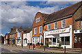
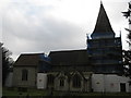
Photos of RH1 3JZ

Area Information
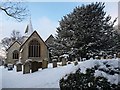
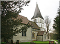
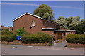
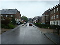
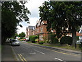
RH1 3JZ is a small residential cluster situated within the Hooley, Merstham & Netherne Ward of Surrey. This specific postcode area contains a population of 1,681 residents, creating a tight-knit community rather than a sprawling suburb. The location sits near the historic Netherne estate, an area that transitioned from farmland recorded in 1522 to a psychiatric hospital before becoming a redevelopment zone. Developers delivered new homes from 1995 onwards, transforming the former site of Netherne Hospital into the modern village of Netherne-on-the-Hill. You will find converted staff accommodation along Netherne Lane, Park Lane, and Woodplace Lane, blending with the newer residential blocks. Living in RH1 3JZ offers the distinct advantage of a plateau location that overlooks Hooley while maintaining close ties to the larger Reigate and Banstead Borough. The area is defined by its history and its calm, village-like atmosphere, making it a focused choice for those seeking a settled environment near Reigate and Banstead.
- Area Type
- Postcode
- Area Size
- Not available
- Population
- 1681
- Population Density
- 2657 people/km²
In RH1 3JZ, 63% of households own their homes, clearly establishing this as an owner-occupied area. The accommodation type is overwhelmingly Houses, which defines the physical character of the residential cluster. You will find properties ranging from converted staff accommodation in villages to the new builds completed by 2008 on the former hospital estate. This mix creates a varied housing stock where buyers can find both period character homes and modern family residences. The area does not feature a significant rental market segment compared to its owner-occupier base. Because the area covers such a small residential cluster, inventory moves quickly, and competition for the right house type can be intense. Buyers looking for smaller properties might find converted bungalows or cottages along Netherne Lane, while those wanting larger family homes will encounter the newer developments built in the mid-2000s. The market here values stability, mirroring the high ownership rate found in the local data.
House Prices in RH1 3JZ
No properties found in this postcode.
Energy Efficiency in RH1 3JZ
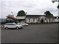
Your daily life in RH1 3JZ is supported by several local amenities within practical reach. Retail options include Co-op Merstham, Tesco Redhill, and Sainsburys Redhill, ensuring you have access to supermarkets and general stores without needing a long drive. There are five notable retail locations available to you, covering most everyday shopping requirements. Transport links to these amenities are reinforced by five accessible railway stations: Merstham Railway Station, Redhill Railway Station, and Nutfield Railway Station are all within easy reach. These stations facilitate your commute while allowing you to visit neighbours in Merstham or Redhill regularly. The area also benefits from the open space found on the converted site of Netherne Hospital, which provides recreational grounds for residents. While there is no dedicated public house or business centre stated in the current inventory, the village feel of Netherne-on-the-Hill offers a quiet environment for walking and relaxation.
Amenities
Schools
Families considering RH1 3JZ have access to a small but consistent selection of educational institutions nearby. Furzefield Primary School holds an Ofsted rating of good and stands as a key local option for younger children. Furzefield Middle School and Furzefield First School also serve the local catchment, providing continuity for students advancing from their primary years. This concentration of schools near RH1 3JZ means you do not need to look far for education options, reducing travel time for drop-off collections. The presence of three named schools within close reach supports the needs of households where parents work in the wider Reigate and Banstead Borough. While specific performance metrics are not detailed in the current data, the inclusion of multiple Furzefield campuses indicates a structured local education pathway. These schools cater to the demographic's needs, accommodating the 47-year-old median age of the population.
| Rank | School | Type | Entry gender | Ages |
|---|
Explore more schools in this area
Go to Schools tabDemographics
The community in RH1 3JZ is dominated by adults between the ages of 30 and 64 years. The median age for residents is 47, indicating a mature demographic less focused on young families and more on stability. Home ownership stands at 63%, meaning the majority of households in this small cluster have bought their own properties. This high level of ownership contrasts with typical rental hotspots and suggests a stable, long-term population base. Most accommodation in RH1 3JZ consists of houses, reflecting the rural heritage of the Netherne-on-the-Hill site rather than urban flats. The predominant ethnic group is White, which aligns with the broader demographic trends of the surrounding Reigate and Banstead borough. There is minimal data on deprivation levels, but the age profile and home ownership rates suggest a neighbourhood of settled residents who have put down roots. The mix of older converted buildings and newer developments supports a lifestyle centred on established routines rather than transient living.
Household Size
Accommodation Type
Tenure
Ethnic Group
Religion
Household Composition
Age
Household Deprivation
NS-SEC
Explore more demographic insights in this area
Go to Demographics tabPlanning
Planning Constraints
- Flood RiskPremium
- Ramsar Wetland SitesPremium
- Area of Outstanding Natural BeautyPremium
- Protected Nature ReservePremium
- Protected WoodlandPremium