Area Overview for RH1 3DB
Photos of RH1 3DB
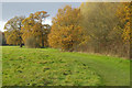
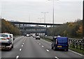
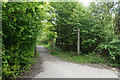
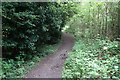

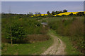
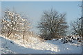
61 photos from this area
Area Information
Key information about the RH1 3DB including its size, population, and administrative classification.
- Area Type
- Postcode
- Area Size
- 37.1 hectares
- Population
- 1681
- Population Density
- 2657 people/km²
House Prices in RH1 3DB
13
Properties
£969,167
Average Sold Price
£210,000
Lowest Price
£1,500,000
Highest Price
Showing 13 properties
| Address | Type | Beds | Baths | Last Sale Price | Last Sale Date | |
|---|---|---|---|---|---|---|
| Albury Edge West, Rockshaw Road, Merstham, RH1 3DB | Semi-detached | 6 | 4 | £1,185,000 | Jun 2021 | |
| The Garth, Rockshaw Road, Merstham, RH1 3DB | house | - | - | £750,000 | Sep 2020 | |
| The Georgian House, Rockshaw Road, Merstham, RH1 3DB | house | 8 | - | £1,350,000 | Feb 2017 | |
| Tanglewood, Rockshaw Road, Merstham, RH1 3DB | house | - | - | £1,500,000 | Aug 2015 | |
| The Mere, Rockshaw Road, Merstham, RH1 3DB | Detached | 7 | - | £820,000 | Apr 2013 | |
| Orchard End, Rockshaw Road, Merstham, RH1 3DB | Detached | 2 | 1 | £210,000 | Nov 2004 | |
| Garthside, Rockshaw Road, Merstham, RH1 3DB | Detached | 5 | 3 | - | - | |
| The Red House, Rockshaw Road, Merstham, RH1 3DB | Detached | 1 | 4 | - | - | |
| Noddyshall, Rockshaw Road, Merstham, RH1 3DB | Detached | 3 | 2 | - | - | |
| Chaldon Rise, Chaldon Rise Mews, Rockshaw Road, Merstham, RH1 3DB | Retirement | - | - | - | - |
Page 1 of 2
Energy Efficiency in RH1 3DB
Amenities
Schools
| Rank | School | Type | Entry gender | Ages |
|---|
Explore more schools in this area
Go to Schools tabDemographics
Household Size
Family (3-5 people)
most common
Accommodation Type
Houses
most common
Tenure
63
majority
Ethnic Group
White
most common
Religion
N/A
most common
Household Composition
N/A
most common
Age
47
median
Adults (30-64 years)
most common
Household Deprivation
N/A
with no deprivation
NS-SEC
31
in Lower managerial occupations
Explore more demographic insights in this area
Go to Demographics tabPlanning
Planning Constraints
- Flood RiskPremium
- Ramsar Wetland SitesPremium
- Area of Outstanding Natural BeautyPremium
- Protected Nature ReservePremium
- Protected WoodlandPremium