Area Overview for RH1 3BN
Photos of RH1 3BN


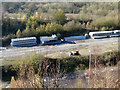
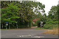
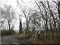
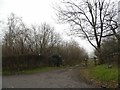
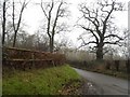

42 photos from this area
Area Information
Key information about the RH1 3BN including its size, population, and administrative classification.
- Area Type
- Postcode
- Area Size
- 18.4 hectares
- Population
- 1679
- Population Density
- 239 people/km²
House Prices in RH1 3BN
40
Properties
£402,575
Average Sold Price
£93,000
Lowest Price
£800,000
Highest Price
Showing 40 properties
| Address | Type | Beds | Baths | Last Sale Price | Last Sale Date | |
|---|---|---|---|---|---|---|
| Five Poplars, 197 London Road North, Merstham, RH1 3BN | Semi-detached | 4 | 2 | £800,000 | Nov 2024 | |
| Ambleside, 193 London Road North, Merstham, RH1 3BN | Detached | 3 | 1 | £687,500 | Nov 2022 | |
| Colwyn, 225 London Road North, Merstham, RH1 3BN | house | - | - | £612,000 | Mar 2021 | |
| Hafod, 199 London Road North, Merstham, RH1 3BN | Detached | 4 | 1 | £677,750 | May 2019 | |
| 1 Railway Cottages, 209 London Road North, Merstham, RH1 3BN | Terraced | 3 | 1 | £399,950 | Dec 2015 | |
| The Firs, 191 London Road North, Merstham, RH1 3BN | Detached | 3 | - | £550,000 | Apr 2015 | |
| Russet Cottage, 217 London Road North, Merstham, RH1 3BN | Semi-detached | 4 | 1 | £470,000 | Feb 2015 | |
| Downlands, 185 London Road North, Merstham, RH1 3BN | house | 4 | - | £481,000 | Dec 2011 | |
| Carlton Cross, 227 London Road North, Merstham, RH1 3BN | Semi-detached | - | - | £300,000 | Sep 2008 | |
| 4 Railway Cottages, 203 London Road North, Merstham, RH1 3BN | Cottage | 4 | 2 | £335,000 | Sep 2006 |
Page 1 of 4
Energy Efficiency in RH1 3BN
Amenities
Schools
| Rank | School | Type | Entry gender | Ages |
|---|
Explore more schools in this area
Go to Schools tabDemographics
Household Size
Family (3-5 people)
most common
Accommodation Type
Houses
most common
Tenure
69
majority
Ethnic Group
White
most common
Religion
N/A
most common
Household Composition
N/A
most common
Age
47
median
Adults (30-64 years)
most common
Household Deprivation
N/A
with no deprivation
NS-SEC
48
in Lower managerial occupations
Explore more demographic insights in this area
Go to Demographics tabPlanning
Planning Constraints
- Flood RiskPremium
- Ramsar Wetland SitesPremium
- Area of Outstanding Natural BeautyPremium
- Protected Nature ReservePremium
- Protected WoodlandPremium