Area Overview for RH1 2GN
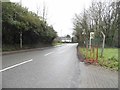
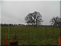
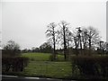
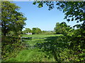
Photos of RH1 2GN


Area Information
Living in RH1 2GN means residing within a tightly packed residential cluster of just one hectare, which supports a population of 1,492 people. This postcode sits in England with such a high density of 145,111 people per square kilometre that it functions as a focused residential hub rather than a sprawling district. The area is defined by its compact nature, offering a distinct sense of locality where neighbours are inevitably close by. You will find a specific postcode area covering this small residential cluster, meaning daily life revolves around immediate surroundings and local infrastructure. The environment is predominantly domestic, accommodating a steady group of residents who value the convenience of living within a defined, manageable footprint. This concentration creates a community where services and homes are in close proximity, eliminating the need for long daily commutes to reach essential facilities. The character of RH1 2GN is shaped by this density, providing a lived-in atmosphere where the community is deeply interconnected. Prospective buyers should appreciate that this is a specific, well-defined location with a clear identity shaped by its population size and land use.
- Area Type
- Postcode
- Area Size
- 1.0 hectares
- Population
- 1492
- Population Density
- 3581 people/km²
The property market in RH1 2GN is characterised by a strong leaning towards owner-occupation, with 60 per cent of homes held by their residents. Houses make up the primary accommodation type, meaning the housing stock is largely composed of standalone domestic properties rather than flats or shared housing. This profile typically appeals to buyers seeking traditional family living spaces or established residential assets in a specific postcode area covering a small residential cluster. The high ownership rate suggests a slow-changing market where properties often remain in families for generations, potentially stabilising neighbourhood values. For those looking at homes in RH1 2GN, the dominance of houses indicates a layout conducive to indoor space and private grounds, although the area density of 145,111 people per square kilometre suggests proximity to others will be unavoidable. The market reflects a settled demographic where residents are more likely to have bought their homes than those opting to rent. This dynamic means buyers should anticipate a market driven by equity growth and long-term residence rather than transient lettings. The specific nature of this postcode area covering a small residential cluster means supply is limited, reinforcing the importance of acting on interest when viewing properties. You will find a market defined by stability, traditional housing types, and a resident base that has chosen to stay long term.
House Prices in RH1 2GN
Showing 22 properties
| Address | Type | Beds | Baths | Last Sale Price | Last Sale Date | |
|---|---|---|---|---|---|---|
| 18 Montagu Crescent, Redhill, RH1 2GN | house | - | - | £500,000 | Jan 2022 | |
| 10 Montagu Crescent, Redhill, RH1 2GN | house | - | - | £440,000 | Dec 2021 | |
| 12 Montagu Crescent, Redhill, RH1 2GN | house | - | - | £495,000 | Dec 2021 | |
| 22 Montagu Crescent, Redhill, RH1 2GN | house | - | - | £435,000 | Nov 2021 | |
| 7 Montagu Crescent, Redhill, RH1 2GN | house | 4 | 3 | - | - | |
| 16 Montagu Crescent, Redhill, RH1 2GN | house | - | - | - | - | |
| 14 Montagu Crescent, Redhill, RH1 2GN | house | - | - | - | - | |
| 2 Montagu Crescent, Redhill, RH1 2GN | house | - | - | - | - | |
| 23 Montagu Crescent, Redhill, RH1 2GN | house | - | - | - | - | |
| 17 Montagu Crescent, Redhill, RH1 2GN | house | - | - | - | - |
Energy Efficiency in RH1 2GN
Your daily life in RH1 2GN benefits from a network of nearby amenities that cater to practical shopping and commuting needs. Five retail outlets operate close by, including Tesco Redhill, Co-op Merstham, and Sainsburys Redhill for your weekly groceries and household necessities. Five railway stations offer direct rail connections, specifically Merstham Railway Station, Redhill Railway Station, and Earlswood Railway Station, providing easy access to wider London and Greater London areas. These transport nodes mean you can commute by train without needing a personal vehicle for every journey. The presence of major chains like Tesco and Sainsburys ensures you have consistent access to quality food and products within a short drive or walk. Living in RH1 2GN grants you convenience, as essential services are located just outside the residential cluster. You can plan your weekly shop at Co-op Merstham or handle bulk purchases at Redhill locations with ease. The rail connectivity means work commutes are manageable, reducing reliance on cars and lowering daily stress. This blend of retail and transport infrastructure creates a functional lifestyle where daily requirements are met without extensive travel.
Amenities
Schools
Families considering RH1 2GN will find a selection of educational facilities within practical reach, catering from primary education through to adult and independent learning. Lime Tree Primary School holds an outstanding Ofsted rating, providing a high-standard early education option for younger children in the vicinity. For pupils ready for advanced study, East Surrey College serves as a sixth-form institution, offering progression opportunities for older students. Residents can also access specialist provision at Battlebridge Education Centre, an independent school offering tailored educational pathways. The Phoenix Centre provides other types of educational or community learning support, rounding out the local educational landscape. This mix allows you to choose between maintained and independent provision depending on your specific needs. The presence of an outstanding-rated primary school is a significant advantage, suggesting the area attracts families prioritising early education quality. Having access to both sixth-form and primary options means the area supports learners at multiple stages without requiring long travel distances. The variety of school types ensures that different educational philosophies and requirements are met within the immediate neighbourhood surrounding RH1 2GN.
| Rank | School | Type | Entry gender | Ages |
|---|
Explore more schools in this area
Go to Schools tabDemographics
The community in RH1 2GN reflects the needs of adults between 30 and 64 years of age, making up the most common age range in the area. With a median age of 47, the population leans significantly towards middle adulthood, suggesting a settlement populated by established families or individuals in their peak working years. Home ownership stands at 60 per cent, indicating that a majority of residents have bought into the local property market rather than renting. Houses form the predominant accommodation type, reinforcing the idea that this is a traditional family area built around single-family dwellings. The predominant ethnic group is White, which places this neighbourhood within a broadly established demographic profile typical of many English suburban clusters. This age distribution means the area is stable, with residents likely focused on long-term stability, schooling for children, or caring for elderly relatives. The 60 per cent ownership rate suggests a settled environment where people are invested in their immediate surroundings. You can expect a neighbourhood where lifestyle choices are dictated by a demographic that values security, stability, and a familiar community structure. Deprivation data is not provided for this specific area in the current records, so observations rely on the clear indicators of age and ownership.
Household Size
Accommodation Type
Tenure
Ethnic Group
Religion
Household Composition
Age
Household Deprivation
NS-SEC
Explore more demographic insights in this area
Go to Demographics tabPlanning
Planning Constraints
- Flood RiskPremium
- Ramsar Wetland SitesPremium
- Area of Outstanding Natural BeautyPremium
- Protected Nature ReservePremium
- Protected WoodlandPremium