Area Overview for RH1 2DS
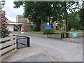
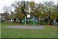
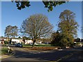
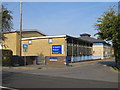
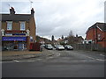
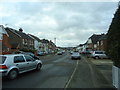
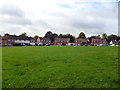
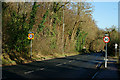
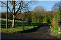
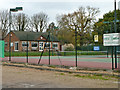
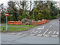
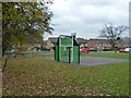
Photos of RH1 2DS
Area Information
RH1 2DS is a small residential cluster covering just 2.3 hectares, yet it houses a significant local population of 1,730 people. This compact footprint results in a high density of 76,064 people per square kilometre, creating a tightly knit environment rather than a sprawling suburb. Living in this postcode means you are situated in a specific residential ring around Redhill, benefiting from immediate proximity to major transport hubs while maintaining a distinct locality feel. The area is characterised by its concentration of homes, which supports a community where neighbours often interact frequently due to the close-quarter layout. You will find yourself surrounded by a concentration of dwellings that prioritise convenience over extensive green space within the immediate boundary. Despite its small physical area, the location offers direct access to the wider Redhill network, making it a practical choice for those working in nearby towns or needing quick transport links. The density creates a lively atmosphere where daily routines are centred on local amenities rather than long commutes to distant shopping districts.
- Area Type
- Postcode
- Area Size
- 2.3 hectares
- Population
- 1730
- Population Density
- 4413 people/km²
Homes in RH1 2DS are defined by a stock where 71 per cent of residents are first-time movers or long-term owners. The predominant accommodation type is houses, which aligns with the area's choice of settled, family-oriented living. This high ownership percentage indicates a market where property values are tied closely to individual pride of ownership and long-term investment rather than short-term letting. You are looking at a residential cluster where the majority of stock has been purchased, creating a stable housing environment. This contrasts with areas driven largely by student rentals or executive lettings. The nature of the housing stock being primarily houses rather than flats suggests a layout suited for families who value private outdoor space. Because this is a small postcode area covering only 2.3 hectares, the supply of new builds is unlikely; instead, the market relies on existing stock. Buyers should expect a consistent property type focused on traditional house construction. The high ownership level also implies that maintenance standards are often managed by owners directly, leading to varied property conditions depending on individual caretaking.
House Prices in RH1 2DS
Showing 27 properties
| Address | Type | Beds | Baths | Last Sale Price | Last Sale Date | |
|---|---|---|---|---|---|---|
| 8 Vandyke Close, Redhill, RH1 2DS | Detached | 4 | 3 | £1,100,000 | Dec 2024 | |
| 40 Vandyke Close, Redhill, RH1 2DS | Detached | 5 | 2 | £760,000 | May 2019 | |
| 14 Vandyke Close, Redhill, RH1 2DS | Detached | 4 | - | £730,000 | Jun 2015 | |
| 12 Vandyke Close, Redhill, RH1 2DS | Detached | 5 | - | £710,000 | Jan 2014 | |
| 38 Vandyke Close, Redhill, RH1 2DS | Detached | - | - | £480,000 | Nov 2007 | |
| 50 Vandyke Close, Redhill, RH1 2DS | house | - | - | £499,950 | Oct 2006 | |
| 48 Vandyke Close, Redhill, RH1 2DS | Detached | - | - | £455,000 | Jun 2006 | |
| 28 Vandyke Close, Redhill, RH1 2DS | Detached | - | - | £544,800 | Jul 2005 | |
| 10 Vandyke Close, Redhill, RH1 2DS | house | - | - | £495,000 | Aug 2003 | |
| 18 Vandyke Close, Redhill, RH1 2DS | Detached | - | - | £280,000 | Jul 1999 |
Energy Efficiency in RH1 2DS
Residents of RH1 2DS have access to five key retail locations including Iceland Redhill, Sainsburys Redhill, and Tesco Marketfield. These supermarkets ensure you can purchase daily essentials without driving far. For rail travel, five stations serve the vicinity, with Redhill Railway Station being a primary hub for regional connections. Connectivity to the airport is seamless via the Gatwick North Terminal Shuttle Station, which is just one station away. The proximity of these amenities means your daily shopping and travel needs are met immediately outside your door. You do not need to travel deep into town centres for most routine tasks. The convenience of having Iceland, Sainsbury's, and Tesco within practical reach defines the lifestyle in this postcode. Residents can enjoy a self-contained life where food shopping and transport planning happen within a short walk or drive. This level of access to major stores and transport nodes creates a practical environment for busy households and families.
Amenities
Schools
There is one primary educational institution listed for residents within RH1 2DS. St Matthew's CofE Primary School serves the local area and holds a 'good' Ofsted rating. This specific rating indicates that the school meets the expected standards for education and behaviour. As a Church of England institution, it follows a specific curriculum and ethos that may appeal to families seeking faith-based education. The limited selection of named schools suggests that the immediate catchment for this 2.3 hectare cluster relies heavily on this single primary option. For families with older children, you may need to check catchment boundaries for secondary institutions not listed in this specific data set. The presence of a good-rated primary school provides a solid foundation for young education without the variability of ungraded establishments. When planning education for children living in RH1 2DS, St Matthew's CofE Primary School is the central reference point for the local elementary years.
| Rank | School | Type | Entry gender | Ages |
|---|
Explore more schools in this area
Go to Schools tabDemographics
The community profile in RH1 2DS reflects a mature demographic with a median age of 47 years. Most residents fall within the adult age range of 30 to 64 years, indicating a neighbourhood dominated by established families and professional households. House ownership stands at 71 per cent, which is a significant majority suggesting that most people have purchased their property rather than rented. This high ownership rate contributes to long-term stability within the community, as residents are more likely to invest in their homes and local infrastructure. The predominant ethnic group is White, mirroring the broader patterns of Southern England but with a clear lack of significant minority representation in this specific small cluster. Accommodation consists primarily of houses, reflecting a preference for detached or semi-detached living over flats or terraced housing. The age profile and ownership data suggest a settled environment where residents have likely lived in the area for many years. This demographic stability means the residents are well connected and resistant to rapid turnover, creating a consistent neighbourhood character for anyone considering buying or moving here.
Household Size
Accommodation Type
Tenure
Ethnic Group
Religion
Household Composition
Age
Household Deprivation
NS-SEC
Explore more demographic insights in this area
Go to Demographics tabPlanning
Planning Constraints
- Flood RiskPremium
- Ramsar Wetland SitesPremium
- Area of Outstanding Natural BeautyPremium
- Protected Nature ReservePremium
- Protected WoodlandPremium