Area Overview for RH1 1PU
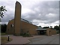
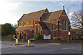
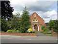
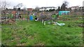
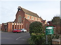
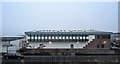
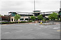
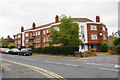
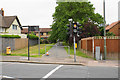
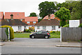
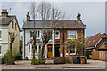
Photos of RH1 1PU

Area Information
Living in RH1 1PU means residing in a specific postcode area that covers a small residential cluster of just over 1,500 square metres. This compact environment supports a population of 1,345 individuals, creating a very high-density living situation by modern standards. The site type description confirms this is a concentrated cluster rather than a sprawling suburb. Daily life here is defined by proximity, with residents living close to essential services and transport links. You will find yourself surrounded by a tight-knit community where distances to shops and stations are short. The area functions as a discrete residential node within the wider Redhill and South London corridor. For those considering homes in RH1 1PU, the sheer density is the defining characteristic of the neighbourhood. You are not looking at a traditional village or large estate, but a focused residential grouping designed for efficiency. The small physical footprint means noise and activity from neighbours may be more immediate than in sprawling developments. Nevertheless, the strategic location ensures you remain connected to major employment hubs without requiring lengthy commutes. This area is suitable for those who prioritise convenience and walkability over space. The character of RH1 1PU is one of utilitarian residential planning, balancing limited land with the high demand for housing in the region.
- Area Type
- Postcode
- Area Size
- 1516 m²
- Population
- 1345
- Population Density
- 3799 people/km²
The property market in RH1 1PU is defined by its focus on flats and a significant rental sector. With only 37 per cent of homes owned, the area presents more opportunity for landlords or investors than for buyers seeking to move purely into owner-occupation. This high rental proportion indicates that many residents operate on a tenancy basis, which can affect tenant stability and neighbourhood turnover rates compared to areas where ownership exceeds 60 per cent. The accommodation type data confirms that flats are the main housing stock, fitting the description of a small residential cluster. You will find most homes in RH1 1PU to be purpose-built blocks or conversions rather than large detached houses. This means limited inventory for those specifically seeking family-sized detached properties, though flats often command premium prices near transport hubs. For homebuyers, the low ownership rate signals a competitive letting market where good service the landlord capability becomes crucial. The physical constraints of the 1,516 square metre area mean that every plot is used efficiently. Development here is unlikely to expand vertically without planning permission. This density creates a micro-market where specific flats become highly sought after due to their location within this postcode area.
House Prices in RH1 1PU
Showing 12 properties
Energy Efficiency in RH1 1PU
Your lifestyle in RH1 1PU revolves around a dense network of retail and transport amenities located within practical reach. For grocery shopping and daily necessities, you have access to Sainsburys Redhill, Iceland Redhill, and Tesco Marketfield. These five retail outlets provide a solid range of food and household goods without requiring a long drive. Transport infrastructure forms the backbone of daily life, with five railway stations and two metro shuttle stations visible from the immediate area. Redhill Railway Station serves as a key interchange, while Earlswood and Merstham stations offer alternative routes. Commuters also benefit from the Gatwick North Terminal and South Terminal Shuttle Stations. London Gatwick Airport is just one station away, making business travel or leisure trips to the south coast effortless. For those driving, the South Terminal Coach Station provides further travel flexibility. While there is no data on parks or leisure venues in this specific cluster, the presence of these five major retail chains and numerous transport hubs ensures your daily needs are met with convenience. The character of this area is functional and efficient, designed for residents who value quick access to goods and travel over quiet green spaces. You can easily run errands or catch a train without significant planning or travel time.
Amenities
Schools
Families in RH1 1PU have access to two specific educational institutions in the vicinity. Primary education is covered by The Warwick School, which caters to younger children before they transfer to secondary provision. For older students, Carrington School acts as an academy providing secondary education. The Ofsted rating for Carrington School is good, offering reassurance regarding the standard of education delivered. This mix of a primary school and an academy means local parents can potentially keep their children within a short distance of their home for their early years. The presence of these named facilities suggests a functional local education network without the need for extensive daily travel to larger comprehensive zones. However, the small size of RH1 1PU implies these schools may share the site or immediate area with the residential cluster, potentially leading to shared spaces or courtyards. Prospective parents should verify catchment areas, as school places are often allocated based on specific address postcodes. The provision of a good-rated academy indicates a commitment to maintaining educational standards within this residential zone.
| Rank | School | Type | Entry gender | Ages |
|---|
Explore more schools in this area
Go to Schools tabDemographics
The community within RH1 1PU reflects a mature demographic profile with a median age of 47 years. The most common age range consists of adults between 30 and 64 years, suggesting a neighbourhood populated by established professionals and families rather than young students or retirees. This age distribution influences local spending habits and service demand, favouring stability over transience. House ownership stands at 37 per cent, meaning that roughly one in three residents owns their home outright or with a mortgage. Consequently, rental accommodation forms the majority of the household structure. Flats are the predominant accommodation type, which aligns with the high population density and the constrained area size. The residents are predominantly of White ethnicity, indicating a relatively homogenous social fabric compared to more diverse urban centres. This demographic makeup supports a stable environment where long-term residents often have significant stakes in the local community. The lack of data on specific deprivation statistics does not obscure the clear picture provided by age and ownership figures. A 47-year-old median age combined with a lower ownership rate suggests a mix of upgraders moving into flats and professionals renting nearby. These structural facts help you understand who your neighbours are and how the area functions socially.
Household Size
Accommodation Type
Tenure
Ethnic Group
Religion
Household Composition
Age
Household Deprivation
NS-SEC
Explore more demographic insights in this area
Go to Demographics tabPlanning
Planning Constraints
- Flood RiskPremium
- Ramsar Wetland SitesPremium
- Area of Outstanding Natural BeautyPremium
- Protected Nature ReservePremium
- Protected WoodlandPremium