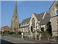
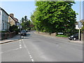
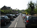
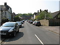
Area Overview for RH1 1BZ
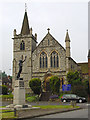
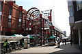
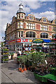
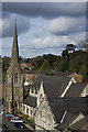
Photos of RH1 1BZ
Area Information
RH1 1BZ represents a specific postcode area defined by a densely packed residential cluster of 1875 square metres. This compact footprint supports a population of 1730 residents, creating a high degree of proximity among neighbours. The location sits within the broader RH1 postcode district, which typically encompasses the Redhill area in Surrey. Despite its small physical size, the area functions as a distinct community unit where daily life revolves around local infrastructure and immediate surroundings. You will find yourself accessing major transport hubs and retail centres within a short distance, yet your immediate neighbourhood feels focused and contained. The concentration of households in such a limited space suggests a mature estate where every street likely serves the people living directly on it. Prospective homebuyers should view RH1 1BZ as a slice of residential functionality rather than a sprawling suburb. The density here means that facilities, parks, and green spaces are easily reachable on foot, eliminating the need for long commutes to the nearest amenities. While the area size is minute compared to wider boroughs, the settlement itself provides all the essential services required for a settled domestic life. This postcode covers the ground directly beneath the feet of nearly 2000 people, creating a palpable sense of locality. Understanding the specific boundaries of this 1875 square metre zone is key to grasping what living in RH1 1BZ entails. It is a place where the immediate environment dictates the rhythm of your day, from morning walks to evening purchases.
- Area Type
- Postcode
- Area Size
- 1875 m²
- Population
- 1730
- Population Density
- 4413 people/km²
Anyone looking at the housing market in RH1 1BZ encounters an area defined by traditional British housing rather than modern apartment blocks. The accommodation type data confirms that houses make up the vast majority of properties here, aligning with the 71% home ownership rate. This structure tells you that the local market is driven by individual family homes rather than high-rise flats or modernist developments. When searching for homes in RH1 1BZ, you will find a stock primarily suited to families and older adults seeking stability in a single-family dwelling. The high level of home ownership implies that the majority of houses are freehold properties with their owners having a long-standing connection to the street. This contrasts with rental markets where turnover is frequent and leasehold arrangements dominate. Because nearly three-quarters of residents own their homes, the property market here is less fluid than in areas with high rental percentages. Finding a detached or semi-detached house in this specific postcode might require patience, as the inventory is likely lean due to the small area size of 1875 square metres. However, the historical prevalence of houses suggests lasting values and established neighbourhood character. Buyers should expect to find a market where owners have invested in their properties over decades, meaning the overall quality of the housing stock may be well-maintained. This tenure profile ensures that the community benefits from resident investment in upkeep and local improvements.
House Prices in RH1 1BZ
Showing 8 properties
| Address | Type | Beds | Baths | Last Sale Price | Last Sale Date | |
|---|---|---|---|---|---|---|
| Flat 2, Crocus House, Carrington Close, Redhill, RH1 1BZ | Flat | - | - | - | - | |
| Flat 4, Crocus House, Carrington Close, Redhill, RH1 1BZ | Flat | - | - | - | - | |
| Flat 6, Crocus House, Carrington Close, Redhill, RH1 1BZ | Flat | - | - | - | - | |
| Flat 5, Crocus House, Carrington Close, Redhill, RH1 1BZ | Flat | - | - | - | - | |
| Flat 1, Crocus House, Carrington Close, Redhill, RH1 1BZ | Flat | - | - | - | - | |
| Flat 8, Crocus House, Carrington Close, Redhill, RH1 1BZ | Flat | 1 | - | - | - | |
| Flat 3, Crocus House, Carrington Close, Redhill, RH1 1BZ | Flat | - | - | - | - | |
| Flat 7, Crocus House, Carrington Close, Redhill, RH1 1BZ | Flat | - | - | - | - |
Energy Efficiency in RH1 1BZ
Living in RH1 1BZ grants immediate access to a wide array of amenities within practical reach. For shoppers, you have three major supermarkets to choose from: Iceland Redhill, Sainsburys Redhill, and Tesco Marketfield. These retail giants offer the convenience of one-stop shopping for groceries and household essentials, ensuring you can stock your home without driving far. The designation of these retailers as notable amenities means they are key fixtures in your weekly routine. Transport options are equally extensive. Five railway stations serve the wider locality, including Redhill Railway Station, Earlswood Railway Station, and Reigate Railway Station. This network provides easy rail links to London and other parts of the south east. For occasional travel or business trips, London Gatwick Airport is just one airport option nearby, accessible via shuttle services from Gatwick North Terminal Station and Gatwick South Terminal Station. Bus services are provided via the South Terminal Coach Station, adding another layer of public transport flexibility. This concentration of retail and transport infrastructure means you can manage your daily errands and leisure activities without leaving the immediate hinterlands of RH1 1BZ. The proximity to these venues creates a lifestyle where work and play are balanced through excellent local connectivity.
Amenities
Schools
Families living in RH1 1BZ have access to specific educational facilities within their immediate vicinity. St Matthew's CofE Primary School stands out as the nearest educational institution, serving children in early education stages. The school holds a good Ofsted rating, which confirms its adherence to educational standards and quality of instruction. The presence of a Church of England primary school indicates a faith-based educational option available to local families. Currently, the data lists only this one primary school option for the immediate surroundings of RH1 1BZ. This means that primary education is locally accessible, though secondary education options would likely require travel to neighbouring towns such as Redhill or Croydon. For parents, knowing that St Matthew's CofE Primary School is nearby provides reassurance regarding the continuity of education without the need for extensive commuting. The school's good rating is a concrete metric of performance, suggesting a positive environment for young learners. While the area is small, having a designated school close by integrates education into the daily fabric of life in RH1 1BZ. Families may find themselves drawn to homes in this postcode specifically to secure a place at this highly regarded primary institution, although specific catchment boundaries should always be verified with the school directly. The concentration of a single primary option within walking distance highlights the community focus on foundational education.
| Rank | School | Type | Entry gender | Ages |
|---|
Explore more schools in this area
Go to Schools tabDemographics
The community within RH1 1BZ reflects a settled residential profile with a median age of 47 years. Adults aged between 30 and 64 years constitute the most common age range, indicating that a significant portion of the population is in the middle of their working lives or approaching retirement. This demographic spread suggests stability rather than a transient or student-heavy population. You are likely to see families with children and empty-nesters sharing the streets of this postcode. Home ownership stands at 71% within this area, marking RH1 1BZ as overwhelmingly an owner-occupied community. This high rate of homeownership typically correlates with long-term residents who have rooted themselves in the locality. The accommodation type is predominantly houses, which aligns with the mature age profile and ownership statistics. The area is less likely to feature a stock of rental properties or purpose-built student accommodation found in younger demographics. The predominant ethnic group is White, which reflects the broader settlement patterns of the Redhill region. With a population density indicating nearly 1000 people per square kilometre, the housing stock is tightly packed, likely comprising terraced or semi-detached homes adapted to this high density. This demographic mix creates a neighbourhood where the majority of neighbours belong to similar life stages and housing tenure groups.
Household Size
Accommodation Type
Tenure
Ethnic Group
Religion
Household Composition
Age
Household Deprivation
NS-SEC
Explore more demographic insights in this area
Go to Demographics tabPlanning
Planning Constraints
- Flood RiskPremium
- Ramsar Wetland SitesPremium
- Area of Outstanding Natural BeautyPremium
- Protected Nature ReservePremium
- Protected WoodlandPremium