Area Overview for RH1 1BH
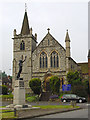
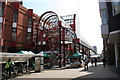
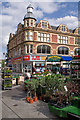
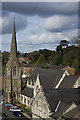
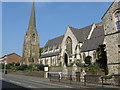
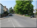
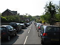
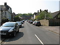
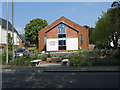
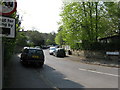
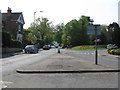
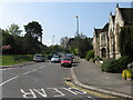
Photos of RH1 1BH
Area Information
RH1 1BH represents a small, residential cluster covering just 767 square metres. This compact postcode serves a population of 1730 people, creating an intimate scale that defines daily life for residents. You will find a clearly established neighbourhood rather than a sprawling development, which often appeals to those seeking a definitive sense of place. The area's size limits expansion, reinforcing its character as a settled community with structured boundaries. Living in RH1 1BH means accessing a defined environment where local rivals are few and residential density is high relative to the available ground. The sheer concentration of homes in such a small footprint suggests a developed locality with established infrastructure. Every day, your surroundings are immediately recognisable as a cohesive residential zone. This compactness ensures that distances to local facilities remain short, reducing the need for extensive travel for routine errands. The area stands as a specific, contained part of the wider South Godalming postal district, offering a distinct identity within the Redhill borough. You inhabit a space where the physical limits are clear, yet the convenience of immediate access to services remains a constant advantage.
- Area Type
- Postcode
- Area Size
- 767 m²
- Population
- 1730
- Population Density
- 4413 people/km²
You are entering an area defined by the predominance of houses, where 100 per cent of the accommodation consists of this dwelling type. With a 71 per cent home ownership rate, the market leans heavily towards owner-occupiers rather than renters or short-term lets. This structure typically moves property transactions more slowly than high-rental zones but often results in lower turnover rates once sold. Buying or selling homes in RH1 1BH involves navigating a market where buyers seek permanent residences rather than investment properties for quick flipping. The housing stock reflects the needs of the 47-year-old median resident, suggesting a preference for solid, substantial properties over modern builds. Since this is a small postcode cluster of only 767 square metres, inventory levels will be naturally low compared to larger boroughs. You may face competition from rivals seeking similar house types within this constrained geography. The local market functions as a specialised segment of the Redhill and wider Surrey property scene, valuing specific house characters like detached family homes or period properties. Renters will find fewer options, while owners enjoy a market that reflects long-term settlement patterns rather than speculative investment trends.
House Prices in RH1 1BH
Showing 7 properties
| Address | Type | Beds | Baths | Last Sale Price | Last Sale Date | |
|---|---|---|---|---|---|---|
| Flat 3, Chestnuts, 7 Gloucester Road, Redhill, RH1 1BH | Flat | - | - | - | - | |
| Flat 1, Chestnuts, 7 Gloucester Road, Redhill, RH1 1BH | Flat | - | - | - | - | |
| Flat 4, Chestnuts, 7 Gloucester Road, Redhill, RH1 1BH | Flat | - | - | - | - | |
| Flat 7, Chestnuts, 7 Gloucester Road, Redhill, RH1 1BH | Flat | 1 | - | - | - | |
| Flat 6, Chestnuts, 7 Gloucester Road, Redhill, RH1 1BH | Flat | - | - | - | - | |
| Flat 5, Chestnuts, 7 Gloucester Road, Redhill, RH1 1BH | Flat | - | - | - | - | |
| Flat 2, Chestnuts, 7 Gloucester Road, Redhill, RH1 1BH | Flat | - | - | - | - |
Energy Efficiency in RH1 1BH
Residents of RH1 1BH enjoy immediate access to a range of amenities within practical reach, including major supermarket chains. You can shop at Iceland Redhill, Sainsburys Redhill, or Tesco Marketfield to meet all your grocery needs without travelling far. Retail options total five venues across various categories, providing sufficient choice for daily provisioning and household essentials. Transport links include five rail stations nearby, such as Redhill Railway Station, Earlswood Railway Station, and Reigate Railway Station, offering direct journeys into London. Commuters also benefit from two Gatwick terminal shuttle stations and one South Terminal Coach Station for travel to the airport. London Gatwick Airport sits within easy reach, making leisure travel convenient for this residential cluster. You may utilise five bus routes or coach services depending on your specific starting point within the postcode. The presence of these transport hubs means your daily commute to central London or Gatwick remains manageable. Local facilities create a rhythm where work, shopping, and travel intersect without requiring long journeys. The area balances residential quiet with the convenience of national network access. You live in a place where utility and transport priority define the daily experience for working professionals and families.
Amenities
Schools
Families considering schools near RH1 1BH have access to St Matthew's CofE Primary School, which sits directly within the local catchment. This institution holds an Ofsted rating of good, providing a reliable standard of education for primary-aged children. The school is situated within the immediate vicinity of the postcode, ensuring short walking distances for students. St Matthew's CofE Primary School operates as a Church of England institution, catering to faith-based education alongside a standard curriculum. With only one primary listed in the immediate data, the educational landscape for young children is narrow, potentially requiring transport solutions for families outside the specific catchment zone. There are no secondary schools explicitly listed in the data for RH1 1BH, meaning older children in this area likely feed into neighbouring zones such as Redhill or nearby towns. The presence of a single-rated primary school suggests a close-knit educational community where the school plays a central role in local life. Parents should verify catchment boundaries precisely for their specific address, as the small size of the postcode means boundaries do not shift frequently. The focus remains on delivering quality primary education within this specific residential cluster.
| Rank | School | Type | Entry gender | Ages |
|---|
Explore more schools in this area
Go to Schools tabDemographics
The community in RH1 1BH is dominated by adults aged between 30 and 64 years, making this a mature area settled by established households. The median age of 47 years confirms that the population skews significantly towards middle and older adulthood rather than young families or children. With 71 per cent of properties owner-occupied, the majority of residents have purchased their homes, fostering a long-term stake in the locality. Accommodation type is exclusively houses, meaning terraced flats or high-rise blocks are absent from this specific cluster. This housing stock aligns perfectly with the demographic profile of adults and older residents who typically prefer detached or semi-detached living over apartment blocks. The predominant ethnic group is White, reflecting a homogenous community structure common in many South London and Surrey suburbs. Deprivation figures are not provided, but the high ownership rate suggests financial stability among residents. You are living alongside people who have roots in the area, often having stayed through different market cycles. This demographic stability creates a predictable environment where neighbours are likely to know each other and share similar life stages. The absence of significant youth or elderly outlier groups indicates a balanced working-age population capable of engaging with local governance and services.
Household Size
Accommodation Type
Tenure
Ethnic Group
Religion
Household Composition
Age
Household Deprivation
NS-SEC
Explore more demographic insights in this area
Go to Demographics tabPlanning
Planning Constraints
- Flood RiskPremium
- Ramsar Wetland SitesPremium
- Area of Outstanding Natural BeautyPremium
- Protected Nature ReservePremium
- Protected WoodlandPremium