Area Overview for RG9 6TD
Photos of RG9 6TD
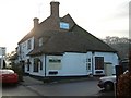
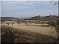
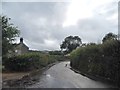
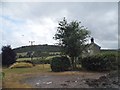
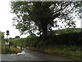
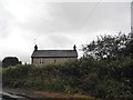
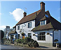
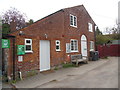
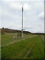
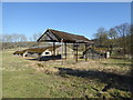
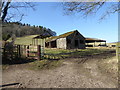
75 photos from this area
Area Information
Key information about the RG9 6TD including its size, population, and administrative classification.
- Area Type
- Postcode
- Area Size
- 19.5 hectares
- Population
- 2409
- Population Density
- 41 people/km²
House Prices in RG9 6TD
32
Properties
£805,353
Average Sold Price
£210,000
Lowest Price
£1,750,000
Highest Price
Showing 32 properties
| Address | Type | Beds | Baths | Last Sale Price | Last Sale Date | |
|---|---|---|---|---|---|---|
| All Saints, Skirmett Road, Skirmett, RG9 6TD | Detached | 4 | 3 | £1,150,000 | Mar 2025 | |
| The Bungalow, Scotchy Lane, Skirmett, RG9 6TD | Detached | - | - | £750,000 | Sep 2023 | |
| Adams Wood, Skirmett Road, Skirmett, RG9 6TD | Detached | 6 | - | £1,250,000 | Jul 2022 | |
| Cobblers Cottage, Skirmett Road, Skirmett, RG9 6TD | Detached | 3 | - | £930,000 | Jul 2022 | |
| Beck House, Skirmett Road, Skirmett, RG9 6TD | Detached | 3 | 2 | £1,750,000 | May 2022 | |
| Walnut Tree Cottage, Skirmett Road, Skirmett, RG9 6TD | Detached | 6 | 3 | £1,600,000 | Oct 2021 | |
| Cavendish, Skirmett Road, Skirmett, RG9 6TD | Bungalow | 3 | - | £510,000 | Oct 2015 | |
| Coombe View, Skirmett Road, Skirmett, RG9 6TD | Cottage | 3 | - | £585,000 | Jun 2014 | |
| Bakery Lodge, Skirmett Road, Skirmett, RG9 6TD | Detached | 4 | 2 | £625,000 | Mar 2014 | |
| Badgers, Skirmett Road, Skirmett, RG9 6TD | house | - | - | £1,425,000 | Feb 2014 |
Page 1 of 4
Energy Efficiency in RG9 6TD
Amenities
Schools
| Rank | School | Type | Entry gender | Ages |
|---|
Explore more schools in this area
Go to Schools tabDemographics
Household Size
Two person
most common
Accommodation Type
Houses
most common
Tenure
73
majority
Ethnic Group
White
most common
Religion
N/A
most common
Household Composition
N/A
most common
Age
47
median
Adults (30-64 years)
most common
Household Deprivation
N/A
with no deprivation
NS-SEC
53
in Lower managerial occupations
Explore more demographic insights in this area
Go to Demographics tabPlanning
Planning Constraints
- Flood RiskPremium
- Ramsar Wetland SitesPremium
- Area of Outstanding Natural BeautyPremium
- Protected Nature ReservePremium
- Protected WoodlandPremium