Area Overview for RG9 5RT
Photos of RG9 5RT
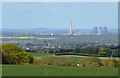
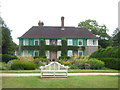
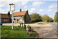
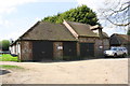
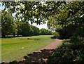
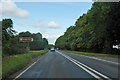
100 photos from this area
Area Information
Key information about the RG9 5RT including its size, population, and administrative classification.
- Area Type
- Postcode
- Area Size
- 2.3 hectares
- Population
- 2069
- Population Density
- 61 people/km²
House Prices in RG9 5RT
5
Properties
£452,000
Average Sold Price
£239,000
Lowest Price
£931,000
Highest Price
Showing 5 properties
| Address | Type | Beds | Baths | Last Sale Price | Last Sale Date | |
|---|---|---|---|---|---|---|
| Chiltern House, Section Of A 4130 Between The Nuffield Turn And Gangsdown Hill, Nuffield, Henley On Thames, RG9 5RT | house | 4 | 3 | £931,000 | Feb 2022 | |
| Vane House, Section Of A 4130 Between The Nuffield Turn And Gangsdown Hill, Nuffield, Henley On Thames, RG9 5RT | Detached | 6 | 3 | £250,000 | Jan 2004 | |
| Cobb House, Section Of A 4130 Between The Nuffield Turn And Gangsdown Hill, Nuffield, Henley On Thames, RG9 5RT | Terraced | - | - | £490,000 | Oct 2000 | |
| Parkwood House, Section Of A 4130 Between The Nuffield Turn And Gangsdown Hill, Nuffield, Henley On Thames, RG9 5RT | Semi-detached | - | - | £350,000 | Jan 1999 | |
| Travellers Shaw, Section Of A 4130 Between The Nuffield Turn And Gangsdown Hill, Nuffield, Henley On Thames, RG9 5RT | Semi-detached | - | - | £239,000 | Jan 1998 |
Energy Efficiency in RG9 5RT
Amenities
Schools
| Rank | School | Type | Entry gender | Ages |
|---|
Explore more schools in this area
Go to Schools tabDemographics
Household Size
Family (3-5 people)
most common
Accommodation Type
Houses
most common
Tenure
67
majority
Ethnic Group
White
most common
Religion
N/A
most common
Household Composition
N/A
most common
Age
47
median
Adults (30-64 years)
most common
Household Deprivation
N/A
with no deprivation
NS-SEC
34
in Lower managerial occupations
Explore more demographic insights in this area
Go to Demographics tabPlanning
Planning Constraints
- Flood RiskPremium
- Ramsar Wetland SitesPremium
- Area of Outstanding Natural BeautyPremium
- Protected Nature ReservePremium
- Protected WoodlandPremium