Area Overview for RG9 4UE
Photos of RG9 4UE


Area Information
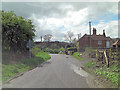
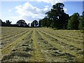
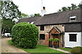
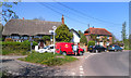
Living in postcodes RG9 4UE offers a character defined by its status as a specific residential cluster rather than a sprawling town. This locality accommodates a population of 1,969 residents spread across a footprint with a density of 77 people per square kilometre. Such a density suggests a residents' focus on semi-rural or suburban surroundings rather than high-rise urban living. The area is situated in England, providing access to the broader infrastructure of the region while maintaining a quieter existence for its inhabitants. Daily life here centres on knowing one's neighbours within a population that has stabilised, creating a familiarity that larger metropolitan zones often lack. Prospective buyers should understand that this postcode represents a precise slice of the larger Henley-on-Thames or Shiplake vicinity. You are purchasing a home in a setting where the community feel is immediate. The environment is likely dominated by housing estates or clusters detached from the main high streets, yet close enough to enjoy their conveniences. This balance allows residents to manage their daily commutes and shopping trips efficiently without facing the congestion of major city centres. Living in this specific cluster means prioritising space and a lower density lifestyle. It is an option for those who value the calm of a smaller residential unit while retaining the amenities of the nearby towns.
- Area Type
- Postcode
- Area Size
- Not available
- Population
- 1969
- Population Density
- 77 people/km²
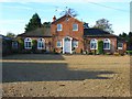
The property market in postcodes RG9 4UE is characterised by a distinct lack of rental stock compared to ownership. With 70% of residents being homeowners, this area functions primarily as an owner-occupied zone. This statistic signifies that the majority of tenures here are freehold properties owned by the occupants themselves. You will not find a high concentration of private rental flats or converted buildings within this specific postcode. Instead, the housing stock consists mainly of houses, which aligns with the preference for detached or semi-detached living found in the RG9 sector. This market structure suggests that if you are looking to buy, you are targeting the secondary or high street market of traditional homeowners. Prices and demand are likely influenced by the desire for a primary residence rather than a satellite rental property. The dominance of houses as the predominant accommodation type means buyers seek space and garden land. This preference shapes the local values, keeping properties as familyhomes rather than investment flats. Living in RG9 4UE implies entering a market where properties change hands less frequently than in dense urban rental zones. The low density further supports the idea of large, standalone homes. Buyers here should expect to navigate a market geared towards long-term retention and family stability.
House Prices in RG9 4UE
No properties found in this postcode.
Energy Efficiency in RG9 4UE
Your lifestyle in RG9 4UE benefits from amenities that are within practical reach of the residential cluster. Retail options include Tesco Henley, Cook Henley-on, and Sainsburys Henley. These five retail outlets provide everyday necessities, groceries, and household goods without the need for long car journeys. For travel, five rail options are available within easy distance. Notable stations include Henley, Shiplake Railway Station, and Wargrave Railway Station. These transport links connect you to wider commercial centres and employment hubs. The combination of local supermarkets and direct rail access defines the convenience factor of this neighbourhood. You can handle your weekly shopping at Tesco Henley or Sainsburys, then commute to central London or Oxfordshire via the rail network. This blend creates a functional living pattern where daily errands are local but work opportunities are regional. The area lacks listed leisure or park venues in the immediate data, so cultural activities will rely on the nearby towns. Dining and socialising will likely occur at the aforementioned supermarket precincts or in the main High Street settlements nearby. This pragmatic approach to amenities ensures you have everything you need close by while preserving the quiet of your home.
Amenities
Schools
Families considering homes in RG9 4UE have access to four specific educational institutions nearby. The options include Harpsden Parochial School, Shiplake Church of England School, and Gillotts School. Harpsden Parochial School and Gillotts School are classified as primary institutions. Shiplake Church of England School also holds primary status and carries an Ofsted rating of good. Gillotts School distinguishes itself by operating as an academy alongside its primary classification, where it holds an outstanding Ofsted rating. This mix of voluntary aided and academy primary schools provides several choices for your children's education. The presence of a school with an outstanding rating is a significant advantage for parents in this postcode. Having two primary options, one of which is rated good and the other outstanding, suggests a competitive local market for education. You do not need to travel far for schooling, as all listed facilities are situated near the residential cluster. The school types indicate a focus on early years and fundamental education before pupils transfer to secondary institutions elsewhere. Checking the distance from your potentialRG94UE address to these specific venues is the next logical step.
| Rank | School | Type | Entry gender | Ages |
|---|
Explore more schools in this area
Go to Schools tabDemographics
The community within RG9 4UE mirrors a settled population with a median age of 47 years. This figure indicates that the primary resident demographic consists of adults aged between 30 and 64 years. A significant majority, 70% of householders, own their residences outright. This high ownership rate points to a neighbourhood where families have chosen to stay long term or where residents work towards securing full equity. The dominant accommodation type is houses, confirming that flats or apartments are not the standard housing stock here. You will find single-family dwellings forming the backbone of this local area. The predominant ethnic group is White, contributing to a demographic profile that is largely homogeneous by current statistics. These facts paint a picture of a mature, stable community. Residents are likely to be established individuals who have invested in housing and family life in RG9 4UE. The age profile suggests a quiet atmosphere rather than a bustling hub of young professionals or temporary tenants. Homeownership dominance means that the market is driven by sellers and buyers rather than landlords and renters. This stability often translates into predictable neighbourhood standards and a consistent voter population. Understanding these figures helps you gauge the social fabric before visiting the area.
Household Size
Accommodation Type
Tenure
Ethnic Group
Religion
Household Composition
Age
Household Deprivation
NS-SEC
Explore more demographic insights in this area
Go to Demographics tabPlanning
Planning Constraints
- Flood RiskPremium
- Ramsar Wetland SitesPremium
- Area of Outstanding Natural BeautyPremium
- Protected Nature ReservePremium
- Protected WoodlandPremium