Area Overview for RG9 4UA
Photos of RG9 4UA


Area Information
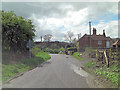
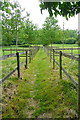
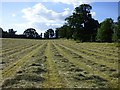
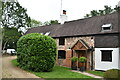
RG9 4UA represents a small, tightly-knit residential cluster within England with a total population of 1,969 people. This postcode covers a modest footprint where residents live at an average density of 77 people per square kilometre. Life in this area is defined by its scale; the area is not a sprawling development but a specific residential pocket that offers a distinct sense of place. The locality feels intimate because the total number of inhabitants is so low, meaning you will know your neighbours and notice changes in the local environment quickly. Living in RG9 4UA means you are part of a quiet settlement rather than a busy urban district. The area provides a backdrop for daily life without the noise or crowding found in larger communities. The residential nature of RG9 4UA is absolute, with housing forms designed for long-term settling rather than transient living. The consistent low density suggests a focus on space and gardens rather than high-rise density or shared corridors. For those considering homes in this postcode, the environment is calm and managed. There are no industrial zones or chaotic commercial strips cluttering the immediate view; the sky remains clear of smokestacks, and the streets remain clear of heavy traffic congestion. This small cluster offers a straightforward lifestyle where your morning commute begins in a peaceful setting. The area is built around the home, making it an ideal base for families who value quiet over urban adrenaline. The character of RG9 4UA remains stable, shaped by the needs of a permanent resident population.
- Area Type
- Postcode
- Area Size
- Not available
- Population
- 1969
- Population Density
- 77 people/km²
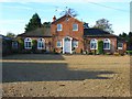
The housing market in RG9 4UA is characterised by a deeply established stock where ownership is the norm. With 70 per cent of the population owning their homes, the area functions as a long-term settlement rather than a rental district. The accommodation type is strictly houses, meaning the market offers detached or semi-detached properties rather than apartments or maisonettes. This format is consistent with the demographic profile of adults aged 30 to 64, who typically require the space and privacy that standalone houses provide. You are not likely to find shared entry vectors or communal halls here; every home is its own private entity. For buyers looking at homes in RG9 4UA, the 70 per cent ownership rate suggests that many properties were purchased some time ago, potentially meaning features vary based on the decade of construction. The market is not driven by urban regeneration or new development projects but by existing stock turnover. This stability means prices reflect the enduring value of the location rather than speculative growth. The total population of 1,969 limits the size of the buyer pool, which can imply a smaller inventory at any given time. There is little evidence of high-rise living or student housing in this immediate area. The property type is uniform, creating a consistent visual identity across the small cluster. When you buy a house here, you are entering a market defined by permanence, not flux. The lack of rental data further isolates this market, making it distinct from nearby areas where landlords might operate more fluidly.
House Prices in RG9 4UA
No properties found in this postcode.
Energy Efficiency in RG9 4UA
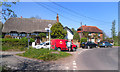
Daily life in RG9 4UA is facilitated by a cluster of retail and transport options that are within practical reach. Residents benefit from five retail locations, with notable venues including Tesco Henley, Cook Henley-on, and Sainsburys Henley. These three supermarkets alone provide ample opportunity for grocery shopping, including fresh produce and household essentials. The presence of Cook Henley-on suggests a range of convenience goods available outside the supermarket chain. For those who prefer a quick stop, the area offers three distinct stops, ensuring you do not need to travel far for everyday items. Transport links are defined by five nearby railway stations, including Henley, Shiplake Railway Station, and Wargrave Railway Station. These stations allow residents to commute without relying on a private car for every journey. The proximity to these stations means you can reach central business districts with relative ease. The combination of supermarkets and rail access creates a convenient lifestyle where errands and commutes are separated but equally accessible. You will find that living in RG9 4UA does not require a long car commute for basic needs. The local amenities are sufficient to support a self-sufficient household, with the bulk of daily requirements met within a short drive or walk to the nearest town services. This balance of retail and transport defines the character of the neighbourhood, keeping life convenient without being overwhelming.
Amenities
Schools
Families living in RG9 4UA have access to a specific mix of educational institutions, all catering to young children. Closest to the postcode are Harpsden Parochial School, Gillotts School (primary), and Shiplake Church of England School, which are all primary settings. Gillotts School also operates as an academy; the data records an outstanding Ofsted rating for the academy variant, while also listing the primary incarnation. Shiplake Church of England School holds a good Ofsted rating. The presence of multiple primary schools indicates a network of local education resources rather than just a single option. The variety of school types, including both maintained schools and academies, provides parents with choices in governance and educational approach. The outstanding rating achieved by the academy branch of Gillotts School stands as a strong marker of educational quality within reach of residents. Parents seeking schools near RG9 4UA can choose between the traditional parochial setting of Harpsden and the church-affiliated curriculum of Shiplake. The concentration of primary education providers suggests that the immediate vicinity focuses on early years learning, with secondary education likely located further away. This school mix supports the demographic reality of a community where most residents are adults aged 30 to 64, raising school-aged children. The data does not list secondary schools, so the known options remain limited to these primary and academy-level institutions.
| Rank | School | Type | Entry gender | Ages |
|---|
Explore more schools in this area
Go to Schools tabDemographics
The community within RG9 4UA is mature and established, with a median age of 47 years. Most residents fall into the adult age range between 30 and 64 years, indicating a working-age population that largely consists of families or retired professionals. This age profile suggests neighbourhoods populated by people with financial stability and established careers. Home ownership is the dominant housing tenure, standing at 70 per cent. This high figure means that most people in RG9 4UA have purchased their properties and are likely to stay in the same home for many years. The result is a stable community where neighbours often know each other by name and share long-term interests. The accommodation type in this postcode is exclusively houses, with no blocks of flats or shared ownership schemes recorded in the data. This constraint defines the physical look of the neighbourhood, with each property likely surrounded by private land. The predominant ethnic group is White, which aligns with the older demographic profile and traditional housing stock typical of the region. You will find a community where children play in the streets and dogs walk freely along the roads, reflecting the secure environment of owner-occupied homes. The absence of rented sector data implies a lack of transient tenancy, further cementing the area's reputation as a place for families to put down permanent roots. The socioeconomic implication of such a high ownership rate is a neighbourhood where residents often have a significant personal investment in local improvements.
Household Size
Accommodation Type
Tenure
Ethnic Group
Religion
Household Composition
Age
Household Deprivation
NS-SEC
Explore more demographic insights in this area
Go to Demographics tabPlanning
Planning Constraints
- Flood RiskPremium
- Ramsar Wetland SitesPremium
- Area of Outstanding Natural BeautyPremium
- Protected Nature ReservePremium
- Protected WoodlandPremium