Area Overview for RG9 4DS
Photos of RG9 4DS
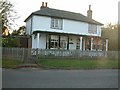
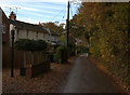

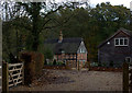
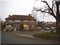
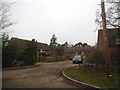
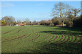
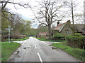
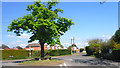

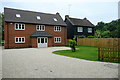
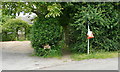
17 photos from this area
Area Information
Key information about the RG9 4DS including its size, population, and administrative classification.
- Area Type
- Postcode
- Area Size
- 1.3 hectares
- Population
- 1969
- Population Density
- 77 people/km²
House Prices in RG9 4DS
14
Properties
£540,083
Average Sold Price
£320,000
Lowest Price
£660,000
Highest Price
Showing 14 properties
| Address | Type | Beds | Baths | Last Sale Price | Last Sale Date | |
|---|---|---|---|---|---|---|
| 12 Heathfield Close, Binfield Heath, Henley On Thames, RG9 4DS | Bungalow | 3 | 2 | £642,500 | Feb 2024 | |
| 4 Heathfield Close, Binfield Heath, Henley On Thames, RG9 4DS | Retail | 3 | 2 | £650,000 | Mar 2022 | |
| 14 Heathfield Close, Binfield Heath, Henley On Thames, RG9 4DS | Bungalow | 3 | 1 | £480,000 | May 2018 | |
| 1 Heathfield Close, Binfield Heath, Henley On Thames, RG9 4DS | house | - | - | £488,000 | Jul 2016 | |
| 7 Heathfield Close, Binfield Heath, Henley On Thames, RG9 4DS | Detached | 6 | - | £660,000 | Jul 2014 | |
| 8 Heathfield Close, Binfield Heath, Henley On Thames, RG9 4DS | house | - | - | £320,000 | Dec 2005 | |
| Caravan, 6 Heathfield Close, Binfield Heath, Henley On Thames, RG9 4DS | Mobile Home | - | - | - | - | |
| 6 Heathfield Close, Binfield Heath, Henley On Thames, RG9 4DS | house | - | - | - | - | |
| 13 Heathfield Close, Binfield Heath, Henley On Thames, RG9 4DS | Detached | - | - | - | - | |
| 2 Heathfield Close, Binfield Heath, Henley On Thames, RG9 4DS | Detached | - | - | - | - |
Page 1 of 2
Energy Efficiency in RG9 4DS
Amenities
Schools
| Rank | School | Type | Entry gender | Ages |
|---|
Explore more schools in this area
Go to Schools tabDemographics
Household Size
Family (3-5 people)
most common
Accommodation Type
Houses
most common
Tenure
70
majority
Ethnic Group
White
most common
Religion
N/A
most common
Household Composition
N/A
most common
Age
47
median
Adults (30-64 years)
most common
Household Deprivation
N/A
with no deprivation
NS-SEC
49
in Lower managerial occupations
Explore more demographic insights in this area
Go to Demographics tabPlanning
Planning Constraints
- Flood RiskPremium
- Ramsar Wetland SitesPremium
- Area of Outstanding Natural BeautyPremium
- Protected Nature ReservePremium
- Protected WoodlandPremium