Area Overview for RG9 3LW
Photos of RG9 3LW
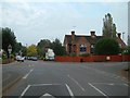

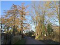
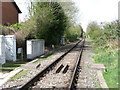
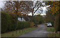
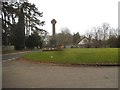
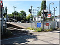
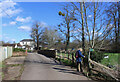
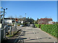
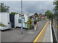
44 photos from this area
Area Information
Key information about the RG9 3LW including its size, population, and administrative classification.
- Area Type
- Postcode
- Area Size
- 3.7 hectares
- Population
- 1706
- Population Density
- 415 people/km²
House Prices in RG9 3LW
20
Properties
£1,266,036
Average Sold Price
£682,500
Lowest Price
£3,500,000
Highest Price
Showing 20 properties
| Address | Type | Beds | Baths | Last Sale Price | Last Sale Date | |
|---|---|---|---|---|---|---|
| The Laurels, Mill Road, Shiplake, Henley On Thames, RG9 3LW | house | - | - | £1,425,000 | Mar 2023 | |
| Shiplake Cottage, Mill Road, Shiplake, Henley On Thames, RG9 3LW | Semi-detached | 4 | 3 | £1,695,000 | Nov 2022 | |
| Elm Cottage, Mill Road, Shiplake, Henley On Thames, RG9 3LW | house | - | - | £1,801,000 | May 2022 | |
| Brookfield, Mill Road, Shiplake, Henley On Thames, RG9 3LW | Detached | 4 | 4 | £3,500,000 | May 2022 | |
| Springfield House, Mill Road, Shiplake, Henley On Thames, RG9 3LW | house | 4 | 2 | £960,000 | Apr 2022 | |
| October Cottage, Mill Road, Shiplake, Henley On Thames, RG9 3LW | Detached | 4 | 3 | £1,025,000 | Mar 2021 | |
| Brook Cottage, Mill Road, Shiplake, Henley On Thames, RG9 3LW | Detached | 3 | 2 | £1,320,000 | Aug 2020 | |
| Hinta, Mill Road, Shiplake, Henley On Thames, RG9 3LW | Bungalow | - | - | £686,000 | Mar 2019 | |
| Virginia Cottage, Mill Road, Shiplake, Henley On Thames, RG9 3LW | house | - | - | £720,000 | Dec 2018 | |
| Gypsy Cottage, Mill Road, Shiplake, Henley On Thames, RG9 3LW | house | - | - | £830,000 | Jun 2018 |
Page 1 of 2
Energy Efficiency in RG9 3LW
Amenities
Schools
| Rank | School | Type | Entry gender | Ages |
|---|
Explore more schools in this area
Go to Schools tabDemographics
Household Size
Two person
most common
Accommodation Type
Houses
most common
Tenure
87
majority
Ethnic Group
White
most common
Religion
N/A
most common
Household Composition
N/A
most common
Age
47
median
Adults (30-64 years)
most common
Household Deprivation
N/A
with no deprivation
NS-SEC
54
in Lower managerial occupations
Explore more demographic insights in this area
Go to Demographics tabPlanning
Planning Constraints
- Flood RiskPremium
- Ramsar Wetland SitesPremium
- Area of Outstanding Natural BeautyPremium
- Protected Nature ReservePremium
- Protected WoodlandPremium