Area Overview for RG9 3LH
Photos of RG9 3LH

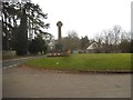
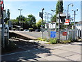
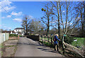
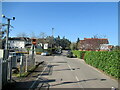
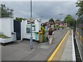
44 photos from this area
Area Information
Key information about the RG9 3LH including its size, population, and administrative classification.
- Area Type
- Postcode
- Area Size
- 1.4 hectares
- Population
- 1706
- Population Density
- 415 people/km²
House Prices in RG9 3LH
9
Properties
£1,072,143
Average Sold Price
£325,000
Lowest Price
£2,400,000
Highest Price
Showing 9 properties
| Address | Type | Beds | Baths | Last Sale Price | Last Sale Date | |
|---|---|---|---|---|---|---|
| Shiplake Lodge, New Road, Shiplake, Henley On Thames, RG9 3LH | Detached | 5 | 3 | £1,550,000 | Jul 2024 | |
| 2 New Road, Shiplake, Henley On Thames, RG9 3LH | Detached | 5 | - | £640,000 | Jun 2021 | |
| Mulleins, New Road, Shiplake, Henley On Thames, RG9 3LH | house | - | - | £790,000 | Oct 2018 | |
| Yule Lodge, New Road, Shiplake, Henley On Thames, RG9 3LH | house | - | - | £1,125,000 | Mar 2014 | |
| Lashbrook Lodge, New Road, Shiplake, Henley On Thames, RG9 3LH | Detached | 6 | 4 | £2,400,000 | May 2013 | |
| The Grey House, New Road, Shiplake, Henley On Thames, RG9 3LH | Semi-detached | - | - | £675,000 | Jul 2000 | |
| Downside, New Road, Shiplake, Henley On Thames, RG9 3LH | Detached | - | - | £325,000 | Mar 1999 | |
| Lime Cottage, New Road, Shiplake, Henley On Thames, RG9 3LH | Bungalow | 2 | 1 | - | - | |
| Solaire House, New Road, Shiplake, Henley On Thames, RG9 3LH | house | - | - | - | - |
Energy Efficiency in RG9 3LH
Amenities
Schools
| Rank | School | Type | Entry gender | Ages |
|---|
Explore more schools in this area
Go to Schools tabDemographics
Household Size
Two person
most common
Accommodation Type
Houses
most common
Tenure
87
majority
Ethnic Group
White
most common
Religion
N/A
most common
Household Composition
N/A
most common
Age
47
median
Adults (30-64 years)
most common
Household Deprivation
N/A
with no deprivation
NS-SEC
54
in Lower managerial occupations
Explore more demographic insights in this area
Go to Demographics tabPlanning
Planning Constraints
- Flood RiskPremium
- Ramsar Wetland SitesPremium
- Area of Outstanding Natural BeautyPremium
- Protected Nature ReservePremium
- Protected WoodlandPremium