Area Overview for RG9 2DS
Photos of RG9 2DS
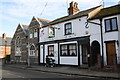
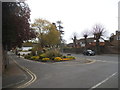
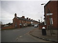
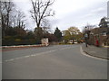
100 photos from this area
Area Information
Key information about the RG9 2DS including its size, population, and administrative classification.
- Area Type
- Postcode
- Area Size
- 4244 m²
- Population
- 2119
- Population Density
- 2619 people/km²
House Prices in RG9 2DS
14
Properties
£449,208
Average Sold Price
£143,000
Lowest Price
£750,000
Highest Price
Showing 14 properties
| Address | Type | Beds | Baths | Last Sale Price | Last Sale Date | |
|---|---|---|---|---|---|---|
| 3 Kings Close, Henley On Thames, RG9 2DS | Terraced | 2 | 1 | £620,000 | Sep 2022 | |
| 11 Kings Close, Henley On Thames, RG9 2DS | Terraced | 3 | - | £640,000 | Mar 2022 | |
| 8 Kings Close, Henley On Thames, RG9 2DS | house | 3 | - | £750,000 | Sep 2021 | |
| 6 Kings Close, Henley On Thames, RG9 2DS | house | 3 | - | £700,000 | Mar 2017 | |
| 7 Kings Close, Henley On Thames, RG9 2DS | Terraced | 3 | 2 | £637,500 | Apr 2016 | |
| 4 Kings Close, Henley On Thames, RG9 2DS | house | - | - | £425,000 | Dec 2012 | |
| 5 Kings Close, Henley On Thames, RG9 2DS | house | 3 | - | £380,000 | Jul 2011 | |
| 10 Kings Close, Henley On Thames, RG9 2DS | Flat | - | - | £250,000 | Feb 2011 | |
| 12 Kings Close, Henley On Thames, RG9 2DS | Terraced | 3 | 1 | £315,000 | Dec 2010 | |
| 2 Kings Close, Henley On Thames, RG9 2DS | Terraced | 2 | 1 | £280,000 | Jun 2005 |
Page 1 of 2
Energy Efficiency in RG9 2DS
Amenities
Schools
| Rank | School | Type | Entry gender | Ages |
|---|
Explore more schools in this area
Go to Schools tabDemographics
Household Size
One person
most common
Accommodation Type
Houses
most common
Tenure
61
majority
Ethnic Group
White
most common
Religion
N/A
most common
Household Composition
N/A
most common
Age
47
median
Adults (30-64 years)
most common
Household Deprivation
N/A
with no deprivation
NS-SEC
52
in Lower managerial occupations
Explore more demographic insights in this area
Go to Demographics tabPlanning
Planning Constraints
- Flood RiskPremium
- Ramsar Wetland SitesPremium
- Area of Outstanding Natural BeautyPremium
- Protected Nature ReservePremium
- Protected WoodlandPremium