Area Overview for RG9 1PJ
Photos of RG9 1PJ
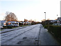
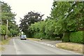
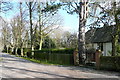

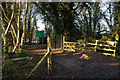
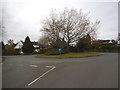
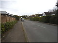
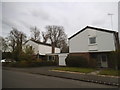
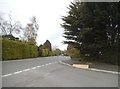
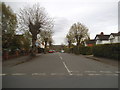
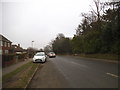
35 photos from this area
Area Information
Key information about the RG9 1PJ including its size, population, and administrative classification.
- Area Type
- Postcode
- Area Size
- 1.2 hectares
- Population
- 1355
- Population Density
- 1780 people/km²
House Prices in RG9 1PJ
18
Properties
£590,708
Average Sold Price
£182,000
Lowest Price
£995,000
Highest Price
Showing 18 properties
| Address | Type | Beds | Baths | Last Sale Price | Last Sale Date | |
|---|---|---|---|---|---|---|
| 12 St Katherines Road, Henley On Thames, RG9 1PJ | Detached | 3 | 2 | £880,000 | Aug 2025 | |
| 7 St Katherines Road, Henley On Thames, RG9 1PJ | Bungalow | 4 | 1 | £900,000 | Jan 2024 | |
| 16 St Katherines Road, Henley On Thames, RG9 1PJ | house | - | - | £995,000 | Jan 2021 | |
| 1 St Katherines Road, Henley On Thames, RG9 1PJ | Bungalow | 3 | - | £730,000 | Oct 2017 | |
| 3 St Katherines Road, Henley On Thames, RG9 1PJ | Bungalow | 4 | - | £690,000 | Nov 2014 | |
| 6 St Katherines Road, Henley On Thames, RG9 1PJ | Detached | 3 | - | £695,000 | Nov 2014 | |
| 9 St Katherines Road, Henley On Thames, RG9 1PJ | Bungalow | 4 | 3 | £610,000 | Oct 2010 | |
| 2 St Katherines Road, Henley On Thames, RG9 1PJ | Detached | - | - | £438,500 | Jul 2006 | |
| 4 St Katherines Road, Henley On Thames, RG9 1PJ | Detached | - | - | £375,000 | Oct 2002 | |
| 10 St Katherines Road, Henley On Thames, RG9 1PJ | Detached | 4 | 1 | £318,000 | Dec 2000 |
Page 1 of 2
Energy Efficiency in RG9 1PJ
Amenities
Schools
| Rank | School | Type | Entry gender | Ages |
|---|
Explore more schools in this area
Go to Schools tabDemographics
Household Size
Two person
most common
Accommodation Type
Houses
most common
Tenure
88
majority
Ethnic Group
White
most common
Religion
N/A
most common
Household Composition
N/A
most common
Age
47
median
Adults (30-64 years)
most common
Household Deprivation
N/A
with no deprivation
NS-SEC
58
in Lower managerial occupations
Explore more demographic insights in this area
Go to Demographics tabPlanning
Planning Constraints
- Flood RiskPremium
- Ramsar Wetland SitesPremium
- Area of Outstanding Natural BeautyPremium
- Protected Nature ReservePremium
- Protected WoodlandPremium