Area Overview for RG9 1PA
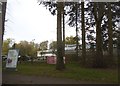
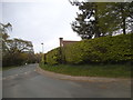
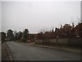
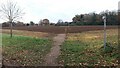
Photos of RG9 1PA


Area Information
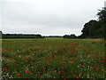
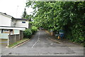
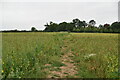
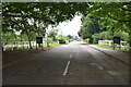
Living in RG9 1PA offers a distinctly quiet residential experience within a compact cluster of just 6480 square metres. This postcode covers a small neighbourhood population of 1969 people, resulting in a low density of 77 people per square kilometre. You will find that the area is primarily residential, offering an escape from the busier streets of adjoining towns while maintaining easy access to local services. The setting is functional and practical, defined by close quarters and a sense of established community. Residents here enjoy a peaceful environment where the immediate surroundings are tightly knit. The area sits in England and functions as a self-contained part of the wider region. Daily life revolves around accessing nearby amenities and schools, with the small footprint meaning you rarely need to travel far for daily necessities. This low-density living appeals to those who value space and tranquility without being isolated from essential facilities. The character of RG9 1PA is one of established domesticity rather than rapid development. You can expect a stable community atmosphere where neighbours often share a long history. The area does not boast vast green spaces or industrial zones, focusing purely on housing. This makes it an ideal choice for individuals seeking a straightforward, low-stress living environment. Whether you are local or relocating, the scale of this postcode ensures a manageable and intimate neighbourhood dynamic.
- Area Type
- Postcode
- Area Size
- 6480 m²
- Population
- 1969
- Population Density
- 77 people/km²
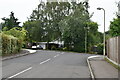
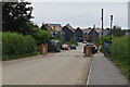
The property market in RG9 1PA reflects a traditional housing stock dominated by detached and semi-detached houses. With 70% home ownership rates, you will find very few private rentals available compared to owner-occupied homes. This high proportion of owner-occupiers indicates that the area attracts buyers rather than landlords seeking tenant yields. The accommodation type is exclusively houses, meaning you can expect a consistent architectural style and garden space across the postcode. This contrasts with mixed-use developments found in busier towns. The small area size of 6480 square metres limits the number of new builds, reinforcing the established nature of the housing stock. Buyers looking at RG9 1PA should anticipate purchasing an existing home rather than finding a brand-new development. The prevalence of house ownership suggests resilient property values linked to local demand for detached living. If you are considering homes in this area, expect a market driven by local transfers and inherited estates. Rental availability will be scarce, making this a less suitable location for flexible movers on short-term contracts. The market dynamics are grounded in the practical needs of families and retirees who value stability over speculation. Prices here likely reflect the quality of life and the scarcity of new supply within such a tight postcode boundary.
House Prices in RG9 1PA
No properties found in this postcode.
Energy Efficiency in RG9 1PA
Your lifestyle in RG9 1PA centres on convenience and access to nearby commercial hubs. You have five retail options within practical reach, including Cook Henley-on, Sainsburys Henley, and Waitrose Henley-on. These venues provide everything from fresh groceries to household essentials without requiring a long drive. The presence of Waitrose indicates a higher standard of shopping experience often sought by residents in affluent areas. For daily needs, you can walk or take a short drive to these shops. Transport links are further enhanced by five rail connections nearby. Henley, Shiplake Railway Station, and Wargrave Railway Station offer multiple departure points for your commute. This variety means you are not reliant on a single train line for travel plans. If one station is overtaken, others remain available options. The proximity to these stations reduces your travel stress and improves your ability to access London or regional destinations. Your daily routine benefits from having major supermarkets and major rail junctions in close quarters. Leisure activities can be supplemented by these transport links, allowing weekend trips without extensive driving. The combination of retail and rail access creates a self-sufficient lifestyle where you rarely need to leave the immediate metropolitan area. Convenience is a defining feature of living here.
Amenities
Schools
Education options for residents of RG9 1PA are located within close proximity, offering a mix of primary institutions. Harpsden Parochial School serves as a local primary option, providing education for younger children in a faith-based setting. Nearby, Shiplake Church of England School holds a 'good' Ofsted rating, indicating a standard of education that meets government expectations. For families requiring higher-tier primary or academy transitions, Gillotts School operates within the immediate vicinity. This institution holds two designations in the local area: it functions as both a primary school and an academy. Crucially, the academy branch carries an 'outstanding' Ofsted rating, a distinction that signals exceptional educational performance. Having an academy with this rating on your doorsteps provides an attractive route for your children's secondary education or alternative pathways. The presence of both parochial and state school options gives you flexibility when choosing schooling environments. You do not need to commute far to secure quality education for your children. The combination of a good-rated church school and an outstanding academy suggests a robust educational infrastructure for the neighbourhood. These schools form the backbone of community life in RG9 1PA, anchoring the area as a viable location for school-run families.
| Rank | School | Type | Entry gender | Ages |
|---|
Explore more schools in this area
Go to Schools tabDemographics
The community in RG9 1PA is defined by stability and maturity. The median age sits at 47 years, reflecting an older demographic compared to national averages for urban centres. Most residents fall into the adult age range of 30 to 64 years, indicating a population that has settled rather than transient households moving frequently. You will see a high level of home ownership, with 70% of households owning their properties outright or via mortgage. This figure suggests a strong investment in the local neighbourhood and long-term commitment to RG9 1PA. Houses dominate the accommodation type landscape, meaning terraced apartments or luxury conversions are rare finds here. The predominant ethnic group is White, aligning with the broader demographic trends often found in established English villages and commuter belts. This homogeneity contributes to a familiar social fabric for new families or retirees. The age profile implies a community with plenty of local support networks for older residents, while still maintaining an active middle-aged population. There is little evidence of recent gentrification or student influx, which differentiates RG9 1PA from rapidly changing urban districts. The demographic data points to a neighbourhood where residents have put down roots. Families here likely value quiet streets over proximity to nightlife. The high ownership rate also correlates with lower tenant turnover, providing a consistent environment for those seeking a permanent home. Such a demographic profile supports local businesses that serve long-term residents.
Household Size
Accommodation Type
Tenure
Ethnic Group
Religion
Household Composition
Age
Household Deprivation
NS-SEC
Explore more demographic insights in this area
Go to Demographics tabPlanning
Planning Constraints
- Flood RiskPremium
- Ramsar Wetland SitesPremium
- Area of Outstanding Natural BeautyPremium
- Protected Nature ReservePremium
- Protected WoodlandPremium