Area Overview for RG9 1NE
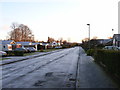
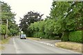
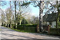
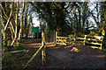
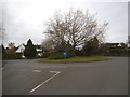
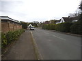
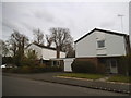
Photos of RG9 1NE

Area Information
Living in RG9 1NE offers a distinct experience centred on a small, tightly knit residential cluster. This specific postcode covers an area of only 797 square metres, serving a population of 1,595 people. Such a compact footprint creates an intimate neighbourhood feel where residents often know one another, yet the location provides immediate access to the wider benefits of the Henley-on-Thames region. Daily life here is characterised by proximity to essential services and transport links without the sprawling urban density found in larger districts. You will find yourself situated in a setting that balances quiet domestic living with convenient reach to local amenities. The area functions as a focused residential hub, ideal for those seeking a home in a defined community rather than a broad, amorphous zone. Understanding the scale of RG9 1NE is key; it is a microcosm of larger settlement patterns, offering stability and familiarity. Whether you are new to the area or considering an upgrade, the compact nature of this postcode ensures you are never far from the heart of local activity.
- Area Type
- Postcode
- Area Size
- 797 m²
- Population
- 1595
- Population Density
- 4570 people/km²
The property market in RG9 1NE is defined by a housing stock that is overwhelmingly owned by occupants. With 73% of homes owned outright or with a mortgage, this is not a renter-heavy zone but a territory for homeowners. The predominant accommodation type is houses, meaning you will unlikely encounter flats or apartment blocks within this specific cluster. This concentration of house stock appeals to buyers seeking traditional UK housing with gardens and private ground. Because the area covers so small a space, the market operates on a hyper-local level where price and availability are dictated by individual properties rather than large developments. For buyers looking at RG9 1NE, the high ownership figure suggests that available stock is likely driven by estate sales, upsizing, or downsizing rather than new builds. The focus on houses over apartments limits immediate choices for younger buyers who prefer urban living. However, for those who specifically require a detached or semi-detached home in a quiet setting, the available properties align perfectly with those needs. The market here is steady, reflecting the 47-year median age of residents who tend to remain in their homes for extended periods.
House Prices in RG9 1NE
Showing 1 properties
| Address | Type | Beds | Baths | Last Sale Price | Last Sale Date | |
|---|---|---|---|---|---|---|
| Oakmount, Peppard Lane, Henley On Thames, RG9 1NE | Detached | 5 | 2 | £1,000,000 | Dec 2023 |
Energy Efficiency in RG9 1NE
Life in RG9 1NE includes practical access to several retail and transport hubs within practical reach. Retail options are supported by three notable venues: Tesco Henley, Cook Henley-on, and Sainsburys Henley. These supermarkets provide the daily essentials without requiring a long drive. You can rely on these three major chains to meet grocery needs. For rail travel, five nearby stations serve the network, including Henley, Shiplake Railway Station, and Wargrave Railway Station. Having three named stations in the immediate vicinity gives you flexibility in journey planning and connectivity to London and beyond. The proximity to Henley-on-Thames likely offers additional leisure and dining opportunities beyond the listed supermarkets. Your lifestyle here blends convenience with the ease of public transport. The fact that you have multiple railway options means you are not reliant on a single line for commuting. Daily errands are manageable via the local shops, while larger commitments can be handled from the nearby rail stations.
Amenities
Schools
Families living in RG9 1NE have access to St Mary's Preparatory as the nearest school. This institution is an independent school holding a Good Ofsted rating. The availability of only one specific school in the immediate vicinity suggests that many residents may rely on catchment-area primary schools in neighbouring postcodes for elementary education. Independent education remains a strong option for those in the area who prefer that schooling model. The Good rating provided by Ofsted confirms that the school meets required standards of quality and performance. For families without an existing independent schooling preference, the lack of state schools listed immediately adjacent to this postcode means you must look slightly further afield for primary or secondary options. The presence of St Mary's Preparatory offers a prestigious educational route that aligns with the area's demographic of older, established homeowners. You will find that educational choices here are somewhat limited by geography, necessitating a look at wider town resources for community primary schools.
| Rank | School | Type | Entry gender | Ages |
|---|
Explore more schools in this area
Go to Schools tabDemographics
The community in RG9 1NE reflects a mature population with a median age of 47 years. Most residents fall within the 30 to 64 years age range, indicating a neighbourhood dominated by working adults and empty nesters rather than young families with younger children. This age profile suggests a stable environment where long-term residents have put down roots. Home ownership stands at a high 73% of households, which points strongly towards an area where people buy to stay rather than rent for short periods. The predominant accommodation type consists of houses, aligning with the preferences of an older demographic seeking space and independence. The area is ethnically diverse but predominantly White, contributing to a familiar cultural landscape for many. You will find a community where established habits and local knowledge likely run deep. This demographic structure means the neighbourhood may appeal to those nearing retirement or professionals looking for a settled, calm environment away from teenage energy. The high ownership rate and house focus create a consistent, predictable neighbourhood vibe that change-resistant residents will appreciate.
Household Size
Accommodation Type
Tenure
Ethnic Group
Religion
Household Composition
Age
Household Deprivation
NS-SEC
Explore more demographic insights in this area
Go to Demographics tabPlanning
Planning Constraints
- Flood RiskPremium
- Ramsar Wetland SitesPremium
- Area of Outstanding Natural BeautyPremium
- Protected Nature ReservePremium
- Protected WoodlandPremium