Area Overview for RG9 1JN
Photos of RG9 1JN
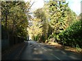
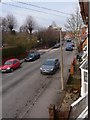
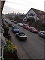
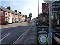
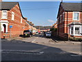
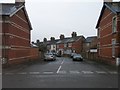
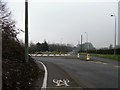
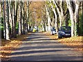

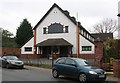
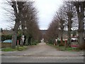
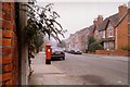
100 photos from this area
Area Information
Key information about the RG9 1JN including its size, population, and administrative classification.
- Area Type
- Postcode
- Area Size
- 1.1 hectares
- Population
- 1595
- Population Density
- 4570 people/km²
House Prices in RG9 1JN
17
Properties
£904,269
Average Sold Price
£500,000
Lowest Price
£1,850,000
Highest Price
Showing 17 properties
| Address | Type | Beds | Baths | Last Sale Price | Last Sale Date | |
|---|---|---|---|---|---|---|
| 32 Western Road, Henley On Thames, RG9 1JN | Detached | 4 | 3 | £1,225,000 | Oct 2025 | |
| 35 Western Road, Henley On Thames, RG9 1JN | Semi-detached | 3 | 1 | £880,000 | Mar 2023 | |
| Prospects, 36 Western Road, Henley On Thames, RG9 1JN | Detached | 4 | 1 | £1,275,000 | Jul 2022 | |
| 25 Western Road, Henley On Thames, RG9 1JN | Retail | 4 | - | £900,000 | Jun 2022 | |
| 38 Western Road, Henley On Thames, RG9 1JN | house | 5 | 5 | £1,850,000 | Mar 2021 | |
| 33 Western Road, Henley On Thames, RG9 1JN | house | - | - | £890,000 | Apr 2019 | |
| 28 Western Road, Henley On Thames, RG9 1JN | house | - | - | £917,500 | Dec 2012 | |
| 27 Western Road, Henley On Thames, RG9 1JN | house | 3 | - | £543,000 | Nov 2012 | |
| 34 Western Road, Henley On Thames, RG9 1JN | Detached | 6 | 3 | £840,000 | Dec 2010 | |
| 24 Western Road, Henley On Thames, RG9 1JN | Semi-detached | 6 | - | £635,000 | May 2007 |
Page 1 of 2
Energy Efficiency in RG9 1JN
Amenities
Schools
| Rank | School | Type | Entry gender | Ages |
|---|
Explore more schools in this area
Go to Schools tabDemographics
Household Size
Family (3-5 people)
most common
Accommodation Type
Houses
most common
Tenure
73
majority
Ethnic Group
White
most common
Religion
N/A
most common
Household Composition
N/A
most common
Age
47
median
Adults (30-64 years)
most common
Household Deprivation
N/A
with no deprivation
NS-SEC
52
in Lower managerial occupations
Explore more demographic insights in this area
Go to Demographics tabPlanning
Planning Constraints
- Flood RiskPremium
- Ramsar Wetland SitesPremium
- Area of Outstanding Natural BeautyPremium
- Protected Nature ReservePremium
- Protected WoodlandPremium