Area Overview for RG9 1EJ
Photos of RG9 1EJ
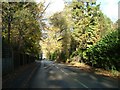
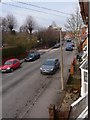
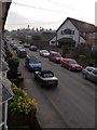
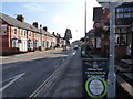
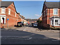
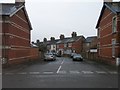
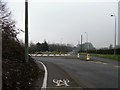
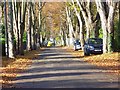
100 photos from this area
Area Information
Key information about the RG9 1EJ including its size, population, and administrative classification.
- Area Type
- Postcode
- Area Size
- 7521 m²
- Population
- 1596
- Population Density
- 2142 people/km²
House Prices in RG9 1EJ
18
Properties
£458,714
Average Sold Price
£140,000
Lowest Price
£655,000
Highest Price
Showing 18 properties
| Address | Type | Beds | Baths | Last Sale Price | Last Sale Date | |
|---|---|---|---|---|---|---|
| Bay Tree Cottage, 2B Farm Road, Henley On Thames, RG9 1EJ | Semi-detached | 2 | 1 | £630,000 | Oct 2024 | |
| 3, Grigsbys Yard, Farm Road, Henley On Thames, RG9 1EJ | Flat | - | - | £390,000 | Apr 2024 | |
| 12 Farm Road, Henley On Thames, RG9 1EJ | house | - | - | £585,000 | Sep 2021 | |
| 10 Farm Road, Henley On Thames, RG9 1EJ | house | - | - | £607,000 | Jun 2021 | |
| 8 Farm Road, Henley On Thames, RG9 1EJ | house | - | - | £655,000 | Dec 2020 | |
| 7 Farm Road, Henley On Thames, RG9 1EJ | house | 3 | - | £204,000 | Jul 2004 | |
| 6 Farm Road, Henley On Thames, RG9 1EJ | Semi-detached | 3 | 1 | £140,000 | May 2000 | |
| Abalone, 2D Farm Road, Henley On Thames, RG9 1EJ | Detached | 3 | 3 | - | - | |
| 2C Farm Road, Henley On Thames, RG9 1EJ | Semi-detached | 3 | 3 | - | - | |
| 2A Farm Road, Henley On Thames, RG9 1EJ | Semi-detached | 2 | - | - | - |
Page 1 of 2
Energy Efficiency in RG9 1EJ
Amenities
Schools
| Rank | School | Type | Entry gender | Ages |
|---|
Explore more schools in this area
Go to Schools tabDemographics
Household Size
One person
most common
Accommodation Type
Houses
most common
Tenure
58
majority
Ethnic Group
White
most common
Religion
N/A
most common
Household Composition
N/A
most common
Age
47
median
Adults (30-64 years)
most common
Household Deprivation
N/A
with no deprivation
NS-SEC
45
in Lower managerial occupations
Explore more demographic insights in this area
Go to Demographics tabPlanning
Planning Constraints
- Flood RiskPremium
- Ramsar Wetland SitesPremium
- Area of Outstanding Natural BeautyPremium
- Protected Nature ReservePremium
- Protected WoodlandPremium