Area Overview for RG8 9JX
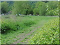
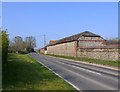
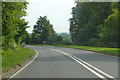
Photos of RG8 9JX

Area Information
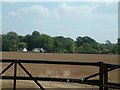
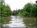
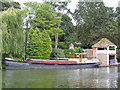
RG8 9JX is a small residential cluster occupying just 6.4 hectares in Berkshire, England. This compact area accommodates a population of 1,352 people, resulting in a relatively low density of 61 people per square kilometre. Living in RG8 9JX means residing in a quiet neighbourhood where large roads are rare and single-family homes are the standard. Because the land is so limited, the community feels intimate rather than sprawling. The area serves as a specific postal code for this residential group, which typically consists of independent houses rather than larger developments. You will find that daily life here is characterised by proximity to open space and a lack of urban congestion. The small size of the locality dictates that major commercial hubs are a short drive away rather than a walk. Residents often describe this postcode as a tranquil spot ideal for those seeking a slower pace. Despite its size, the area connects well to the wider Thames Valley region through nearby rail links. Understanding the scale of RG8 9JX helps set expectations for a lifestyle defined by privacy and connection to the surrounding countryside.
- Area Type
- Postcode
- Area Size
- 6.4 hectares
- Population
- 1352
- Population Density
- 61 people/km²
You will find that the housing stock in RG8 9JX is dominated by owner-occupied homes. With 79% of residents owning their properties, this postcode functions as a traditional family neighbourhood rather than a rental hotspot. The accommodation type is listed as houses, which means you will primarily view detached or semi-detached properties during your search. There are no flats or apartments recorded within this specific 6.4-hectare area. This high ownership rate typically correlates with stable property values and a community invested in long-term improvement. When viewing homes in RG8 9JX, you should expect to compete with other owners looking to move rather than facing rental agencies. The small area size limits the total number of properties available, creating a tight but manageable market. Buyers often appreciate the stability of an owner-occupied area where turnover is lower than in city centres. The focus here is on family-sized houses rather than investment flats for short-term lets. You should regard this postcode as a choice for those seeking permanence and space rather than a flexible rental arrangement.
House Prices in RG8 9JX
Showing 14 properties
| Address | Type | Beds | Baths | Last Sale Price | Last Sale Date | |
|---|---|---|---|---|---|---|
| Tierra Mia, Wallingford Road, Streatley, Reading, RG8 9JX | Detached | 6 | 3 | £1,315,000 | Aug 2022 | |
| Lardon Lodge, Wallingford Road, Streatley, Reading, RG8 9JX | Detached | 4 | 2 | £865,000 | Jul 2015 | |
| Highfield House, Wallingford Road, Streatley, Reading, RG8 9JX | house | - | - | £1,242,000 | Jul 2009 | |
| Townsend House, Wallingford Road, Streatley, Reading, RG8 9JX | Detached | 5 | 5 | - | - | |
| Townsend Farm, Wallingford Road, Streatley, Reading, RG8 9JX | house | 6 | - | - | - | |
| The Studio, Stable Cottages, Wallingford Road, Streatley, Reading, RG8 9JX | Bungalow | - | - | - | - | |
| 2, Stable Cottages, Wallingford Road, Streatley, Reading, RG8 9JX | house | - | - | - | - | |
| Townsend Farm Bungalow, Wallingford Road, Streatley, Reading, RG8 9JX | Bungalow | - | - | - | - | |
| 3, Stable Cottages, Wallingford Road, Streatley, Reading, RG8 9JX | house | - | - | - | - | |
| The Annexe At, Stable Cottages, Wallingford Road, Streatley, Reading, RG8 9JX | Detached | - | - | - | - |
Energy Efficiency in RG8 9JX
Residents of RG8 9JX enjoy a wide range of amenities within practical reach for daily errands and leisure. There are three railway stations nearby, including Goring & Streatley Railway Station, Cholsey Railway Station, and Pangbourne Railway Station. These rail links provide frequent services to London Reading and other major hubs. For shoppers, five retail locations offer essential goods, with notable venues including Tesco Goring, Co-op Woodcote, and Tesco Cholsey. These supermarkets are minutes away and stock everything from groceries to household essentials. One metro stop in Wallingford provides direct overground connections for those wanting faster northern line access. You can combine a morning coffee at a local park with a quick trip to Cholsey for lunch. The layout of nearby amenities encourages a mix of drives for weekly shop and trains for longer commutes. This balance creates a flexible lifestyle where convenience is never far away. The presence of multiple retail chains means you have choice and value without needing to travel far.
Amenities
Schools
Families in this area have access to local education through Streatley C.E. Voluntary Controlled School. This facility is a primary school and holds an Ofsted rating of good. The school serves students in the earlier stages of their education, providing a foundation before secondary transitions later on. This is the only school specifically listed in the immediate vicinity of RG8 9JX based on the available information. The designation as a voluntary controlled school means it operates under local authority governance while maintaining some charitable funding structures. You will need to check catchment boundaries separately, as the proximity to this specific school name does not guarantee enrollment for every postcode in the area. The good rating indicates a standard of education that meets the expectations of most parents. Parents looking at schools near RG8 9JX will find this institution offers a recognised path for their children's primary education. The lack of secondary schools in the immediate data profile means larger town centres provide the next educational step for teens.
| Rank | School | Type | Entry gender | Ages |
|---|
Explore more schools in this area
Go to Schools tabDemographics
The community within RG8 9JX reflects a settled, mature population structure. The median age for residents is 47 years, confirming that adults aged 30 to 64 represent the most common age range in the area. This demographic profile suggests a neighbourhood favoured by professionals and established families rather than young singles or students. Household stability is high, with a home ownership rate of 79%. This figure indicates that the vast majority of people in RG8 9JX have purchased their properties rather than renting. The accommodation type is exclusively houses, reinforcing the suburban character of the postcode. There is no data to suggest apartment living within this specific cluster of addresses. The predominant ethnic group in the area is White, which aligns with typical patterns for established suburbs in this part of Berkshire. You can expect a quiet social environment where long-term residents form the core of the community. The older age profile often means well-maintained gardens and established trees lining the streets. Families moving here will find a demographic that mirrors their own life stage.
Household Size
Accommodation Type
Tenure
Ethnic Group
Religion
Household Composition
Age
Household Deprivation
NS-SEC
Explore more demographic insights in this area
Go to Demographics tabPlanning
Planning Constraints
- Flood RiskPremium
- Ramsar Wetland SitesPremium
- Area of Outstanding Natural BeautyPremium
- Protected Nature ReservePremium
- Protected WoodlandPremium