Area Overview for RG8 9ED
Photos of RG8 9ED

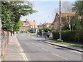
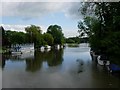


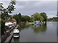


100 photos from this area
Area Information
Key information about the RG8 9ED including its size, population, and administrative classification.
- Area Type
- Postcode
- Area Size
- 1.6 hectares
- Population
- 1499
- Population Density
- 990 people/km²
House Prices in RG8 9ED
14
Properties
£739,556
Average Sold Price
£365,000
Lowest Price
£1,700,000
Highest Price
Showing 14 properties
| Address | Type | Beds | Baths | Last Sale Price | Last Sale Date | |
|---|---|---|---|---|---|---|
| Querton, Manor Road, Goring, Reading, RG8 9ED | Semi-detached | 4 | 1 | £975,000 | Jun 2019 | |
| Long Meadow Lodge, Manor Road, Goring, Reading, RG8 9ED | house | 4 | - | £1,250,000 | Mar 2011 | |
| Greycourt, Manor Road, Goring, Reading, RG8 9ED | house | - | - | £1,700,000 | Feb 2010 | |
| Beckett, Manor Road, Goring, Reading, RG8 9ED | house | - | - | £695,000 | Apr 2009 | |
| Byways, Manor Road, Goring, Reading, RG8 9ED | Flat | - | - | £375,000 | May 2005 | |
| Birch Croft, Manor Road, Goring, Reading, RG8 9ED | Flat | - | - | £375,000 | May 2005 | |
| Rivermead, Manor Road, Goring, Reading, RG8 9ED | Semi-detached | - | - | £461,000 | Jun 2001 | |
| The Spinney, Manor Road, Goring, Reading, RG8 9ED | Bungalow | - | - | £365,000 | Sep 1998 | |
| Little Mead, Manor Road, Goring, Reading, RG8 9ED | Semi-detached | - | - | £460,000 | Nov 1997 | |
| Little Norfolk, Manor Road, Goring, Reading, RG8 9ED | house | 5 | 2 | - | - |
Page 1 of 2
Energy Efficiency in RG8 9ED
Amenities
Schools
| Rank | School | Type | Entry gender | Ages |
|---|
Explore more schools in this area
Go to Schools tabDemographics
Household Size
Two person
most common
Accommodation Type
Houses
most common
Tenure
85
majority
Ethnic Group
White
most common
Religion
N/A
most common
Household Composition
N/A
most common
Age
47
median
Elderly (65+ years)
most common
Household Deprivation
N/A
with no deprivation
NS-SEC
57
in Lower managerial occupations
Explore more demographic insights in this area
Go to Demographics tabPlanning
Planning Constraints
- Flood RiskPremium
- Ramsar Wetland SitesPremium
- Area of Outstanding Natural BeautyPremium
- Protected Nature ReservePremium
- Protected WoodlandPremium