Area Overview for RG8 0HY
Photos of RG8 0HY
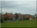
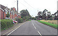
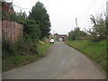
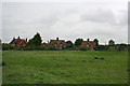
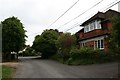
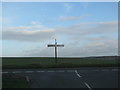
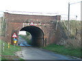
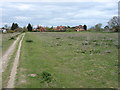
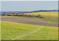
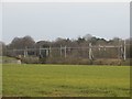
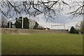
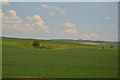
61 photos from this area
Area Information
Key information about the RG8 0HY including its size, population, and administrative classification.
- Area Type
- Postcode
- Area Size
- 9170 m²
- Population
- 1665
- Population Density
- 177 people/km²
House Prices in RG8 0HY
9
Properties
£638,983
Average Sold Price
£148,950
Lowest Price
£980,000
Highest Price
Showing 9 properties
| Address | Type | Beds | Baths | Last Sale Price | Last Sale Date | |
|---|---|---|---|---|---|---|
| Little Down, Wallingford Road, South Stoke, Reading, RG8 0HY | Retail | 5 | 3 | £899,950 | Oct 2022 | |
| Mulberry, Wallingford Road, South Stoke, Reading, RG8 0HY | Detached | 4 | 3 | £980,000 | Feb 2017 | |
| Rosedale, Wallingford Road, South Stoke, Reading, RG8 0HY | Detached | 4 | 3 | £975,000 | Jan 2017 | |
| White Gables, Wallingford Road, South Stoke, Reading, RG8 0HY | house | 3 | - | £480,000 | Nov 2011 | |
| Bright Ravens, Wallingford Road, South Stoke, Reading, RG8 0HY | Detached | 3 | 2 | £350,000 | Sep 2011 | |
| Chiltern View, Wallingford Road, South Stoke, Reading, RG8 0HY | Detached | - | - | £148,950 | Jul 1996 | |
| Halfacre, Wallingford Road, South Stoke, Reading, RG8 0HY | Detached | 5 | - | - | - | |
| Bryn Mawr, Wallingford Road, South Stoke, Reading, RG8 0HY | Detached | - | - | - | - | |
| L'avathison, Wallingford Road, South Stoke, Reading, RG8 0HY | Detached | - | - | - | - |
Energy Efficiency in RG8 0HY
Amenities
Schools
| Rank | School | Type | Entry gender | Ages |
|---|
Explore more schools in this area
Go to Schools tabDemographics
Household Size
Two person
most common
Accommodation Type
Houses
most common
Tenure
72
majority
Ethnic Group
White
most common
Religion
N/A
most common
Household Composition
N/A
most common
Age
47
median
Adults (30-64 years)
most common
Household Deprivation
N/A
with no deprivation
NS-SEC
52
in Lower managerial occupations
Explore more demographic insights in this area
Go to Demographics tabPlanning
Planning Constraints
- Flood RiskPremium
- Ramsar Wetland SitesPremium
- Area of Outstanding Natural BeautyPremium
- Protected Nature ReservePremium
- Protected WoodlandPremium