Area Overview for RG8 0EN
Photos of RG8 0EN
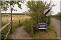
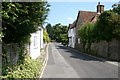
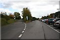
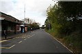
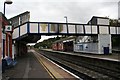
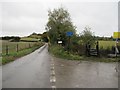
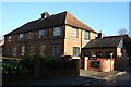
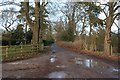
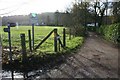


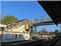
100 photos from this area
Area Information
Key information about the RG8 0EN including its size, population, and administrative classification.
- Area Type
- Postcode
- Area Size
- 13.9 hectares
- Population
- 1499
- Population Density
- 990 people/km²
House Prices in RG8 0EN
22
Properties
£721,450
Average Sold Price
£545,000
Lowest Price
£950,000
Highest Price
Showing 22 properties
| Address | Type | Beds | Baths | Last Sale Price | Last Sale Date | |
|---|---|---|---|---|---|---|
| Ryecroft, 43 Gatehampton Road, Goring, Reading, RG8 0EN | house | 3 | 1 | £811,000 | Nov 2024 | |
| 41 Gatehampton Road, Goring, Reading, RG8 0EN | Semi-detached | 4 | 2 | £950,000 | Sep 2024 | |
| 45 Gatehampton Road, Goring, Reading, RG8 0EN | Bungalow | - | - | £670,000 | Aug 2023 | |
| Loppings, 55 Gatehampton Road, Goring, Reading, RG8 0EN | house | - | - | £881,000 | Sep 2021 | |
| The Nook, 51 Gatehampton Road, Goring, Reading, RG8 0EN | Detached | 4 | 2 | £735,000 | Nov 2019 | |
| 19 Gatehampton Road, Goring, Reading, RG8 0EN | house | - | - | £675,000 | Nov 2018 | |
| Byfield, 47 Gatehampton Road, Goring, Reading, RG8 0EN | Detached | 4 | - | £712,500 | Oct 2015 | |
| Hartslock, 37 Gatehampton Road, Goring, Reading, RG8 0EN | house | - | - | £655,000 | Oct 2014 | |
| Yworry, 29 Gatehampton Road, Goring, Reading, RG8 0EN | Detached | 4 | - | £580,000 | Sep 2014 | |
| Ladram, 31 Gatehampton Road, Goring, Reading, RG8 0EN | Detached | 4 | - | £545,000 | Jul 2013 |
Page 1 of 3
Energy Efficiency in RG8 0EN
Amenities
Schools
| Rank | School | Type | Entry gender | Ages |
|---|
Explore more schools in this area
Go to Schools tabDemographics
Household Size
Two person
most common
Accommodation Type
Houses
most common
Tenure
85
majority
Ethnic Group
White
most common
Religion
N/A
most common
Household Composition
N/A
most common
Age
47
median
Elderly (65+ years)
most common
Household Deprivation
N/A
with no deprivation
NS-SEC
57
in Lower managerial occupations
Explore more demographic insights in this area
Go to Demographics tabPlanning
Planning Constraints
- Flood RiskPremium
- Ramsar Wetland SitesPremium
- Area of Outstanding Natural BeautyPremium
- Protected Nature ReservePremium
- Protected WoodlandPremium