Area Overview for RG7 5BX
Photos of RG7 5BX
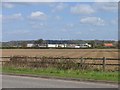
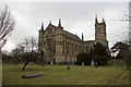
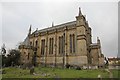
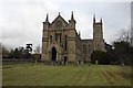
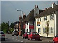
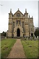
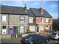
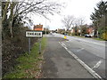
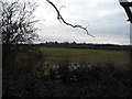
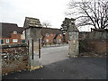
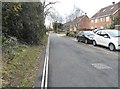
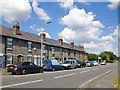
44 photos from this area
Area Information
Key information about the RG7 5BX including its size, population, and administrative classification.
- Area Type
- Postcode
- Area Size
- 1.8 hectares
- Population
- 1481
- Population Density
- 733 people/km²
House Prices in RG7 5BX
51
Properties
£207,765
Average Sold Price
£30,000
Lowest Price
£452,000
Highest Price
Showing 51 properties
| Address | Type | Beds | Baths | Last Sale Price | Last Sale Date | |
|---|---|---|---|---|---|---|
| 37 Church Street, Theale, Reading, RG7 5BX | Terraced | 3 | 2 | £452,000 | Mar 2022 | |
| 13 Church Street, Theale, Reading, RG7 5BX | Semi-detached | 3 | 1 | £368,000 | Jun 2021 | |
| 21 Church Street, Theale, Reading, RG7 5BX | Semi-detached | 3 | 1 | £300,000 | Feb 2016 | |
| 19 Church Street, Theale, Reading, RG7 5BX | Semi-detached | - | - | £275,000 | Aug 2012 | |
| Pillinger House, Church Street, Theale, Reading, RG7 5BX | Flat | - | - | £140,000 | Oct 2011 | |
| Palmer House, Church Street, Theale, Reading, RG7 5BX | Flat | 1 | 1 | £140,000 | Oct 2011 | |
| 23 Church Street, Theale, Reading, RG7 5BX | Semi-detached | - | - | £287,000 | Mar 2008 | |
| 31 Church Street, Theale, Reading, RG7 5BX | Terraced | - | - | £183,995 | Jun 2007 | |
| 25 Church Street, Theale, Reading, RG7 5BX | Semi-detached | - | - | £243,000 | Jun 2004 | |
| 15 Church Street, Theale, Reading, RG7 5BX | Semi-detached | - | - | £154,950 | Jul 2000 |
Page 1 of 6
Energy Efficiency in RG7 5BX
Amenities
Schools
| Rank | School | Type | Entry gender | Ages |
|---|
Explore more schools in this area
Go to Schools tabDemographics
Household Size
Family (3-5 people)
most common
Accommodation Type
Houses
most common
Tenure
74
majority
Ethnic Group
White
most common
Religion
N/A
most common
Household Composition
N/A
most common
Age
47
median
Adults (30-64 years)
most common
Household Deprivation
N/A
with no deprivation
NS-SEC
42
in Lower managerial occupations
Explore more demographic insights in this area
Go to Demographics tabPlanning
Planning Constraints
- Flood RiskPremium
- Ramsar Wetland SitesPremium
- Area of Outstanding Natural BeautyPremium
- Protected Nature ReservePremium
- Protected WoodlandPremium