Area Overview for RG7 5AZ
Photos of RG7 5AZ
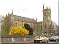
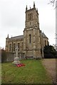
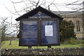
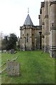

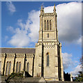

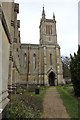
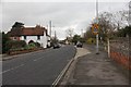
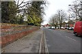
96 photos from this area
Area Information
Key information about the RG7 5AZ including its size, population, and administrative classification.
- Area Type
- Postcode
- Area Size
- 6884 m²
- Population
- 1572
- Population Density
- 972 people/km²
House Prices in RG7 5AZ
30
Properties
£181,100
Average Sold Price
£75,500
Lowest Price
£310,000
Highest Price
Showing 30 properties
| Address | Type | Beds | Baths | Last Sale Price | Last Sale Date | |
|---|---|---|---|---|---|---|
| 48 The Crescent, Theale, Reading, RG7 5AZ | Maisonette | 1 | 1 | £190,000 | Mar 2024 | |
| 54 The Crescent, Theale, Reading, RG7 5AZ | Terraced | 3 | 1 | £150,000 | Nov 2019 | |
| 26 The Crescent, Theale, Reading, RG7 5AZ | Terraced | 3 | 1 | £310,000 | Apr 2017 | |
| 38 The Crescent, Theale, Reading, RG7 5AZ | Semi-detached | 3 | - | £180,000 | May 2010 | |
| 42 The Crescent, Theale, Reading, RG7 5AZ | Terraced | - | - | £75,500 | Jan 2003 | |
| 46 The Crescent, Theale, Reading, RG7 5AZ | Retail | 3 | 1 | - | - | |
| 52 The Crescent, Theale, Reading, RG7 5AZ | house | - | - | - | - | |
| 64 The Crescent, Theale, Reading, RG7 5AZ | Maisonette | - | - | - | - | |
| 18A The Crescent, Theale, Reading, RG7 5AZ | Flat | - | - | - | - | |
| 50 The Crescent, Theale, Reading, RG7 5AZ | Maisonette | - | - | - | - |
Page 1 of 3
Energy Efficiency in RG7 5AZ
Amenities
Schools
| Rank | School | Type | Entry gender | Ages |
|---|
Explore more schools in this area
Go to Schools tabDemographics
Household Size
One person
most common
Accommodation Type
Houses
most common
Tenure
49
majority
Ethnic Group
White
most common
Religion
N/A
most common
Household Composition
N/A
most common
Age
47
median
Adults (30-64 years)
most common
Household Deprivation
N/A
with no deprivation
NS-SEC
35
in Lower managerial occupations
Explore more demographic insights in this area
Go to Demographics tabPlanning
Planning Constraints
- Flood RiskPremium
- Ramsar Wetland SitesPremium
- Area of Outstanding Natural BeautyPremium
- Protected Nature ReservePremium
- Protected WoodlandPremium