Area Overview for RG7 3RN
Photos of RG7 3RN


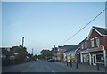


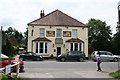
48 photos from this area
Area Information
Key information about the RG7 3RN including its size, population, and administrative classification.
- Area Type
- Postcode
- Area Size
- 1.9 hectares
- Population
- 2415
- Population Density
- 109 people/km²
House Prices in RG7 3RN
42
Properties
£371,212
Average Sold Price
£93,500
Lowest Price
£745,000
Highest Price
Showing 42 properties
| Address | Type | Beds | Baths | Last Sale Price | Last Sale Date | |
|---|---|---|---|---|---|---|
| 12 Windmill Road, Mortimer Common, Reading, RG7 3RN | house | - | - | £495,000 | Jul 2021 | |
| 19 Windmill Road, Mortimer Common, Reading, RG7 3RN | house | - | - | £535,000 | Feb 2021 | |
| 36 Windmill Road, Mortimer Common, Reading, RG7 3RN | house | 4 | 3 | £742,500 | Feb 2021 | |
| 16 Windmill Road, Mortimer Common, Reading, RG7 3RN | house | - | - | £556,000 | May 2020 | |
| 6 Windmill Road, Mortimer Common, Reading, RG7 3RN | Semi-detached | 3 | 1 | £420,000 | Dec 2019 | |
| 17 Windmill Road, Mortimer Common, Reading, RG7 3RN | Semi-detached | 3 | - | £380,000 | Apr 2019 | |
| 42 Windmill Road, Mortimer Common, Reading, RG7 3RN | Detached | 4 | - | £745,000 | Feb 2019 | |
| Pint Cottage, Windmill Road, Mortimer Common, Reading, RG7 3RN | Semi-detached | 2 | 2 | £390,000 | Nov 2017 | |
| 48 Windmill Road, Mortimer Common, Reading, RG7 3RN | Semi-detached | 3 | 2 | £476,000 | Aug 2017 | |
| Mill Hill Cottage, 32 Windmill Road, Mortimer Common, Reading, RG7 3RN | Detached | 4 | 2 | £538,000 | Apr 2017 |
Page 1 of 5
Energy Efficiency in RG7 3RN
Amenities
Schools
| Rank | School | Type | Entry gender | Ages |
|---|
Explore more schools in this area
Go to Schools tabDemographics
Household Size
Family (3-5 people)
most common
Accommodation Type
Houses
most common
Tenure
73
majority
Ethnic Group
White
most common
Religion
N/A
most common
Household Composition
N/A
most common
Age
47
median
Adults (30-64 years)
most common
Household Deprivation
N/A
with no deprivation
NS-SEC
46
in Lower managerial occupations
Explore more demographic insights in this area
Go to Demographics tabPlanning
Planning Constraints
- Flood RiskPremium
- Ramsar Wetland SitesPremium
- Area of Outstanding Natural BeautyPremium
- Protected Nature ReservePremium
- Protected WoodlandPremium