Area Overview for RG7 2PH
Photos of RG7 2PH
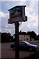
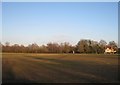
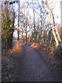
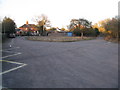
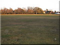
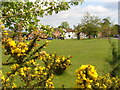
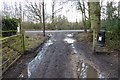
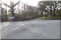
60 photos from this area
Area Information
Key information about the RG7 2PH including its size, population, and administrative classification.
- Area Type
- Postcode
- Area Size
- 16.5 hectares
- Population
- 1365
- Population Density
- 80 people/km²
House Prices in RG7 2PH
23
Properties
£532,823
Average Sold Price
£220,000
Lowest Price
£895,000
Highest Price
Showing 23 properties
| Address | Type | Beds | Baths | Last Sale Price | Last Sale Date | |
|---|---|---|---|---|---|---|
| Cherry Tree Cottage, The Common, Silchester, RG7 2PH | Detached | 5 | 1 | £895,000 | Jun 2021 | |
| Fiveways, The Common, Silchester, RG7 2PH | Detached | 3 | 1 | £500,000 | Jun 2021 | |
| Yew Tree Cottage, The Common, Silchester, RG7 2PH | Detached | 3 | 2 | £541,000 | Apr 2021 | |
| Vyne Cottage, The Common, Silchester, RG7 2PH | Detached | 3 | 2 | £525,000 | Sep 2020 | |
| Keepers Cottage, The Common, Silchester, RG7 2PH | house | - | - | £740,000 | Aug 2020 | |
| Sallow Copse, The Common, Silchester, RG7 2PH | house | - | - | £573,233 | Jul 2020 | |
| Heathcote Cottage, The Common, Silchester, RG7 2PH | Detached | 4 | 2 | £545,000 | Dec 2019 | |
| Lovegrove Cottage, The Common, Silchester, RG7 2PH | Detached | 4 | - | £465,000 | Feb 2014 | |
| Yew Tree Bungalow, The Common, Silchester, RG7 2PH | Semi-detached | 1 | - | £220,000 | Sep 2013 | |
| Forge Cottage, The Common, Silchester, RG7 2PH | Semi-detached | - | - | £324,000 | Sep 2006 |
Page 1 of 3
Energy Efficiency in RG7 2PH
Amenities
Schools
| Rank | School | Type | Entry gender | Ages |
|---|
Explore more schools in this area
Go to Schools tabDemographics
Household Size
Two person
most common
Accommodation Type
Houses
most common
Tenure
77
majority
Ethnic Group
White
most common
Religion
N/A
most common
Household Composition
N/A
most common
Age
47
median
Adults (30-64 years)
most common
Household Deprivation
N/A
with no deprivation
NS-SEC
47
in Lower managerial occupations
Explore more demographic insights in this area
Go to Demographics tabPlanning
Planning Constraints
- Flood RiskPremium
- Ramsar Wetland SitesPremium
- Area of Outstanding Natural BeautyPremium
- Protected Nature ReservePremium
- Protected WoodlandPremium