Area Overview for RG6 6ER
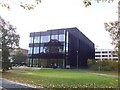
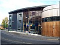
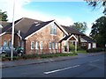
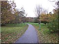
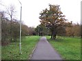
Photos of RG6 6ER


Area Information
Living in RG6 6ER offers a distinct experience defined by its intense residential focus. This postcode cluster covers a small area with a population of 2,765, resulting in a high density of 2,111 people per square kilometre. You will find a tight-knit community where homes are close together, creating a very local atmosphere. The character of the area revolves around functionality and proximity, catering to those who value being near their neighbours rather than expansive green spaces. Daily life here is characterised by efficient use of space and a strong sense of locality. The high density means public services and infrastructure are likely well-utilised, though you may experience more traffic than in rural settings. Residents here often prefer the convenience of urban living without necessarily being in a major city centre. The area suits individuals looking for a contained environment where everything feels within a short walk or a brief drive. You should expect a lifestyle where the local community plays a central role in your daily routine, with interactions between neighbours being more frequent than in sprawling suburban developments. This compact nature makes it an ideal choice for those seeking a straightforward, neighbourhood-centric living arrangement.
- Area Type
- Postcode
- Area Size
- Not available
- Population
- 2765
- Population Density
- 2111 people/km²
The property market in RG6 6ER is heavily skewed towards owner-occupied homes. An impressive 82% of residents own their properties, signalling that this is a buy-to-live area rather than a rental hotspot. The accommodation type is primarily houses, which aligns with the ownership figures. This means you will encounter a range of family-sized properties rather than investment flats or student lets. The house market here is competitive given the high density of 2,111 people per square kilometre. If you are looking to move into RG6 6ER, expect to find a mix of established homes suited for families or couples raising young children. The prevalence of houses suggests limited stock of converted urban flats in this specific postcode. Buyers should focus on properties that match the local architectural style of traditional dwellings. The high ownership rate also implies that the local market is stable, with fewer transient occupants than in student towns. This stability provides security for both current buyers and sellers. As the area is small, any new development restrictions may be strict to preserve the existing character. Prospective homeowners should act quickly if they identify a suitable property, as the tight-knit community may not accommodate rapid turnover.
House Prices in RG6 6ER
No properties found in this postcode.
Energy Efficiency in RG6 6ER
Your lifestyle in RG6 6ER revolves around convenient access to essential shopping and transport hubs. Five retail outlets lie within easy reach, providing daily necessities and groceries without a long trek to the city centre. Co-op Whiteknights, Co-op Erleigh, and M&S at Weldale BP are notable retailers available to you. These food stores ensure you can pick up essentials frequently. For travel, five rail stations are nearby, offering quick connections to Reading Railway Station, Reading West Railway Station, and Earley Railway Station. This network makes it simple to reach broader employment zones or leisure destinations. The area is not characterised by fancy dining or luxury leisure facilities, but it provides practical convenience for everyday living. You will walk past familiar high street brands and local chains that support the daily rhythm of home life. Walking distances are short, which encourages active transport for school runs or grocery trips. The lack of major parks or large leisure centres is offset by the density of residential streets and community focus. Living in RG6 6ER means relying on robust local infrastructure rather than sprawling commercial districts.
Amenities
Schools
Families in RG6 6ER benefit from immediate access to two primary schools sharing similar names in the locality. You have Earley St Peter's Church of England Voluntary Aided Primary School and Earley St Peter's Church of England Primary School nearby. Both institutions provide education for younger children within the community. The University of Reading is also located near the area, indicating proximity to higher education facilities. This mix of infant and voluntary aided schools offers options for families with children of different ages. The presence of a major university influencing the immediate vicinity suggests a well-educated community environment. Parents can choose between the Church of England voluntary aided option or potentially access broader educational resources linked to the university campus. While specific Ofsted ratings are not provided in the current data, the location of these institutions confirms they serve the local catchment area effectively. The proximity to the university also means that adult learners and families may benefit from shared facilities or community events. Choosing schools near RG6 6ER ensures reduced travel time and stronger parental involvement through walking or cycling routes.
| Rank | School | Type | Entry gender | Ages |
|---|
Explore more schools in this area
Go to Schools tabDemographics
The community in RG6 6ER is predominantly young adults aged between 15 and 29 years. The median age stands at just 22, confirming that this is an area defined by youthful energy and early adulthood. You will find that 82% of residents own their homes, a remarkably high figure for such a young demographic. Most occupants live in houses, suggesting a preference for detached or semi-detached family structures over flats or apartments. The predominant ethnic group is White, reflecting the majority composition of the neighbourhood. This high rate of home ownership indicates financial stability despite the younger age profile, possibly pointing to a strong local investment culture or family inheritance patterns. The area feels established rather than transitional, even with the young population. You are unlikely to find many long-term tenants in this specific cluster. The data does not provide details on deprivation levels, so you cannot assess income gaps directly from the available figures. However, the combination of young adults and high ownership suggests a settled group with deep roots in RG6 6ER. This demographic profile shapes the local amenities and social scene, likely focusing on entertainment suitable for younger families and adults.
Household Size
Accommodation Type
Tenure
Ethnic Group
Religion
Household Composition
Age
Household Deprivation
NS-SEC
Explore more demographic insights in this area
Go to Demographics tabPlanning
Planning Constraints
- Flood RiskPremium
- Ramsar Wetland SitesPremium
- Area of Outstanding Natural BeautyPremium
- Protected Nature ReservePremium
- Protected WoodlandPremium