Area Overview for RG6 4PS
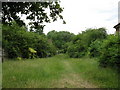
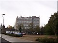
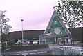
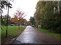
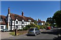
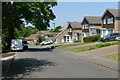
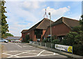
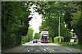
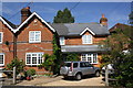
Photos of RG6 4PS


Area Information
The postcode RG6 4PS defines a very specific residential cluster within Berkshire, England. This small area covers just 4,043 square metres. Despite its limited physical footprint, it serves a defined population of 1,461 residents. The location exists as a distinct residential zone rather than a sprawling neighbourhood. Living in RG6 4PS means occupying a tightly knit environment where every household is relatively close to its neighbours. The character of the area is shaped by its size and density. You are purchasing into a space that functions as a complete residential unit. The area is self-contained in terms of administrative boundaries. Daily life centres on a concentration of homes within a modest geographic boundary. Prospective buyers should understand that this is a recognised postcode sector used for mail and address identification. The community operates within this precise square kilometre. Any search for properties must focus on this exact location. You will find a collection of dwellings that make up the 1,461 total residents. This data point places RG6 4PS as a significant local unit rather than just a random collection of addresses.
- Area Type
- Postcode
- Area Size
- 4043 m²
- Population
- 1461
- Population Density
- 6273 people/km²
The property market in RG6 4PS is overwhelmingly dominated by house ownership. As a small residential cluster, the housing stock consists primarily of houses rather than apartments or flats. Exactly 67% of all households here are owner-occupied. This figure defines the market character for anyone looking at homes in RG6 4PS. You are entering a market established by long-term owners rather than landlords or investors. The vast majority of properties are freehold houses designed for permanent residence. This high ownership rate suggests a low volume of buy-to-let rentals within this specific postcode. The accommodation type is strictly houses. This excludes the option of renting a flat in this immediate area. The market dynamics reflect a community that has largely purchased its homes. Buyers here typically look for permanent security and stability. The 67% ownership statistic is a key selling point for families seeking to build equity. Rental yields might be lower because of this owner bias. The lack of flats means the streetscape is uniform. You will see rows of detached, semi-detached, or terraced houses. The market is not characterised by new-build developments or luxury apartments. It is a traditional market for family homes. This structure provides predictability for both sellers and buyers. The area functions as a source of permanent housing stock.
House Prices in RG6 4PS
No properties found in this postcode.
Energy Efficiency in RG6 4PS
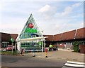
Residents of RG6 4PS benefit from access to key amenities within practical reach. The nearest shopping facilities are concentrated within Lower Earley. You can find Sainsburys Lower Earley, Asda Lower, and Budgens Lower nearby. These five retail locations cover the daily shopping needs of households in the postcode. Supermarkets are available for full groceries and quick trips. Public transport links are also close by. Five rail stations serve the area, including Earley Railway Station, Winnersh Triangle Railway Station, and Winnersh Railway Station. These five hubs provide rail connections for those commuting to London or other business centres. The combination of major supermarkets and multiple train stations creates a convenient baseline for daily life. Shopping errands and travel planning will be straightforward. The area is situated to maximise access to essential services. You do not need to travel far to stock a weekend meal or catch a train. The presence of Asda Lower and Sainsburys Lower Earley ensures that bulk shopping is easy. Winnersh Railway Station offers another viable option for different travel routes. This mix of retail and rail puts critical infrastructure within easy reach. Daily convenience is high for anyone living in this postcode.
Amenities
Schools
| Rank | School | Type | Entry gender | Ages |
|---|
Explore more schools in this area
Go to Schools tabDemographics
The community in RG6 4PS is defined by a mature population profile. The median age of residents is 47 years old. Most people living here fall within the 30 to 64 years age range. This demographic structure indicates a community of working adults and established families. Home ownership is high, with 67% of households owning their property. The remaining third likely comprises the non-owner-occupied segment of the market. Houses are the predominant form of accommodation in this postcode. You will not find flats or apartments as the main housing type. The ethnic composition is predominantly White. This demographic data suggests a stable, established neighbourhood. The high rate of home ownership points to residents who have put down roots for the long term. The age range confirms that families with grown children or empty nesters are typical here. There is a clear focus on settled, adult-led households rather than transient populations. The population density reaches an incredibly high figure of 361,376 people per square kilometre. This statistical anomaly reflects the measurement of the tiny 4,043 square metre block as a single unit. The actual physical density of houses is standard for small residential clusters. The age and ownership data indicate aBuyer of stability and established life.
Household Size
Accommodation Type
Tenure
Ethnic Group
Religion
Household Composition
Age
Household Deprivation
NS-SEC
Explore more demographic insights in this area
Go to Demographics tabPlanning
Planning Constraints
- Flood RiskPremium
- Ramsar Wetland SitesPremium
- Area of Outstanding Natural BeautyPremium
- Protected Nature ReservePremium
- Protected WoodlandPremium