Area Overview for RG6 1NN
Photos of RG6 1NN
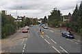
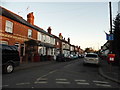
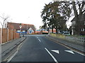
88 photos from this area
Area Information
Key information about the RG6 1NN including its size, population, and administrative classification.
- Area Type
- Postcode
- Area Size
- 7361 m²
- Population
- 1887
- Population Density
- 15116 people/km²
House Prices in RG6 1NN
63
Properties
£201,699
Average Sold Price
£54,000
Lowest Price
£328,000
Highest Price
Showing 63 properties
| Address | Type | Beds | Baths | Last Sale Price | Last Sale Date | |
|---|---|---|---|---|---|---|
| 90 Pitcroft Avenue, Reading, RG6 1NN | Terraced | 3 | 1 | £307,000 | Sep 2025 | |
| 88 Pitcroft Avenue, Reading, RG6 1NN | Terraced | 2 | 1 | £280,000 | Sep 2024 | |
| 41 Pitcroft Avenue, Reading, RG6 1NN | Flat | 2 | 1 | £320,000 | Dec 2023 | |
| 98 Pitcroft Avenue, Reading, RG6 1NN | Terraced | 3 | 1 | £310,000 | Aug 2023 | |
| 94 Pitcroft Avenue, Reading, RG6 1NN | Terraced | - | - | £279,000 | Apr 2022 | |
| 63 Pitcroft Avenue, Reading, RG6 1NN | Retail | 3 | 1 | £310,000 | Mar 2022 | |
| 73 Pitcroft Avenue, Reading, RG6 1NN | Terraced | 5 | 2 | £302,000 | Apr 2020 | |
| 75 Pitcroft Avenue, Reading, RG6 1NN | Terraced | 4 | 2 | £275,000 | Feb 2020 | |
| 87 Pitcroft Avenue, Reading, RG6 1NN | Terraced | 2 | 1 | £253,000 | Jan 2020 | |
| 45 Pitcroft Avenue, Reading, RG6 1NN | Terraced | 3 | 1 | £270,000 | Oct 2019 |
Page 1 of 7
Energy Efficiency in RG6 1NN
Amenities
Schools
| Rank | School | Type | Entry gender | Ages |
|---|
Explore more schools in this area
Go to Schools tabDemographics
Household Size
Family (3-5 people)
most common
Accommodation Type
Houses
most common
Tenure
36
majority
Ethnic Group
White
most common
Religion
N/A
most common
Household Composition
N/A
most common
Age
22
median
Young Adults (15-29 years)
most common
Household Deprivation
N/A
with no deprivation
NS-SEC
23
in Lower managerial occupations
Explore more demographic insights in this area
Go to Demographics tabPlanning
Planning Constraints
- Flood RiskPremium
- Ramsar Wetland SitesPremium
- Area of Outstanding Natural BeautyPremium
- Protected Nature ReservePremium
- Protected WoodlandPremium