Area Overview for RG6 1LD
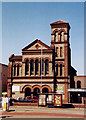
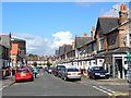
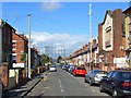
Photos of RG6 1LD


Area Information
RG6 1LD represents a highly concentrated residential cluster within Berkshire, covering a total area of just 6449 square metres. With a population of 1603 residents, this postcode area achieves a population density of 248558 people per square kilometre, indicating an extremely tight-knit neighbourhood where properties are in close proximity. Living in RG6 1LD means experiencing a community defined by its compact size and high occupancy rates. The area functions as a specific residential pocket rather than a broad district, catering to those who prefer immediate access to neighbours and amenities. Daily life here is characterised by the immediate presence of other homes, creating an environment where community interaction can be frequent. The density suggests a setting where silence may not always be a priority, yet the proximity offers distinct convenience for residents. Prospective buyers looking at this location will find themselves entering a zone where every street corner is minutes away from another household. The sheer intensity of the density makes RG6 1LD a unique choice for someone seeking a suburban setting with minimal expansive green space between dwellings. This area serves as a fundamental part of the Reading postcodes, providing a defined boundary for locals who know exactly where their home and their surroundings begin and end. The factual reality of the size and population density shapes the entire experience of buying a home here.
- Area Type
- Postcode
- Area Size
- 6449 m²
- Population
- 1603
- Population Density
- 4130 people/km²
The housing landscape in RG6 1LD is defined by a specific reality regarding tenure and structure. Houses make up the primary accommodation type available in this postcode, indicating that detached, semi-detached, or terraced family homes characterise the streets. However, only 47% of residents own their homes outright, suggesting that the market supports a significant rental sector or houses owned by younger owners still paying off mortgages. This split implies that the area attracts diverse buyers, from first-time purchasers to investors seeking rental yields among the student or young professional demographic. For homebuyers considering RG6 1LD, the fact that fewer than half of the residents are owners suggests a competitive market where acquiring a property may require strong negotiation skills or significant deposits. The prevalence of houses rather than flats means you are likely purchasing a structure designed for traditional family living, which often commands a higher price per square metre than studio apartments. The small area size of 6449 square metres means that every available property is relatively accessible, yet inventory may be limited due to the total population count of just 1603 people. Examining RG6 1LD requires understanding that you are entering a mix of owner-occupied homes and potentially long-term rental properties. This dynamic creates a market where pricing can fluctuate based on broader student and parking trends rather than just local amenities. The data confirms that houses dominate the stock, making this postcode a practical choice for those seeking residential ground-level properties rather than flat living.
House Prices in RG6 1LD
Showing 4 properties
| Address | Type | Beds | Baths | Last Sale Price | Last Sale Date | |
|---|---|---|---|---|---|---|
| 2, St Helens Court, Wokingham Road, Reading, RG6 1LD | Flat | - | - | £180,000 | Nov 2023 | |
| 4, St Helens Court, Wokingham Road, Reading, RG6 1LD | Maisonette | 2 | 2 | £249,000 | Jul 2023 | |
| 3, St Helens Court, Wokingham Road, Reading, RG6 1LD | Flat | 2 | 2 | £240,000 | Jul 2018 | |
| 1, St Helens Court, Wokingham Road, Reading, RG6 1LD | Flat | 2 | - | - | - |
Energy Efficiency in RG6 1LD
Residents of RG6 1LD benefit from a practical range of amenities located within practical reach of their homes. Five notable retail outlets serve the local community, including Co-op London, Tesco Reading, and Co-op Erleigh. These supermarkets and stores ensure that daily shopping, grocery runs, and general retail needs are met without the need for long travel. You can complete most errands quickly by visiting these specific venues, which form the commercial heart accessible to the postcode. Convenience is a key feature of living here, allowing weekly shop trips to fit easily into a busy schedule. Transport remains a central part of the lifestyle equation, supported by five nearby rail options. Reading Railway Station, Earley Railway Station, and Reading West Railway Station provide the necessary connections for commuters and visitors alike. The proximity to these stations means that daily commutes to major towns do not require extensive planning. Combining retail access with rail links creates a functional environment where work, leisure, and household needs intersect. While the area is densely populated, the presence of these specific commercial and transport hubs prevents isolation. Homebuyers looking at RG6 1LD find that daily life is streamlined by the immediate availability of Tesco and other Co-op branches. The lifestyle here is defined by accessibility to these named amenities, ensuring that residents never travel too far for essentials.
Amenities
Schools
| Rank | School | Type | Entry gender | Ages |
|---|
Explore more schools in this area
Go to Schools tabDemographics
The community profile of RG6 1LD is dominated by young adults, with the most common age range falling between 15 and 29 years. The median age for residents is just 22 years old, confirming that this postcode area is primarily served by students, young professionals, or those recently entering the independent living sphere. Only 47% of residents report home ownership, meaning nearly half of the 1603 population likely rent or rely on family accommodation. The predominant ethnic group in this area is White, reflecting the typical demographic makeup of parts of Reading and surrounding educational zones. Houses constitute the main accommodation type for this postcode, distinguishing it from high-rise apartment blocks found elsewhere. This preference for houses among such a young demographic often points to terraced or semi-detached family homes repurposed by youth or older occupants moving nearby. The low home ownership rate combined with a young median age suggests a dynamic population that may be transient or on the verge of establishing long-term roots. Living in RG6 1LD involves interacting with a generation that prioritises flexibility while managing mortgage costs. The demographic data paints a clear picture of a youthful electorate and consumer base. Understanding these figures is essential for any homebuyer assessing the potential for stability or future resale value within the RG6 1LD neighbourhood.
Household Size
Accommodation Type
Tenure
Ethnic Group
Religion
Household Composition
Age
Household Deprivation
NS-SEC
Explore more demographic insights in this area
Go to Demographics tabPlanning
Planning Constraints
- Flood RiskPremium
- Ramsar Wetland SitesPremium
- Area of Outstanding Natural BeautyPremium
- Protected Nature ReservePremium
- Protected WoodlandPremium