Area Overview for RG5 4UL
Photos of RG5 4UL
Area Information
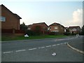
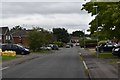
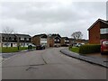
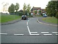
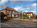
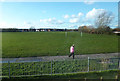
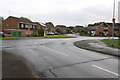
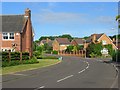
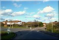
RG5 4UL stands as a specific residential cluster within the wider Reading postcode area, distinguished by its small footprint of just 4,487 square metres. The area supports a population of 1,410 residents, creating a tight-knit community where neighbours are likely to know one another. Living in RG5 4UL means engaging with a compact environment where every street carries significant weight within the local social fabric. This postcode covers a small group of homes that offer proximity to essential services while maintaining a distinct separation from the busiest arterial routes. The demographic profile suggests a mature settlement with a median age of 47, indicating a shift away from high-density student housing or young professional hubs towards family-oriented living. Daily life here is defined by stability and established routines rather than rapid urban development. You will find a neighbourhood that has settled into a consistent rhythm, supported by a high rate of home ownership that reaches 72 per cent. This suggests a community invested in their local plots rather than transient tenants. The architecture consists predominantly of houses, reflecting traditional UK suburban planning rather than modern high-rise developments. Prospective buyers looking for this postcode should recognise it as a quiet, manageable patch of England that prioritises stability over expansive urban amenities. It is a place where the focus remains on the immediate surroundings and the people who call them home permanently.
- Area Type
- Postcode
- Area Size
- 4487 m²
- Population
- 1410
- Population Density
- 6046 people/km²
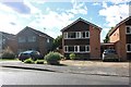
Buying a home in RG5 4UL presents a clear picture of the local property market, defined overwhelmingly by owner-occupancy. With 72 per cent of households owned outright, this area is not a hotbed of short-term rentals or investment properties bought for flipping. Instead, the market consists of people who view their homes as their primary long-term asset. The accommodation type data confirms that houses are the standard building form within this postcode, removing the option for those seeking urban-style apartments or shared ownership flats common in larger towns. For you, a prospective buyer, this means looking primarily at detached, semi-detached, or terraced family homes rather than rental units. The high home ownership rate suggests that sellers in RG5 4UL are typically current owners looking to upgrade, relocate for work, or downsize, rather than selling inherited properties under pressure. This dynamic often leads to more realistic expectations and negotiations between two parties who both understand the nature of the asset. The small area size of 4,487 square metres limits the total supply, which can make finding specific property types within RG5 4UL itself a precise task. However, the dominance of houses ensures that if you require garden space or internal garage access, your options here are consistent with your requirements. The market reflects a stable asset class suited for those seeking security and a traditional suburban lifestyle.
House Prices in RG5 4UL
Showing 13 properties
Energy Efficiency in RG5 4UL
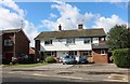
Your daily routine in RG5 4UL benefits from a selection of retail options located within practical reach. Three major supermarkets anchor the local shopping experience: Tesco Woodley, Morrisons Daily, and Lidl Woodley. These three venues offer a wide spectrum of groceries, enabling you to find everything from premium produce to budget essentials without needing to travel far. With five retail locations noted in the immediate vicinity, you have multiple points of access for your weekly shopping, comparison shopping, and top-up trips. This variety supports convenience and ensures that fresh food is always available locally. Beyond food, five railway stations are within easy reach, providing seamless links to Winnersh Triangle, Earley, and Twyford. This transport web allows you to commute efficiently from your home while maintaining a local lifestyle. The settlement pattern of RG5 4UL, covering 4,487 square metres, means that services are concentrated rather than dispersed over miles of sprawling suburbs. You can walk or drive a short distance to stock up on essentials, a significant advantage over car-dependent locations. While the area may not boast the diverse dining scene or large leisure complexes of a major city, the presence of these key retail and transport nodes ensures your core lifestyle needs are met efficiently. The concentration of amenities like Tesco and Lidl means you do not need to commit to long travel times for basic provisions, preserving time for family life or leisure.
Amenities
Schools
Families considering a home in RG5 4UL have access to specific educational facilities that serve the immediate neighbourhood. The only primary school listed for this area is Woodley CofE Primary School. This institution holds an Ofsted rating of good, indicating a standard of education that meets the required benchmarks for quality teaching, student safety, and leadership. The presence of this single named school suggests that the immediate vicinity caters to younger children, likely drawing pupils from across a slightly wider catchment area given the small number of residents aged under ten in the total population of 1,410. Because the data only lists one primary school, you will not find comprehensive secondary school information directly attached to this specific postcode cluster. Parents may need to consider schools slightly further afield for older children, though Woodley CofE Primary School remains the definitive choice for early education within this postcode. The school type is Church of England, which informs the cultural and religious ethos that runs through the institution's curriculum. For those prioritising faith-based education, this is a relevant factor. The good rating is a concrete metric that allows you to judge the institution's performance without speculation. While the data does not list sixth forms or colleges, the existence of a rated primary school confirms that essential foundational education is available nearby for families residing in RG5 4UL.
| Rank | School | Type | Entry gender | Ages |
|---|
Explore more schools in this area
Go to Schools tabDemographics
The community within RG5 4UL is characterised by maturity and stability. You will find that the median age for residents in this area is 47 years, placing it firmly within the adult demographic range spanning from 30 to 64 years old. This age profile indicates a neighbourhood dominated by families with established careers, rather than students or young professionals moving through for short-term stays. The vast majority of households in RG5 4UL are owned outright, with a home ownership rate of 72 per cent. This high percentage of owner-occupiers contributes to a sense of permanence and long-term investment in the locality. Accommodation types are exclusively houses, meaning you will not encounter apartment blocks or high-density flats within this specific cluster. The physical layout reflects this single-family focus, ensuring privacy and gardens for most residents. Ethnically, the predominant group in RG5 4UL is White, which aligns with the broader character of established commuter towns in the region. The fact that the most common age range is adults between 30 and 64 years old suggests that children are present in significant numbers, supporting local demand for family-oriented facilities. This demographic stability often correlates with lower transient populations and a more consistent demand for local services. Residents here are likely to have deep roots in the area, contributing to a cohesive social structure without the volatility often found in major city centres.
Household Size
Accommodation Type
Tenure
Ethnic Group
Religion
Household Composition
Age
Household Deprivation
NS-SEC
Explore more demographic insights in this area
Go to Demographics tabPlanning
Planning Constraints
- Flood RiskPremium
- Ramsar Wetland SitesPremium
- Area of Outstanding Natural BeautyPremium
- Protected Nature ReservePremium
- Protected WoodlandPremium