Area Overview for RG5 4HH
Photos of RG5 4HH
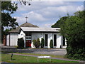
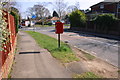
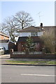
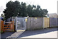
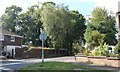
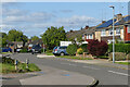
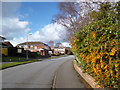
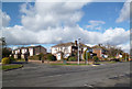
13 photos from this area
Area Information
Key information about the RG5 4HH including its size, population, and administrative classification.
- Area Type
- Postcode
- Area Size
- 1.7 hectares
- Population
- 2067
- Population Density
- 4123 people/km²
House Prices in RG5 4HH
33
Properties
£340,850
Average Sold Price
£92,950
Lowest Price
£505,000
Highest Price
Showing 33 properties
| Address | Type | Beds | Baths | Last Sale Price | Last Sale Date | |
|---|---|---|---|---|---|---|
| 51 Fosters Lane, Woodley, RG5 4HH | house | 3 | 1 | £422,500 | Sep 2025 | |
| 45 Fosters Lane, Woodley, RG5 4HH | Semi-detached | 2 | 1 | £475,000 | Nov 2024 | |
| 33 Fosters Lane, Woodley, RG5 4HH | Bungalow | 2 | 2 | £465,000 | May 2023 | |
| 27 Fosters Lane, Woodley, RG5 4HH | Bungalow | 3 | 1 | £470,000 | May 2023 | |
| 35 Fosters Lane, Woodley, RG5 4HH | Flat | - | - | £455,000 | Jun 2022 | |
| 13 Fosters Lane, Woodley, RG5 4HH | Bungalow | - | - | £396,000 | Mar 2022 | |
| 42 Fosters Lane, Woodley, RG5 4HH | house | - | - | £437,500 | Dec 2021 | |
| 9 Fosters Lane, Woodley, RG5 4HH | Flat | - | - | £495,000 | Mar 2021 | |
| 44 Fosters Lane, Woodley, RG5 4HH | house | - | - | £450,000 | Jan 2021 | |
| Springfield, Fosters Lane, Woodley, RG5 4HH | Bungalow | - | - | £475,000 | Oct 2019 |
Page 1 of 4
Energy Efficiency in RG5 4HH
Amenities
Schools
| Rank | School | Type | Entry gender | Ages |
|---|
Explore more schools in this area
Go to Schools tabDemographics
Household Size
Family (3-5 people)
most common
Accommodation Type
Houses
most common
Tenure
80
majority
Ethnic Group
White
most common
Religion
N/A
most common
Household Composition
N/A
most common
Age
47
median
Adults (30-64 years)
most common
Household Deprivation
N/A
with no deprivation
NS-SEC
44
in Lower managerial occupations
Explore more demographic insights in this area
Go to Demographics tabPlanning
Planning Constraints
- Flood RiskPremium
- Ramsar Wetland SitesPremium
- Area of Outstanding Natural BeautyPremium
- Protected Nature ReservePremium
- Protected WoodlandPremium