Area Overview for RG5 3DB
Photos of RG5 3DB

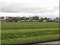
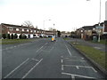
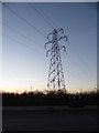
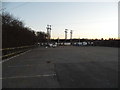
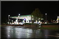
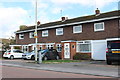
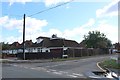
31 photos from this area
Area Information
Key information about the RG5 3DB including its size, population, and administrative classification.
- Area Type
- Postcode
- Area Size
- 2.3 hectares
- Population
- 1525
- Population Density
- 3538 people/km²
House Prices in RG5 3DB
33
Properties
£381,211
Average Sold Price
£96,400
Lowest Price
£770,000
Highest Price
Showing 33 properties
| Address | Type | Beds | Baths | Last Sale Price | Last Sale Date | |
|---|---|---|---|---|---|---|
| 24 Reading Road, Woodley, RG5 3DB | Semi-detached | 4 | 2 | £610,000 | Jun 2023 | |
| 72 Reading Road, Woodley, RG5 3DB | Semi-detached | 4 | 2 | £744,000 | Jun 2020 | |
| 38 Reading Road, Woodley, RG5 3DB | house | - | - | £410,500 | Jul 2019 | |
| 64 Reading Road, Woodley, RG5 3DB | house | - | - | £300,000 | Mar 2019 | |
| 50 Reading Road, Woodley, RG5 3DB | Detached | 5 | 3 | £770,000 | Oct 2018 | |
| 42 Reading Road, Woodley, RG5 3DB | Semi-detached | 4 | 2 | £595,000 | Jun 2018 | |
| 12 Reading Road, Woodley, RG5 3DB | Semi-detached | 5 | - | £585,000 | Aug 2017 | |
| 62 Reading Road, Woodley, RG5 3DB | Detached | 4 | 1 | £615,000 | Aug 2014 | |
| 4 Reading Road, Woodley, RG5 3DB | Semi-detached | 1 | 1 | £275,000 | Oct 2013 | |
| 74 Reading Road, Woodley, RG5 3DB | house | - | - | £540,000 | Sep 2013 |
Page 1 of 4
Energy Efficiency in RG5 3DB
Amenities
Schools
| Rank | School | Type | Entry gender | Ages |
|---|
Explore more schools in this area
Go to Schools tabDemographics
Household Size
Family (3-5 people)
most common
Accommodation Type
Houses
most common
Tenure
85
majority
Ethnic Group
White
most common
Religion
N/A
most common
Household Composition
N/A
most common
Age
47
median
Adults (30-64 years)
most common
Household Deprivation
N/A
with no deprivation
NS-SEC
42
in Lower managerial occupations
Explore more demographic insights in this area
Go to Demographics tabPlanning
Planning Constraints
- Flood RiskPremium
- Ramsar Wetland SitesPremium
- Area of Outstanding Natural BeautyPremium
- Protected Nature ReservePremium
- Protected WoodlandPremium