Area Overview for RG45 7NN
Photos of RG45 7NN


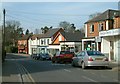

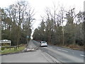
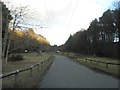


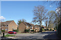
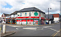
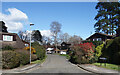
36 photos from this area
Area Information
Key information about the RG45 7NN including its size, population, and administrative classification.
- Area Type
- Postcode
- Area Size
- 1.8 hectares
- Population
- 1941
- Population Density
- 3497 people/km²
House Prices in RG45 7NN
12
Properties
£699,550
Average Sold Price
£137,000
Lowest Price
£1,710,000
Highest Price
Showing 12 properties
| Address | Type | Beds | Baths | Last Sale Price | Last Sale Date | |
|---|---|---|---|---|---|---|
| Bluebells, 75A Waterloo Road, Crowthorne, RG45 7NN | Detached | 6 | 5 | £1,710,000 | Jul 2020 | |
| Honeywood, 67 Waterloo Road, Crowthorne, RG45 7NN | Bungalow | 4 | - | £615,000 | Feb 2017 | |
| Merrowcroft, 75 Waterloo Road, Crowthorne, RG45 7NN | Detached | 6 | - | £1,600,000 | Sep 2016 | |
| 71 Waterloo Road, Crowthorne, RG45 7NN | Semi-detached | 3 | - | £387,500 | Sep 2013 | |
| Silverwood House, 77A Waterloo Road, Crowthorne, RG45 7NN | house | - | - | £950,000 | Apr 2010 | |
| Linden House, 77 Waterloo Road, Crowthorne, RG45 7NN | house | 5 | - | £615,000 | Nov 2007 | |
| 63 Waterloo Road, Crowthorne, RG45 7NN | house | - | - | £345,000 | Mar 2003 | |
| Uplyme, 69 Waterloo Road, Crowthorne, RG45 7NN | Semi-detached | - | - | £386,000 | Oct 2002 | |
| 65 Waterloo Road, Crowthorne, RG45 7NN | Semi-detached | - | - | £250,000 | Oct 2000 | |
| 61 Waterloo Road, Crowthorne, RG45 7NN | Detached | - | - | £137,000 | Aug 1996 |
Page 1 of 2
Energy Efficiency in RG45 7NN
Amenities
Schools
| Rank | School | Type | Entry gender | Ages |
|---|
Explore more schools in this area
Go to Schools tabDemographics
Household Size
Two person
most common
Accommodation Type
Houses
most common
Tenure
77
majority
Ethnic Group
White
most common
Religion
N/A
most common
Household Composition
N/A
most common
Age
47
median
Adults (30-64 years)
most common
Household Deprivation
N/A
with no deprivation
NS-SEC
53
in Lower managerial occupations
Explore more demographic insights in this area
Go to Demographics tabPlanning
Planning Constraints
- Flood RiskPremium
- Ramsar Wetland SitesPremium
- Area of Outstanding Natural BeautyPremium
- Protected Nature ReservePremium
- Protected WoodlandPremium