Area Overview for RG45 6HN
Photos of RG45 6HN
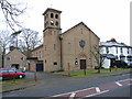

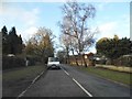
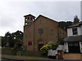
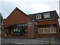
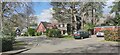
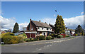
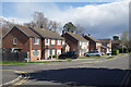
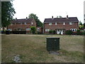
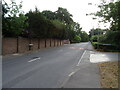
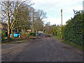
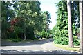
17 photos from this area
Area Information
Key information about the RG45 6HN including its size, population, and administrative classification.
- Area Type
- Postcode
- Area Size
- 2.8 hectares
- Population
- 1608
- Population Density
- 2106 people/km²
House Prices in RG45 6HN
39
Properties
£494,926
Average Sold Price
£123,500
Lowest Price
£760,000
Highest Price
Showing 39 properties
| Address | Type | Beds | Baths | Last Sale Price | Last Sale Date | |
|---|---|---|---|---|---|---|
| 58 Heathermount Drive, Crowthorne, RG45 6HN | Detached | 4 | 2 | £375,000 | Mar 2025 | |
| 72 Heathermount Drive, Crowthorne, RG45 6HN | house | 3 | 1 | £610,000 | Dec 2024 | |
| 2 Heathermount Drive, Crowthorne, RG45 6HN | Detached | 4 | 2 | £715,000 | Jul 2024 | |
| 16 Heathermount Drive, Crowthorne, RG45 6HN | house | - | - | £656,500 | May 2021 | |
| 86 Heathermount Drive, Crowthorne, RG45 6HN | Detached | 4 | 3 | £740,000 | Apr 2021 | |
| 82 Heathermount Drive, Crowthorne, RG45 6HN | house | - | - | £510,000 | Mar 2021 | |
| 34 Heathermount Drive, Crowthorne, RG45 6HN | house | - | - | £595,000 | Nov 2020 | |
| 50 Heathermount Drive, Crowthorne, RG45 6HN | Semi-detached | 4 | 2 | £760,000 | Aug 2020 | |
| 20 Heathermount Drive, Crowthorne, RG45 6HN | house | 5 | 1 | £665,000 | Jul 2020 | |
| 12 Heathermount Drive, Crowthorne, RG45 6HN | Detached | 3 | 2 | £570,000 | Sep 2019 |
Page 1 of 4
Energy Efficiency in RG45 6HN
Amenities
Schools
| Rank | School | Type | Entry gender | Ages |
|---|
Explore more schools in this area
Go to Schools tabDemographics
Household Size
Two person
most common
Accommodation Type
Houses
most common
Tenure
90
majority
Ethnic Group
White
most common
Religion
N/A
most common
Household Composition
N/A
most common
Age
47
median
Adults (30-64 years)
most common
Household Deprivation
N/A
with no deprivation
NS-SEC
57
in Lower managerial occupations
Explore more demographic insights in this area
Go to Demographics tabPlanning
Planning Constraints
- Flood RiskPremium
- Ramsar Wetland SitesPremium
- Area of Outstanding Natural BeautyPremium
- Protected Nature ReservePremium
- Protected WoodlandPremium