Area Overview for RG42 5RH
Photos of RG42 5RH

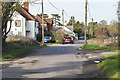


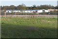

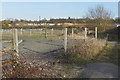
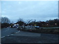
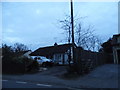

28 photos from this area
Area Information
Key information about the RG42 5RH including its size, population, and administrative classification.
- Area Type
- Postcode
- Area Size
- 4.3 hectares
- Population
- 1360
- Population Density
- 752 people/km²
House Prices in RG42 5RH
19
Properties
£430,325
Average Sold Price
£138,250
Lowest Price
£760,000
Highest Price
Showing 19 properties
| Address | Type | Beds | Baths | Last Sale Price | Last Sale Date | |
|---|---|---|---|---|---|---|
| Stable View, West End Lane, Warfield, Bracknell, RG42 5RH | Semi-detached | 3 | 1 | £575,000 | Jul 2025 | |
| Speech House, West End Lane, Warfield, Bracknell, RG42 5RH | Semi-detached | 4 | 1 | £490,000 | Jun 2021 | |
| The Old Farmhouse, West End Lane, Warfield, Bracknell, RG42 5RH | Detached | 4 | 2 | £760,000 | Feb 2021 | |
| Hillside View Cottage, West End Lane, Warfield, Bracknell, RG42 5RH | house | - | - | £435,000 | Jan 2020 | |
| Furrows, West End Lane, Warfield, Bracknell, RG42 5RH | house | 3 | - | £445,000 | Aug 2018 | |
| Parklands, West End Lane, Warfield, Bracknell, RG42 5RH | Detached | 3 | - | £400,000 | May 2014 | |
| Fairview Cottage, West End Lane, Warfield, Bracknell, RG42 5RH | house | 2 | - | £390,000 | Jan 2010 | |
| Gates Cottage, West End Lane, Warfield, Bracknell, RG42 5RH | Detached | - | - | £470,000 | Jun 2004 | |
| Herons Flight, West End Lane, Warfield, Bracknell, RG42 5RH | house | 3 | - | £200,000 | Jul 2001 | |
| East View Cottage, West End Lane, Warfield, Bracknell, RG42 5RH | Semi-detached | - | - | £138,250 | Dec 1997 |
Page 1 of 2
Energy Efficiency in RG42 5RH
Amenities
Schools
| Rank | School | Type | Entry gender | Ages |
|---|
Explore more schools in this area
Go to Schools tabDemographics
Household Size
Two person
most common
Accommodation Type
Houses
most common
Tenure
77
majority
Ethnic Group
White
most common
Religion
N/A
most common
Household Composition
N/A
most common
Age
47
median
Adults (30-64 years)
most common
Household Deprivation
N/A
with no deprivation
NS-SEC
56
in Lower managerial occupations
Explore more demographic insights in this area
Go to Demographics tabPlanning
Planning Constraints
- Flood RiskPremium
- Ramsar Wetland SitesPremium
- Area of Outstanding Natural BeautyPremium
- Protected Nature ReservePremium
- Protected WoodlandPremium