Area Overview for RG42 5AN
Photos of RG42 5AN
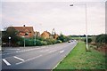
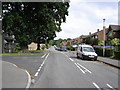
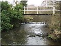
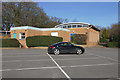
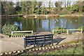
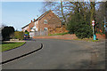
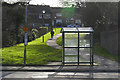
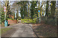
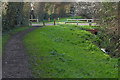
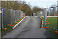
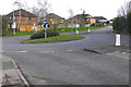
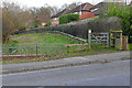
34 photos from this area
Area Information
Key information about the RG42 5AN including its size, population, and administrative classification.
- Area Type
- Postcode
- Area Size
- 4.0 hectares
- Population
- 1360
- Population Density
- 752 people/km²
House Prices in RG42 5AN
26
Properties
£702,269
Average Sold Price
£375,000
Lowest Price
£1,250,000
Highest Price
Showing 26 properties
| Address | Type | Beds | Baths | Last Sale Price | Last Sale Date | |
|---|---|---|---|---|---|---|
| 15 Honeysuckle Copse, Warfield, Bracknell, RG42 5AN | Detached | 4 | 3 | £1,250,000 | May 2024 | |
| 2 Honeysuckle Copse, Warfield, Bracknell, RG42 5AN | Semi-detached | 3 | 1 | £545,000 | Mar 2024 | |
| 24 Honeysuckle Copse, Warfield, Bracknell, RG42 5AN | Semi-detached | 5 | 2 | £708,500 | Oct 2023 | |
| 10 Honeysuckle Copse, Warfield, Bracknell, RG42 5AN | Detached | 5 | 3 | £745,000 | Jul 2023 | |
| 4 Honeysuckle Copse, Warfield, Bracknell, RG42 5AN | Detached | 4 | 3 | £926,500 | Nov 2022 | |
| 14 Honeysuckle Copse, Warfield, Bracknell, RG42 5AN | house | - | - | £570,000 | Mar 2021 | |
| 18 Honeysuckle Copse, Warfield, Bracknell, RG42 5AN | Detached | 3 | 3 | £529,995 | Nov 2020 | |
| 22 Honeysuckle Copse, Warfield, Bracknell, RG42 5AN | Maisonette | - | - | £375,000 | Aug 2020 | |
| 25 Honeysuckle Copse, Warfield, Bracknell, RG42 5AN | house | - | - | £600,000 | Jul 2020 | |
| 21 Honeysuckle Copse, Warfield, Bracknell, RG42 5AN | Detached | 4 | 3 | £500,000 | Jun 2020 |
Page 1 of 3
Energy Efficiency in RG42 5AN
Amenities
Schools
| Rank | School | Type | Entry gender | Ages |
|---|
Explore more schools in this area
Go to Schools tabDemographics
Household Size
Two person
most common
Accommodation Type
Houses
most common
Tenure
77
majority
Ethnic Group
White
most common
Religion
N/A
most common
Household Composition
N/A
most common
Age
47
median
Adults (30-64 years)
most common
Household Deprivation
N/A
with no deprivation
NS-SEC
56
in Lower managerial occupations
Explore more demographic insights in this area
Go to Demographics tabPlanning
Planning Constraints
- Flood RiskPremium
- Ramsar Wetland SitesPremium
- Area of Outstanding Natural BeautyPremium
- Protected Nature ReservePremium
- Protected WoodlandPremium