Area Overview for RG42 4HY
Photos of RG42 4HY

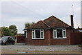
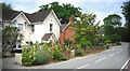
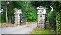
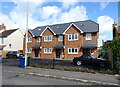
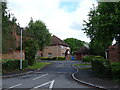
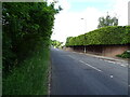
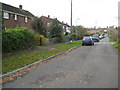
26 photos from this area
Area Information
Key information about the RG42 4HY including its size, population, and administrative classification.
- Area Type
- Postcode
- Area Size
- 1.0 hectares
- Population
- 1642
- Population Density
- 1917 people/km²
House Prices in RG42 4HY
17
Properties
£397,042
Average Sold Price
£180,000
Lowest Price
£720,000
Highest Price
Showing 17 properties
| Address | Type | Beds | Baths | Last Sale Price | Last Sale Date | |
|---|---|---|---|---|---|---|
| 6 Chase Gardens, Binfield, Bracknell, RG42 4HY | Bungalow | 4 | 3 | £720,000 | Dec 2025 | |
| 19 Chase Gardens, Binfield, Bracknell, RG42 4HY | Bungalow | 2 | 1 | £565,000 | Mar 2025 | |
| Buckhurst, 13 Chase Gardens, Binfield, Bracknell, RG42 4HY | Bungalow | 3 | 2 | £485,000 | Feb 2023 | |
| 5 Chase Gardens, Binfield, Bracknell, RG42 4HY | Bungalow | - | - | £435,000 | Feb 2021 | |
| 11 Chase Gardens, Binfield, Bracknell, RG42 4HY | Semi-detached | 4 | 2 | £415,000 | Jun 2018 | |
| 15 Chase Gardens, Binfield, Bracknell, RG42 4HY | Bungalow | 2 | - | £395,000 | Aug 2016 | |
| 9 Chase Gardens, Binfield, Bracknell, RG42 4HY | Semi-detached | 3 | - | £445,000 | Jul 2016 | |
| 10 Chase Gardens, Binfield, Bracknell, RG42 4HY | Semi-detached | 2 | 1 | £322,000 | Feb 2014 | |
| 7 Chase Gardens, Binfield, Bracknell, RG42 4HY | Semi-detached | - | - | £287,500 | Oct 2007 | |
| 2 Chase Gardens, Binfield, Bracknell, RG42 4HY | Semi-detached | - | - | £225,000 | Aug 2003 |
Page 1 of 2
Energy Efficiency in RG42 4HY
Amenities
Schools
| Rank | School | Type | Entry gender | Ages |
|---|
Explore more schools in this area
Go to Schools tabDemographics
Household Size
Family (3-5 people)
most common
Accommodation Type
Houses
most common
Tenure
87
majority
Ethnic Group
White
most common
Religion
N/A
most common
Household Composition
N/A
most common
Age
47
median
Adults (30-64 years)
most common
Household Deprivation
N/A
with no deprivation
NS-SEC
52
in Lower managerial occupations
Explore more demographic insights in this area
Go to Demographics tabPlanning
Planning Constraints
- Flood RiskPremium
- Ramsar Wetland SitesPremium
- Area of Outstanding Natural BeautyPremium
- Protected Nature ReservePremium
- Protected WoodlandPremium