Area Overview for RG42 2LN
Photos of RG42 2LN
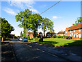

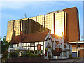
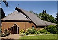
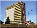
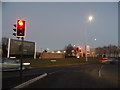

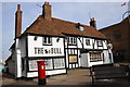
58 photos from this area
Area Information
Key information about the RG42 2LN including its size, population, and administrative classification.
- Area Type
- Postcode
- Area Size
- 6815 m²
- Population
- 1623
- Population Density
- 3126 people/km²
House Prices in RG42 2LN
12
Properties
£312,769
Average Sold Price
£120,000
Lowest Price
£400,000
Highest Price
Showing 12 properties
| Address | Type | Beds | Baths | Last Sale Price | Last Sale Date | |
|---|---|---|---|---|---|---|
| 33 Bull Lane, Bracknell, RG42 2LN | Terraced | 3 | 1 | £380,000 | Dec 2024 | |
| 37 Bull Lane, Bracknell, RG42 2LN | Terraced | 3 | 1 | £400,000 | Oct 2022 | |
| 29 Bull Lane, Bracknell, RG42 2LN | Retail | 2 | - | £375,000 | Oct 2022 | |
| 41 Bull Lane, Bracknell, RG42 2LN | house | 3 | - | £370,150 | Jan 2021 | |
| 49 Bull Lane, Bracknell, RG42 2LN | Terraced | 3 | 2 | £380,000 | Jul 2020 | |
| 35 Bull Lane, Bracknell, RG42 2LN | house | - | - | £287,000 | Jun 2019 | |
| 45 Bull Lane, Bracknell, RG42 2LN | house | - | - | £190,000 | Dec 2006 | |
| 31 Bull Lane, Bracknell, RG42 2LN | house | - | - | £120,000 | Apr 2001 | |
| 43 Bull Lane, Bracknell, RG42 2LN | house | - | - | - | - | |
| 27 Bull Lane, Bracknell, RG42 2LN | house | - | - | - | - |
Page 1 of 2
Energy Efficiency in RG42 2LN
Amenities
Schools
| Rank | School | Type | Entry gender | Ages |
|---|
Explore more schools in this area
Go to Schools tabDemographics
Household Size
Two person
most common
Accommodation Type
Houses
most common
Tenure
62
majority
Ethnic Group
White
most common
Religion
N/A
most common
Household Composition
N/A
most common
Age
47
median
Adults (30-64 years)
most common
Household Deprivation
N/A
with no deprivation
NS-SEC
44
in Lower managerial occupations
Explore more demographic insights in this area
Go to Demographics tabPlanning
Planning Constraints
- Flood RiskPremium
- Ramsar Wetland SitesPremium
- Area of Outstanding Natural BeautyPremium
- Protected Nature ReservePremium
- Protected WoodlandPremium